General Information
Nahiya (Subdistrict)
Bilbilê
Also Known As
Xilalka, المروية, خوللكو, صولاقلي, خلالنكو

Photos
Summaries
I. Summary from TirejAfrin Site (English) of Xilalka
Villages of Bilbile District / bilbile
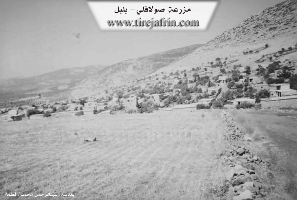
Solaqli (صولاقلي) - Xilalka
===
According to the book 'جبل الكرد' 'Mountain of the Kurds' / Afrin City / Geographical Study:
Xilalka, Solaqli (صولاقلي), Al-Marawiya (المروية) /3387n - 390ha - 11km - 750m/:
- Khalilaka (خلالكا): It took its name from the abundant waters and the sound of their flow, and there were and still are many water springs in the vicinity of the village. The Ottoman designation means "abundant in waters." The Arabic name is a translation of the folk name.
- A medium-sized village located on the lower southern slope of Girê Çûçik mountain. It abounds in springs, and has a high percentage of university degree holders who studied in the former socialist bloc countries, as most of its students believed in communist ideology. It is the village of Khoja Khalilaka (خوجة خلالكا) who was a communist and imam of the village mosque for many years.
According to the book 'عفرين .... نهرها ورواببها الخضراء' 'Afrin.... Its River and Green Hills':
Solaqli (صولاقلي): A village in the Kurdish Mountain (جبل الكرد) belonging to Bilbile district, Afrin City region, Aleppo governorate.
It is a large village located on the lower southern slope with little incline of the small Damerik mountain with limestone rocks covered with green and basaltic rocks. It is 11km from Bilbile town in the southwestern direction. It abounds in springs and streams. Its fertile agricultural lands with volcanic fertile soil extend in the southeastern direction. It is bordered to the north by a high and rugged mountain chain planted with forest trees, behind which is Kawenda village, and to the south by a plain and several streams and the Bilbile - Rajo road and Kurzil and Golaqli villages, and to the west by a stream valley and a very high and rugged mountain chain and Jilanli and Jaqmaq Kabir villages, and to the east by Ali Bak farm at a distance of 1km. A stream passes through the center of the village starting from the north and ending in the south. The number of its houses reaches 150 houses and its age is 400 years. Its old dwellings are stone-clay with flat wooden roofs, and the modern ones are cement that expanded eastward and westward. It has an electricity network and an elementary school, and a municipality was established in it. The village drinks from cisterns that collect rainwater and from artesian wells. It has a mosque in the center of the village. Most of its inhabitants work in cultivating olives, grains, vineyards and vegetables in dry farming on 390 hectares, raising sheep and goats, and some work in marble quarries surrounding the village. The road from it to Bilbile town is dirt followed by Ali Bak farm.
Village mayor: Ahmad Hamo Khalil (أحمد حمو خليل)
II. Ax û Walat Book 1
199
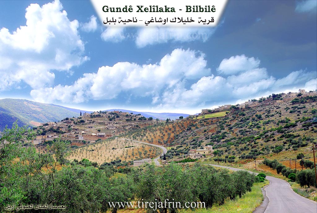
THE VILLAGE OF XILALKA
29.7.2016
Xilalka is the last village in the Bilbilê district of Efrîn canton. It is located 7 km northwest of the town of Bilbilê and 45 km north of the city of Efrîn.
The name of the village comes from the word (XİL), meaning an avalanche of rocks, because the village was built at the foot of a rocky mountain, and in the winters when snow and rain fell, rocks would avalanche with it.
Another view says that it means ((The sound of water)) because the village was famous for its water springs.
200
The village of Xilalka is located at the foot of Gazê mountain from the north side. The height of Gazê mountain is 1100 m, and it is a continuation of the ((Gir)) mountain of Bilbilê.
To the north of the village is the Meydankê valley which reaches the Eşûnê dam, and Gazê mountain. To the east is the village of Elî Beg, to the south is Kurzêla Çiya, Segrekê hill, Guvîjê hill and Kaniya Tawa hill, and to the south are the village of Cela and Xewrekê mountain.
The village of Xilaka is famous for its abundance of water springs. There are around 64 springs and wells there, including: the Tawa spring to the east of the village, the Mala spring and the Axzotkê spring to the south, the Gûzê spring to the south, the Bilik spring, Mehmedko, Şêx Reşîd, Çirçirkê, Tizbîkê, and so on.
The Golmirê valley is to the southwest of the village; the flocks of all the villages of Meydana, Elemdara, Çeqmaqa, Cela, Çençeliya, Çeqmaqa Biçûk, Kurzêla Çiya, Cirqa used to gather there, due to the abundance of water in that valley, but now the water has decreased due to changes in weather conditions and the abundance of new wells.
The village of Xilalka is famous for its building stones, so there are many types of stone there, such as black stone, qewir, uravî, mor, sor, morî, şewitî, green, the color of meat and fat, eggplant, basalt, and flint stone. All these types are found in all areas and
201
provinces of Syria were sent. Therefore, all the buildings in the village were built with stones from the surrounding area.
((Kurmokê)) is like an ancient town to the northwest of the village, in which there are many caves and cisterns, which indicate the historical depth of this town.
Qapê Qîzkê is like a stone gate in Benê Sor to the northwest of the village.
There are 3 cemeteries in the village: Şêxild, Şêx Îs, and Kaniya Mala, and the deceased of the village are buried at Şêx Îs and Kaniya Mala.
The Seîdê well is to the west of the village, and its water is still available. Farmers and shepherds get their water from it.
Around the village there are many hills, including: benê Sor, Spî, Poz, Sosina, Cewşê, Cindîr, Qoq, Gelî Koka, Dibrîk, Avşînkê, Pîr, Bîrqaplî.
There are nearly 300 houses and more than 4000 people in the village. Xilalka is the largest village in the Bilbilê district, and it is the last village affiliated with Bilbilê.
The people of Xilalka village make their living primarily from agriculture, and olive, almond, cherry, and vine trees are the main ones. They also plant vegetable gardens by the wells and springs, along with fields of barley, wheat, lentils, chickpeas, and sesame.
202
Raising livestock comes in second place, as sheep, goats, and cattle are raised, and their products are sold in the markets of Reco, Meydana, Bilbilê, and Efrîn. Some families also keep bees.
There are many shops and a blacksmith shop in the village. Many people from the village work in various workshops in Reco, Meydana, Qestela Miqdêd, Şera, and Efrîn.
Nearly 50 people work in the institutions and bodies of the Autonomous Administration in Bilbilê and Efrîn, and they make a living for their families.
It is worth noting that nearly 1000 people have settled in Efrîn and live there.
There are 16 families in the village:
The families of Biloyê Hemkê, Biloyê Murêd, Qûbê, Tone, Hisênê Mehmûd, Heso, Şeref, Şêx, Şêxê Reşkê, Qele, Şêxina, Mehmûdê Kose, Parsîkê, Qertel, Qere, and the family of Elûş. All families are Kurdish.
Kevirê Mêran (The Stone of Men): a square in the middle of the village, each family had its own stone in that square. If a foreign guest came and sat on someone's stone, he would become the guest of that family.
203
There are 12 martyrs from the village who were martyred in the New Revolution of Kurdistan at various times and places, they are:
Şehîd Tîrêj, Reşo, Şînda, Mezlûm, Mihemed, Tekoşer, Mezlûm Qendîl, Şoreş, Kendal, Heneş, Şoreş Rojava, and şehîd Reşoyê Biçûk.
There are many famous people from the village, including:
The renowned Kurdish bard ((Beytaz)) is from this village and lived here. He was the first bard to sing the song ((Zênebê)). He learned the art of the bard from his father Mihemed, who was himself a tembûr player. In 2002, the bard Beytaz passed away and was buried in the cemetery of the Henên shrine.
The artist Ismaîl Mihemed was known as a modern bard, and he continued his life in the city of Heleb, but unfortunately, he passed away from diabetes in 2014.
Ehmedê Qoşo is an old bard and tembûr player. He sang many songs of the bard Îbramê Tirko.
Hemze Beko was the first teacher of the Kurdish language. He learned the Kurdish language from the teacher Reşîd Hemo, and he taught Kurdish to many people and, in the field of language,
204
he undertook a great effort, for which he was imprisoned many times by the Syrian state.
Bîlal Mihemed Kose: as a linguist and at the same time the son-in-law of the great poet Cegerxwîn. He has written many books, such as: ((Pend û Şîret – Pend û Peng)). He now lives in Germany with his family.
Teacher Mihemed Şêx Qenber is one of the first intellectuals in the Efrîn canton. He has worked as a teacher in many schools and regions, and he has developed himself greatly in the field of Kurdewarî (Kurdish culture).
The level of education in the village is high. More than 200 people have obtained university degrees in various fields. Also, many students are continuing their studies.
Possible Village Name Meaning of Xilalka
Khalilaka: It took its name from the abundant waters and the sound of their flow. The Ottoman designation means "abundant in waters." The Arabic name is a translation of the folk name.
Source: TirejAfrin Site