General Information
Nahiya (Subdistrict)
Mabeta
Also Known As
Al-Mun'azilah, Ruto, Xirabî Rûtê, المنعزلة, روطو, ريطو
Photos
Basic Information about Xirabî Rûtê
Source: Tirej Afrin
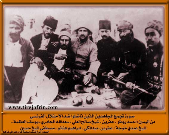
Etymology: Named after the Mujahid Ehmed Rûto. The word "Rûto" means naked or isolated (rût), which was a personal nickname for the mentioned Mujahid. The Arabic name is a translation of the Kurdish name.
Foundation Date/Period: About 50 years
Hills: Çiyayê Hawar
Other Landmarks: Geliyê Sîlê
Summaries
I. Summary from TirejAfrin Site (English) of Xirabî Rûtê
Source: https://www.tirejafrin.com/site/kura%20afrin%20%20%20mebetli%20-rute.htm
Xirab Rût Rûto El-Munazîle / 15km 480m
It is the village of the Mujahid Ehmed Rûto. It was destroyed by the French in the beginning of the third decade of the twentieth century because of his resistance to them. The word "Rûto" means naked or isolated (rût), and it is a personal nickname for the mentioned Mujahid. The Arabized designation is a translation of the Kurdish name.
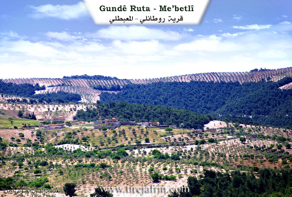
According to the book Efrîn... Her River and Her Green Hills by the writer Ebdulrehman Mihemed from the village of Qetme, Rûto is a village in Çiyayê Kurmênc which follows the Mabeta sub district, Efrîn area, Aleppo governorate.
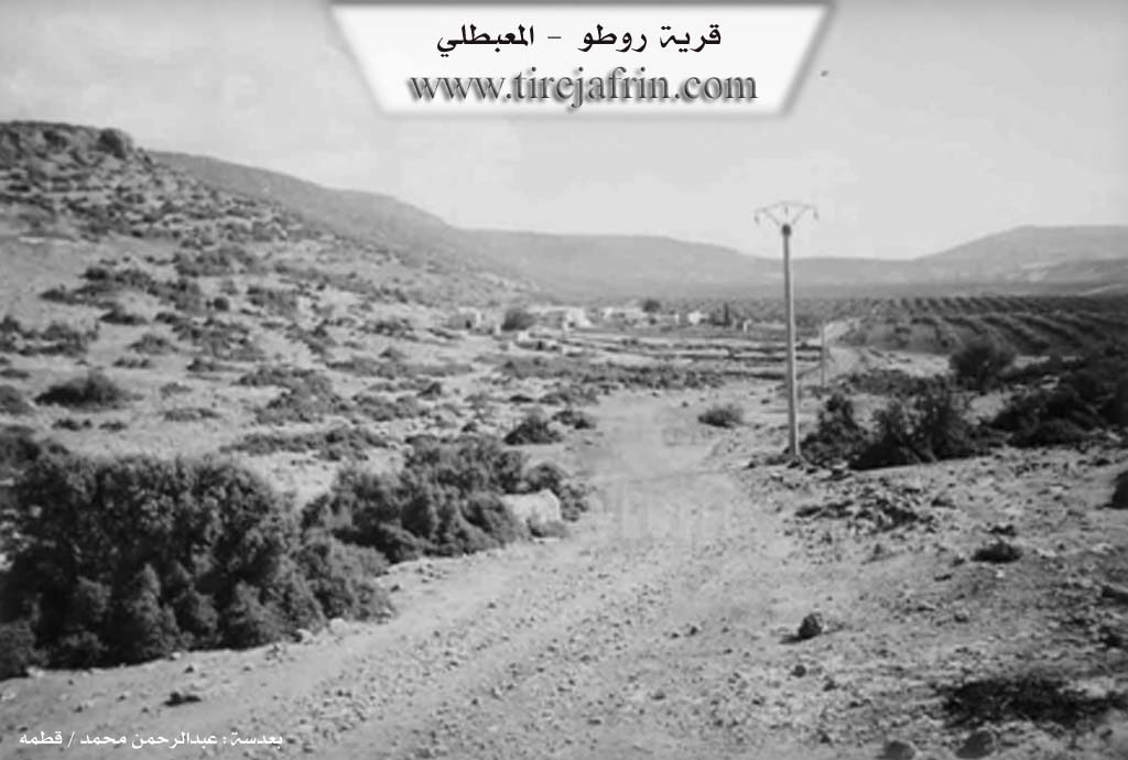
It is a small farm situated near the foot of Çiyayê Hawar on fertile agricultural land. It is bordered to the north by a high mountain chain planted with forest trees and the village of Dax Obasî. It is bordered to the south by a wide plain and the villages of Şêx Hotko and Emarli. It is bordered to the west by a wide plain and the villages of Ebrez and Şêx Kîlo. It is bordered to the east by Geliyê Sîlê and the villages of Sêmalk and Şorbe.
The number of its houses reaches about 10 houses and its age is about 50 years. It was previously a farm for Ehmed Rûto and is currently inhabited by 5 families. An electricity network and a dirt road to the village are available in it.
Preparation and execution:
Director of the Tirej Efrîn site: Ebdulrehman Hacî Osman
Sources:
- Book: جبل الكرد (عفرين) دراسة جغرافية Çiyayê Kurmênc (Efrîn): A Geographical Study by د. محمد عبدو علي Dr. Mihemed Ebdo Elî.
- Book: عفرين .... نهرها وروابيها الخضراء Efrîn... Her River and Her Green Hills by عبدالرحمن محمد Ebdulrehman Mihemed from the village of Qetme.
- 20/12/2013
Foundation/Origin Information of Xirabî Rûtê
It was previously a farm of Ahmed Ruto.
Source: TirejAfrin Site
Possible Village Name Meaning of Xirabî Rûtê
It is the village of the fighter Ahmed Ruto. The word "Ruto" means naked or isolated, and it is a personal nickname for the mentioned fighter. The Arabic designation is a translation of the Kurdish name.
Source: TirejAfrin Site