General Information
Nahiya (Subdistrict)
Cindires
Also Known As
Al-Rihan, Yalanqoz, Yalanqozê, الريحان, يلانقوز
Families, Clans, etc.
Hanan Reşîd Xalid

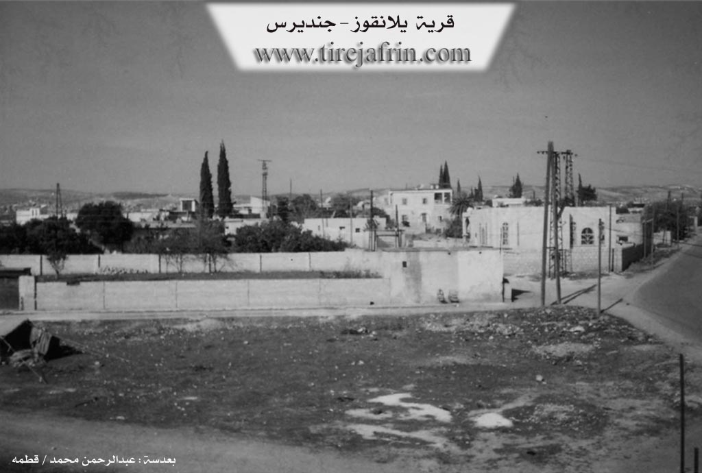
Photos
Basic Information about Yalanqozê
Source: Tirej Afrin
Etymology: The name is Turkish, meaning "The Lying Spring"
Foundation Date/Period: approximately 400 years ago
Summaries
I. Summary from TirejAfrin Site (English) of Yalanqozê
Source: https://www.tirejafrin.com/site/kura%20afrin%20Cindires%20-%20yalanqoze.htm
The following details appear in the book جبل الكرد (عفرين) دراسة جغرافية Çiyayê Kurmênc (Efrîn): A Geographical Study by د. محمد عبدو علي Dr. Mihemed Ebdo Elî:
Yalanqoz, Arabized as El Rîhan /1728 inhabitants, 2km, 260m elevation/.
The name is Turkish, meaning "The Lying Spring".
It is a large village that has currently become a neighborhood of the town of Cindirês. It is situated on an elevation of land, which indicates that it is built upon a vanished archaeological site.
The following details appear in the book عفرين .... نهرها وروابيها الخضراء Efrîn... Her River and Her Green Hills by the writer عبدالرحمن محمد Ebdulrehman Mihemed from the village of Qetme:
Yalanqoz is a village in Çiyayê Kurmênc following the Cindirês subdistrict, Efrîn region, Heleb governorate. It is a large village located at the bottom of the southeastern slope of Çiyayê Kurmênc and on the Cindirês plain to the north. Its soil is fertile alluvium. It was formerly 1km away from the town of Cindirês, but currently, it is 100m away.
It is bordered to the north by a fertile agricultural plain planted with olive trees and the villages of Kefer Sefrê and Koran. It is bordered to the south, at a distance of 100m, by the town of Cindirês. To the west, there is a fertile agricultural plain planted with olive trees and the villages of Baflûr and Aşkan Xerbî. To the east, there is a fertile plain planted with olive trees and the villages of Zindikan, Burc Qemûş, and Qîlê.
It is a village surrounded by olive trees from all directions and has become one of the neighborhoods of Cindirês. The number of its houses is approximately 100 houses, and its age is approximately 400 years according to the statements of one of the long lived residents of the village. Its old houses are of stone and mud with flat wooden roofs, while the modern ones are concrete and have expanded to the north, south, and east.
A electricity network, a primary school, a mosque, a telephone center, and several modern olive presses are available in the village. The village drinks from a well connected to a water network from a well dug in Kefer Sefrê. The residents work in agriculture (olives and grains) via rainfed methods, and via irrigation from artesian wells for summer vegetables and fruit trees (pomegranate, walnut).
It is connected to the subdistrict center by an asphalt road that passes through its center to several neighboring villages on the northern side of the village. Among its most important families is the family of Hanan Reşîd Xalid Agha, who were the first to inhabit the village 400 years ago, evidenced by the presence of three old villas in the center of the village; the age of these villas is more than one hundred years.
Village Mukhtar: Mihemed Hesen Hesen
Sources
Book: جبل الكرد (عفرين) دراسة جغرافية Çiyayê Kurmênc (Efrîn): A Geographical Study by د. محمد عبدو علي Dr. Mihemed Ebdo Elî.
Book: عفرين .... نهرها وروابيها الخضراء Efrîn... Her River and Her Green Hills by عبدالرحمن محمد Ebdulrehman Mihemed from the village of Qetme.
Studies of Navenda Tirej Soft / Ebdulrehman Hacî Osman.
Preparation and Execution:
Manager of Tirej Efrîn site: Ebdulrehman Hacî Osman
20/12/2013
Foundation/Origin Information of Yalanqozê
The Agha family Hanan, Rashid, Khalid were the first to inhabit the village 400 years ago.
Source: TirejAfrin Site
Possible Village Name Meaning of Yalanqozê
The name is Turkish meaning "the lying eye".
Source: TirejAfrin Site