General Information
Nahiya (Subdistrict)
Efrîn
Also Known As
Ziyadiyah
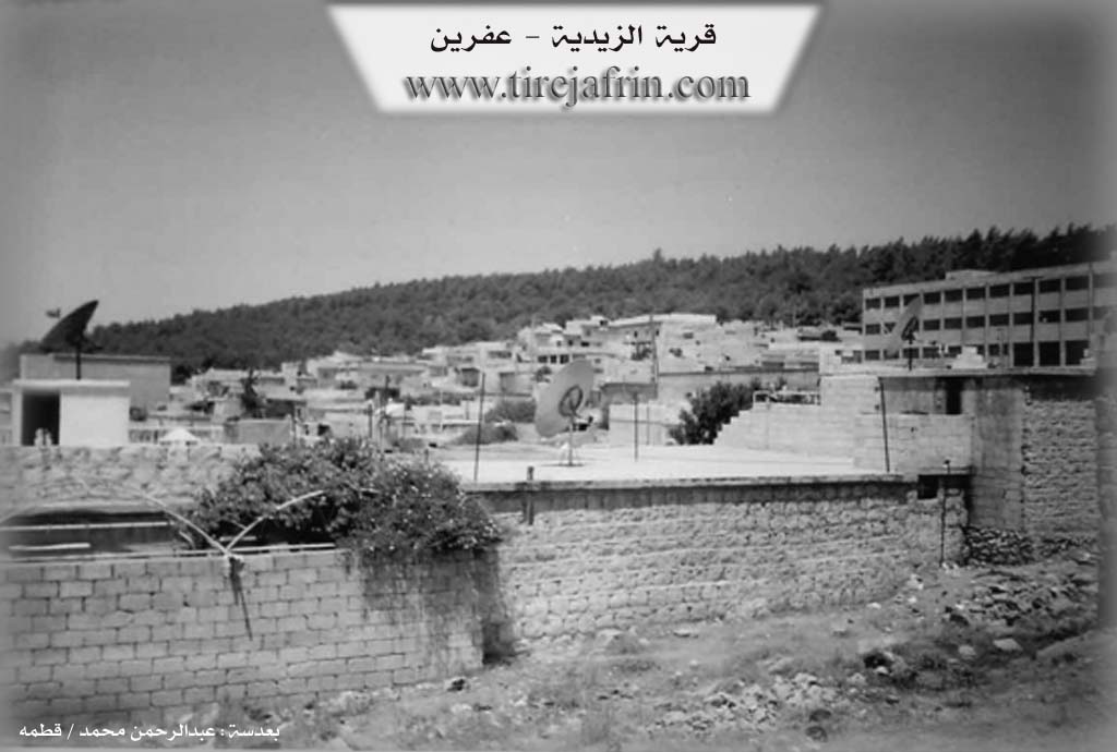
Photos
Basic Information about Zêdiyê
Source: Tirej Afrin
Etymology: Named in relation to the shrine of Şêx Zêd located inside the Zêdiyê cemetery on the peak of the height
Foundation Date/Period: Approximately 150 years ago
Hills: Xemrevn, Ziyadê
Shrines: Şêx Zêd
Other Landmarks: Riya Reco-Efrîn
Summaries
I. Summary from TirejAfrin Site (English) of Zêdiyê
Source: https://www.tirejafrin.com/site/kura%20afrin%20markaz-%20zediya.htm
The following came in the book جبل الكرد (عفرين) دراسة جغرافية Çiyayê Kurmênc (Efrîn): A Geographical Study by د. محمد عبدو علي Dr. Mihemed Ebdo Elî:
Zêdiyê Neighborhood: In the north, it is the old village of Zêdiyê. It was inhabited by peasants and agents belonging to some Christian families from Heleb who had laid their hands, with the help of European consulates and the French, on the plain adjacent to the city of Efrîn from the west. This neighborhood extended north until it currently reached the peak of the Xemrevn height. The inhabitants of this neighborhood are a mix of Kurds, some Arabs, and Qurbat. As for the name, it is in relation to the shrine of Şêx Zêd located inside the Zêdiyê cemetery on the peak of the height.
The following came in the book عفرين .... نهرها وروابيها الخضراء Efrîn... Her River and Her Green Hills by the writer عبدالرحمن محمد Ebdulrehman Mihemed from the village of Qetme:
Zêdiyê: A village in Çiyayê Kurmênc following the Efrîn center subdistrict, Heleb governorate. It is a small village located on Ziyadê mountain, on the southern slope of the mountain and on a valley extending north towards the south. It was previously composed of temporary barracks made of zinc during the French occupation. Currently, the village has become one of the neighborhoods of the city of Efrîn called Zêdiyê neighborhood.
It is bordered to the north by a mountainous height planted with forest trees, the Zêdiyê shrine, and the village of Tel Tewîl. To the south, it is bordered by a wide fertile plain and neighborhoods of the city of Efrîn, Kersana Taş. To the west, it is bordered by Riya Reco-Efrîn (Reco Efrîn road), a plain planted with olive trees, the village of Keferşîl, and the Mehmûdiyê neighborhood. To the east, it is bordered by a mountainous height and the Efrîn river.
The number of its old houses reaches about 15 houses, and its age is about 150 years. Currently, it has been administratively annexed to the city of Efrîn. It has an electricity and water network, primary and preparatory schools, an industrial secondary school, a bakery, the forestry department, and a cooperative agricultural bank.
Sources:
- Book: جبل الكرد (عفرين) دراسة جغرافية Çiyayê Kurmênc (Efrîn): A Geographical Study by د. محمد عبدو علي Dr. Mihemed Ebdo Elî.
- Book: عفرين .... نهرها وروابيها الخضراء Efrîn... Her River and Her Green Hills by عبدالرحمن محمد Ebdulrehman Mihemed from the village of Qetme.
Preparation and execution:
- Manager of Tirej Efrîn site: Ebdulrehman Hacî Osman
- 20/12/2013