General Information
Nahiya (Subdistrict)
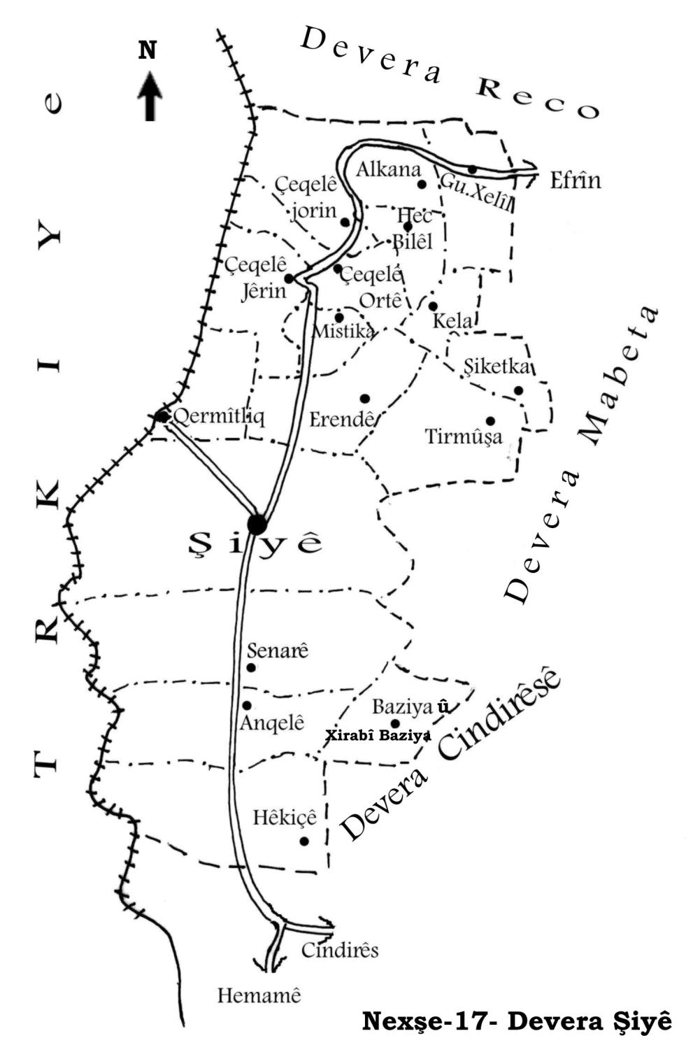
Şiyê
Also Known As
Jiqallali Wustani, Çeqelê Mamedê, Çeqelê Ortê, جقلللي وسطى, چقللي وسطاني, چقللي وسطى, جقاليه اورتي
Families, Clans, etc.
Hecû, Hesûne, Iskender, Mala Alkî Betê, Mala Bekrî Heyder, Mala Eswed, Mala Eşbûk, Mala Gunpê, Mala Haco, Mala Hecfîlek, Mala Korbilo, Mala Mamadê, Mala Mamo, Mala Muftî, Mala Qadirî Xoce, Mala Selmê, Mala Skender, Mala Şe'na, Mamed, Reş Wêlîk, Tarî
Photos
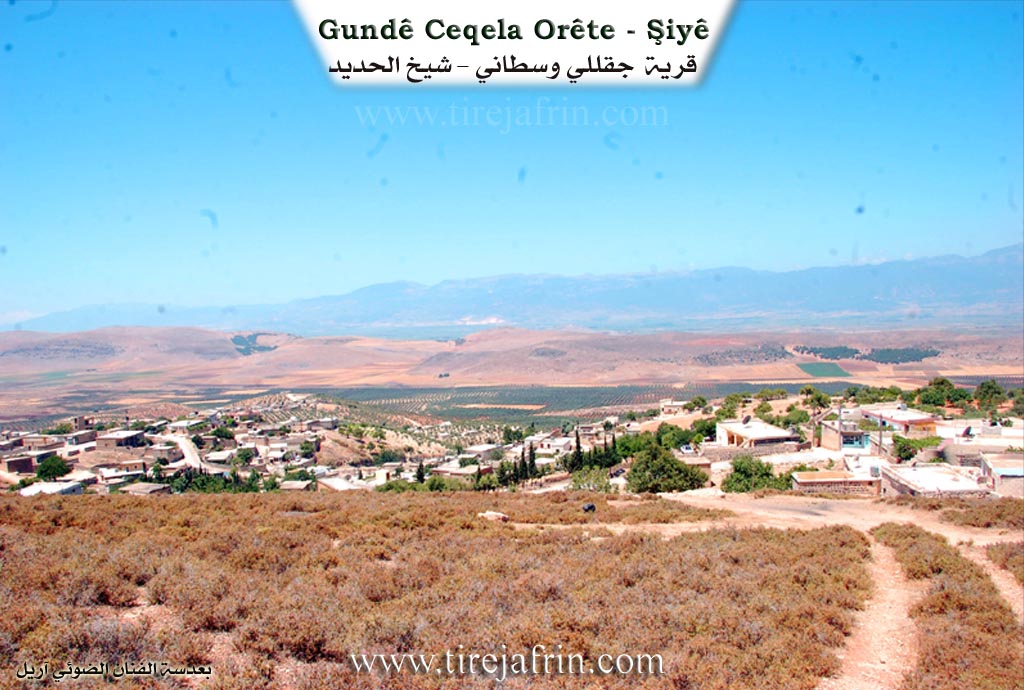
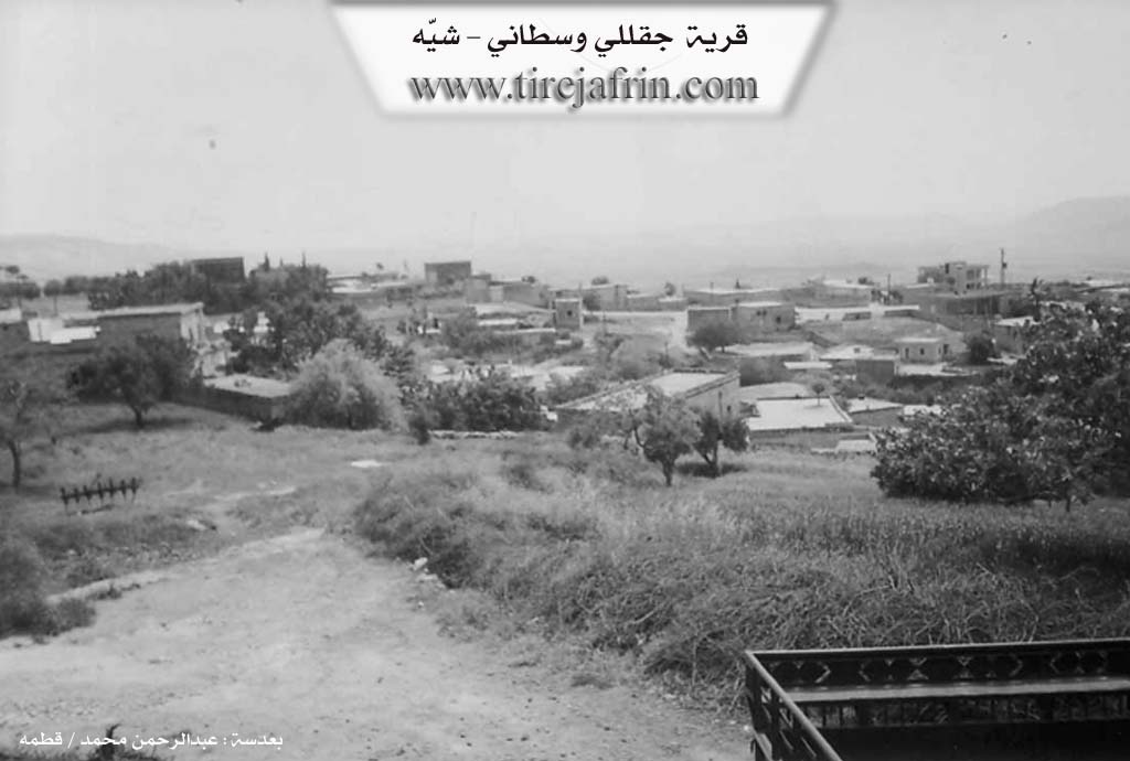
Basic Information about Çeqelê Ortê
Source: Tirej Afrin
Etymology: Named Çeqel Mamed after one of its early residents named Mamed; also called Middle (Ort/Westa) because it lies between the three Çeqellî villages
Foundation Date/Period: Approximately 350 years ago
Summaries
I. Summary from TirejAfrin Site (English) of Çeqelê Ortê
Source: https://www.tirejafrin.com/site/kura%20afrin%20%20%20shiye%20-%20ceqele%20orta.htm
Çeqel Ort Çeqel Mamed Çeqellî Westa
According to the book جبل الكرد (عفرين) دراسة جغرافية Çiyayê Kurmênc (Efrîn): A Geographical Study by د. محمد عبدو علي Dr. Mihemed Ebdo Elî: The village is known as Çeqel Ort, Çeqel Mamed, and Çeqellî Westa (Middle). It has 1545 inhabitants, is located 10 km away, and sits at an elevation of 470 m.
It is called Çeqel Mamed after one of its early inhabitants named Mamed. It is also situated between the three Çeqellî villages, which is why it bears the description of being the middle village. It is a small village situated at the end of a mountain slope that descends steeply toward the west. It is divided into two parts by a sharp and deep watercourse, and torrents occasionally cause disasters for the village. Its lands border the Turkish border to the west.
The following details are found in the book عفرين .... نهرها وروابيها الخضراء Efrîn... Her River and Her Green Hills by the writer عبدالرحمن محمد Ebdulrehman Mihemed from the village of Qetme: Çeqellî Westanî is a village in Çiyayê Kurmênc, administratively belonging to the Şiyê subdistrict, Efrîn region, Heleb governorate.
It is a large village located on the western slope of the central section of the mentioned mountain, atop a limestone rocky plateau, at the beginnings of watercourses sloping toward the south and west. It is located 6 km north of the town of Şiyê. It is bordered to the north by a deep valley and the village of Sewlîcik; to the south by a slope, a plain planted with olive trees, and the village of Mîstikan; to the west, 500 m away, by the village of Çeqellî Jêrîn; and to the east by a mountain range, several watercourses, and the village of Kelanlî.
The number of houses reaches 130, and the age of the village is approximately 350 years, according to the accounts of the village residents. Its old houses are made of stone and mud with wooden ceilings, while the modern ones are concrete and extend to the edges of the village. There is a primary and preparatory (middle) school that serves three villages. The village obtains drinking water from rainwater collection and currently from artesian wells. An electricity network, telephone network, and water network are available.
The residents work in rain fed agriculture (olives, grains, vines) and livestock rearing. It is connected to the subdistrict center by a paved road that passes through its center to several neighboring villages.
Among the families present in the village are: the Mamed family, the Tarî family, the Hecû family, the Iskender family, the Reş Wêlîk family, and the Hesûne family. The village mukhtar is Cuma Mihemed Betal.
Sources
Book: جبل الكرد (عفرين) دراسة جغرافية Çiyayê Kurmênc (Efrîn): A Geographical Study by د. محمد عبدو علي Dr. Mihemed Ebdo Elî.
Book: عفرين .... نهرها وروابيها الخضراء Efrîn... Her River and Her Green Hills by عبدالرحمن محمد Ebdulrehman Mihemed from the village of Qetme.
Preparation and execution:
Manager of Tirej Efrîn site: Ebdulrehman Hacî Osman
20/12/2013
II. Summary of Çeqelê Ortê from Multi Channel
The documentary explores Çeqela Ortê a historical village in the Şiyê district of the Çiyayê Kurmênc region also known as Efrîn. It is the oldest and central part of a triad of villages that includes Çeqela Jorîn and Çeqela Jêrîn.
The village was founded roughly 400 to 500 years ago by two primary families named Mala Eşbûk and Mala Haco who intermarried and initiated the settlement. The original inhabitants relied heavily on livestock and settled near a Roman well in the lower part of the village. The surrounding villages were subsequently settled by descendants as they sought new grazing lands and water sources. For instance Mala Mamo established Çeqela Jorîn after discovering a water source where their flocks gathered while Mala Korbilo was already living in the area that became Çeqela Jêrîn. In the early twentieth century during the French presence in Sûriye prominent local figures like Betal ê Elo and later Reşê Hisek served as muxtars. Elders also recall the arrival of Armenian refugees during times of persecution noting how local families like Mala Selmê hid and protected them in a valley known as Geliya Mîra to prevent them from being killed or forced to become Muslim.
The population of Çeqela Ortê is entirely Kurdish though elders express deep respect for their Arab and Turkish neighbors. The community values education highly with a school established around 1948 in the courtyard of Mala Hecfîlek. This early school drew students from surrounding villages like Hecbilêl Olkano Mistiko and Kelo. Today the village has produced many professionals including doctors and engineers as well as a maritime captain based in Fransa named Lawend Huseyn Hacû. Women traditionally played central roles in the local economy and culture creating intricate embroidery trousseaus and wearing traditional facial tattoos.
The village features ancient infrastructure such as three historical caves in the rocky area belonging to Mala Eswed where people and livestock once sheltered. Olive oil was traditionally pressed in communal wooden presses and a 150 year old press belonging to Mala Qadirî Xoce still survives. Spiritual life is deeply tied to local shrines. During droughts villagers performed a rainmaking ritual called qeşmer. They dressed a local man in old clothes splashed him with water and marched through the village collecting food. They then cooked communal meals at sacred sites including Mala Eloyê Hecî Şêx Îskender Îbrahîm Dede Xelîl Dede and Sefîr Dede.
The village has a proud patriotic legacy. This is exemplified by the grave of Muhemmed Bekir affectionately known as Mîço an engineer and editor for the Hawar magazine in Swêd. As the son in law of the legendary Kurdish figure Osman Sebrî he specifically requested to be buried in his beloved village of Çeqela. His tombstone is inscribed in Kurdish featuring the poetry of Cegerxwîn honoring his lifelong dedication to his culture.
Transcriptions and Subtitles
| Source | Video | Subtitles | Transcript |
|---|---|---|---|
| Multi Channel 1 | Watch Video | Download SRT | View Transcript |
Possible Village Name Meaning of Çeqelê Ortê
It is called "Çeqelê Mamedê" after one of its early inhabitants named "Mamed."
Source: TirejAfrin Site