General Information
Nahiya (Subdistrict)
Mabeta
Also Known As
'Ên Ĥecer Şerq, Kanî Kevirê, Ayn al-Hajar, Ên Hecer, عين الحجر شرقي, عين حجر الوسطى, Ain Al-Hajar Eastern, Ain Hajar Al-Wusta, Ên' Ĝecer, عين الحجر الشرقي, عين حجر الصغير والشرقي, مزرعة عين الحجر
Tribes
Goçer
Families, Clans, etc.
Arifê Pîrê, Elxelyo, Elûş, Elûş Îbiş, Emîr Şêxko, Pîro, Seydê Zêbo

Photos
Basic Information about Ên' Ĥecer
Source: Afrin 366
Etymology: Named after a spring called Kaniya Kêvir (Spring of the Stone) or Eyn el-Hacer, which flowed from a cliff/rock; the village was originally located near this spring.
Springs: Kaniya Kêvir, Eyn Hacere
Hills: Girê Zîkê
Ruins: Delûb, Kafarûm
Other Landmarks: Coyê gundê şêx, Ma'melê Bêrînê
Summaries
I. Summary from TirejAfrin Site (English) of Ên' Ĥecer
Source: https://www.tirejafrin.com/site/kura%20afrin%20%20%20mebetli%20-%20ayin%20hecer%20xerbi.htm
Eyn Elhecer (Ain al-Hajar)
Based on the book جبل الكرد (عفرين) دراسة جغرافية Çiyayê Kurmênc (Efrîn): A Geographical Study by د. محمد عبدو علي Dr. Mihemed Ebdo Elî:
Eyn Elhecer (Population: 1339 / Area: 440 hectares / Distance: 8km / Elevation: 430m): There are three small villages known by this name, and they have other local names in circulation. All are located on an elongated plateau extending in a west-east direction, with northern slopes descending steeply towards the valley of Geliyê Zerafkê.
Eyn Elhecer a Rojava (Western Ain al-Hajar) is known by three Kurdish names:
Gundê Omo: A proper noun derived from the name 'Omer'.
Mala Sinê: Meaning "House of Sinê" (mal + Sinê), where Sinê is also a proper noun.
Goçera: The inhabitants belong to the Kurdish Goçer tribe, and it was named after them.
Based on the book عفرين .... نهرها وروابيها الخضراء Efrîn... Her River and Her Green Hills by the writer عبدالرحمن محمد Ebdulrehman Mihemed from the village of Qetme:
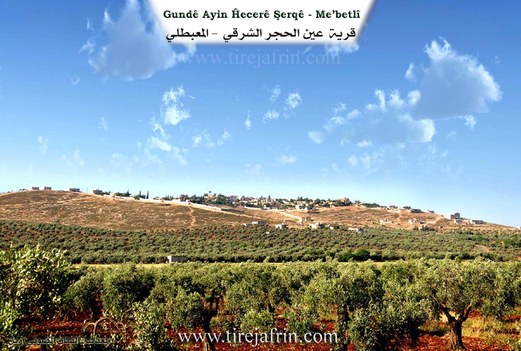
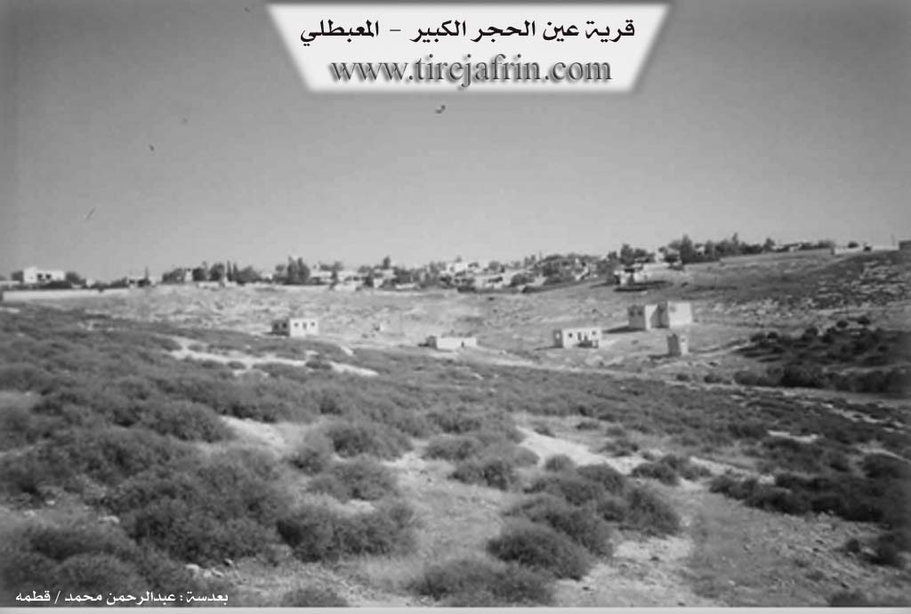
Eyn Elhecera Mezin (Big Ain al-Hajar) is a village in Çiyayê Kurmênc, administratively belonging to the Mabeta sub-district, Efrîn district, Aleppo governorate. It is a medium-sized village located in the central part of the mentioned mountain, atop a limestone plateau. Its northern slopes descend towards the valley of Geliyê Serfetî, and eastward towards the valley of Çemê Efrînê. Its slopes end at undulating plains 8km to the east of the town of Mabeta.
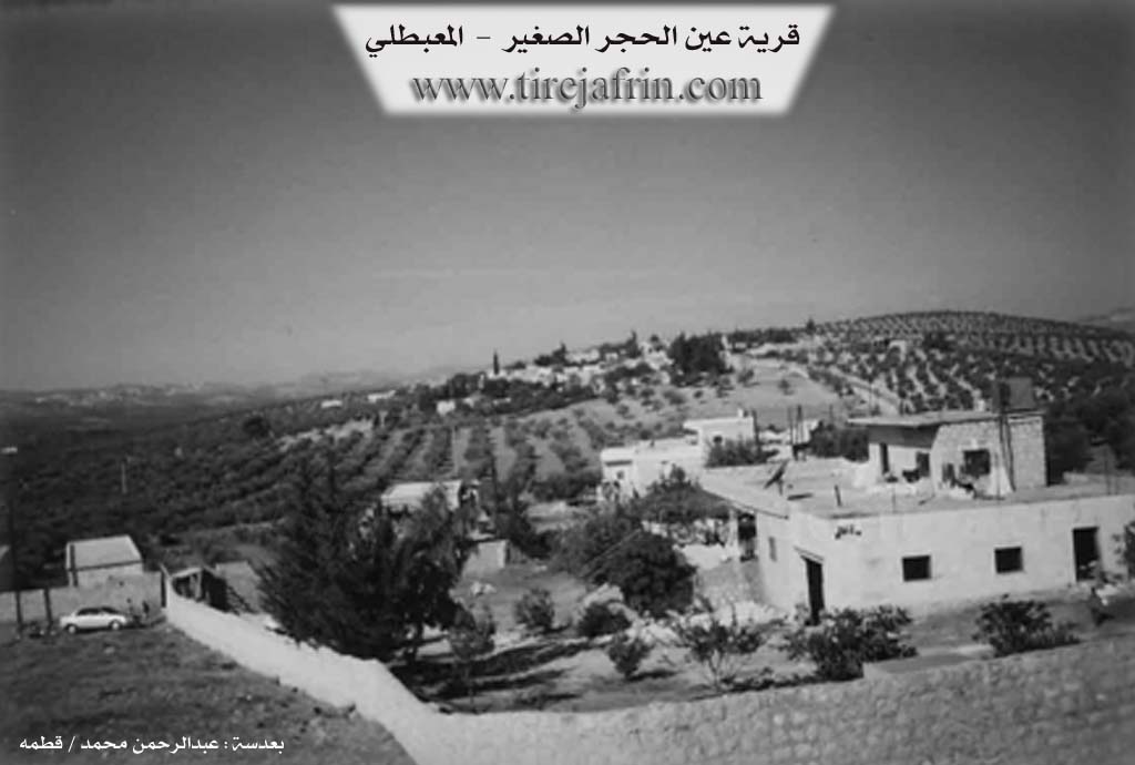
The village is bordered to the north by a rugged slope, the valley of Geliyê Zerafkê, a fertile agricultural plain, the village of Şêxûtkê, and the village of Embarlî. To the south, it is bordered by a slope and a fertile plain called Deşta Eyn Dîbê, the village of Çewîq, and Tel Tawîl. To the west, there is a slope, a mountainous elevation, and the village of Eyn Elhecera Piçûk (Small Ain al-Hajar). To the east, there is a slope, a plain, the valley of Çemê Efrînê, the village of Estaro, and the village of Qurt Qûlaqa Mezin.
The number of houses reaches approximately 55, and the village is about 250 years old. The dwellings are built of stone and mud with flat wooden roofs, while modern ones are made of cement; the village has expanded to the west and east. An electricity network is available, as well as a water network supplied by the well of Kokan Jêrîn located next to the public road. The village contains a primary school and a modern mosque in the center. It is connected to the sub-district center by a paved road reaching the middle of the village.
The inhabitants work in rainfed agriculture on an area of 444 hectares (grains, legumes, olives) and irrigated agriculture pumping from artesian wells for summer vegetables in the southern, western, and northern plains, alongside raising sheep and goats. Among the most important families is the Emîr Şêxko family (they were the first to inhabit the current village).
Notable holders of higher degrees in the village include:
Adil Elûş (PhD in Economics, Russia).
Village Mukhtar: Namî Osman.
Sources:
- Book: جبل الكرد (عفرين) دراسة جغرافية Çiyayê Kurmênc (Efrîn): A Geographical Study by د. محمد عبدو علي Dr. Mihemed Ebdo Elî.
- Book: عفرين .... نهرها وروابيها الخضراء Efrîn... Her River and Her Green Hills by عبدالرحمن محمد Ebdulrehman Mihemed from the village of Qetme.
- Director of Tirej Efrîn site: Ebdulrehman Hacî Osman.
Preparation and Execution: Ebdulrehman Hacî Osman
- Date: 20/12/2013
II. Summary of Ên' Ĥecer from Afrin 366
Source: https://www.youtube.com/watch?v=7eH6HnNe9mo
The village of Eyn Hacere, located in the Efrîn region, is historically defined by its relationship to water and stone. The village derives its name, which translates to "Spring of the Stone", from an ancient water source known locally as Kaniya Kêvir or Eyn el-Hacer. According to village elders, the original settlement was located "li jêr" (down below), directly adjacent to this spring which issued from a zineyr (cliff or rock face). Over time, the residents migrated approximately one to two kilometers away from the water source to establish the current settlement, which is divided into two sections: Eyn Hacere mezin (Big Eyn Hacere) and Eyn Hacere cûcik (Small Eyn Hacere).
The social history of Eyn Hacere begins with the arrival of the Seydê Zêbo family, who are cited by elders as the first lineage to settle the area "berî giya" (before everyone else). Following this founding period, other families such as Elxelyo arrived. The community is tight-knit, with residents describing themselves as "pismamê hevdune" (cousins of one another). Another prominent household mentioned is Mala Arifê Pîrê, also known as the house of Ebû Fadî. Despite the deep roots of these families, the village faces significant demographic challenges; elders lament that many young people have emigrated to places like Heleb (Aleppo) or Tirkî (Turkey), leaving the older generation to tend the land alone.
The village contains specific historical remnants of agricultural life. A notable feature is the Delûb, an ancient stone roller used on a threshing floor. Historically, villagers would bring their wheat to this spot, attach animals to the stone, and drive them in circles to crush the grain. While the Delûb remains as a physical testament to the past, the agricultural present is marked by cefaf (drought), with elders noting that the springs and wells are running dry.
Geographically, Eyn Hacere commands a view of a vast landscape of neighboring settlements. From the village, one can see Stêr, Kûkan, Qestelê, Qerebaba, Sînka, Metîna, and Helkê. The area is also marked by nearby historical sites such as Kafarûm, described as having buildings or ruins where a camp has been established, and the hill known as Girê Zîkê. The village also overlooks the Ma'melê Bêrînê. Culturally, the village maintains a spirit of religious and ethnic pluralism; during the interviews, a distinct and respectful greeting was sent specifically to the Êzîdî community, highlighting the diverse social fabric of the wider region.
Transcriptions and Subtitles
| Source | Video | Subtitles | Transcript |
|---|---|---|---|
| Afrin 366 1 | Watch Video | Download SRT | View Transcript |
Foundation/Origin Information of Ên' Ĥecer
The first inhabitants included a man named Khalil. The Beit Al-Biro family was the first to inhabit the village.
Source: TirejAfrin Site
Possible Village Name Meaning of Ên' Ĥecer
One of its names, Mala Xelî Pîrê, means "house of Khalil son of the old woman."
Source: TirejAfrin Site
V. Links
- Tirej Afrin:
https://www.tirejafrin.com/site/kura%20afrin%20%20%20mebetli%20-%20ayin%20hecer%20sherbi.htm - Tirej Afrin:
https://www.tirejafrin.com/site/kura%20afrin%20%20%20mebetli%20-%20ayin%20hecer%20xerbi.htm - Video:
https://www.youtube.com/watch?v=tjWpomkUNo0 - Afrin 366:
https://www.youtube.com/watch?v=7eH6HnNe9mo