General Information
Nahiya (Subdistrict)
Reco
Also Known As
Hajika Foqani, Hecîka, Hecîka Jorîn, Hecîko, Ĥecîka, Ĥêcîka Jorin, الحجيج, حجيكا فوقاني, حجيكلي, حاجيكه جورن
Tribes
Şêxan
Families, Clans, etc.
Birîm, Huso

Photos
Basic Information about Ĥêcîka Jorin
Source: Ax û Welat (Information for Ĥêcîka Jêrin and Ĥêcîka Jorin)
Etymology: Hemo da viran which implies a place where people gathered or settled.
Foundation Date/Period: 250 years ago
Number of Caves: 3
Springs: Kaniya Şûrkê
Hills: Çiyayê Emînê, Şûrçiyayê Kaşê Eniya Hizir
Shrines: Sêbikê, Sêbê Quncik
Ruins: Xirabê Îbî
Trees: Çinar
Other Landmarks: Geliyê Kêmiriyê
Summaries
I. Summary from TirejAfrin Site (English) of Ĥêcîka Jorin
Source: https://www.tirejafrin.com/site/kura%20afrin%20%20%20Reco%20-%20hecika%20jorin.htm
It is stated in the book جبل الكرد (عفرين) دراسة جغرافية Çiyayê Kurmênc (Efrîn): A Geographical Study: Hecîka, Hecîklî, El-Hecîc / 404 inhabitants, 4km. Altitude: 920m.
The origin of its naming comes from "Hac," which is a religious title for one of its early inhabitants.
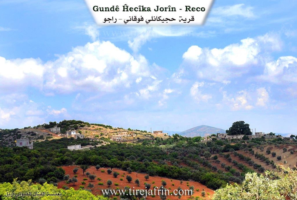
The village consists of two parts: Upper and Lower. It is one of the small villages. It is located on one of the heights of the forestry Etmana mountain, and their location is beautiful.
It is stated in the book عفرين .... نهرها وروابيها الخضراء Efrîn... Her River and Her Green Hills: Hecîka Foqanî is a village in Çiyayê Kurmênc that follows the subdistrict of Reco, area of Efrîn, governorate of Heleb. It is a small village situated on a high mountainous elevation. The village is surrounded by oak and terebinth trees from all sides. It is bordered to the north by high mountains and the village of Hopkanlî; to the south by a deep valley planted with olive trees and vines and the village of Qûde Kuy; to the east by a slope, a deep valley, and the village of Mûsêk Obesî; and to the west by a high mountain chain and the village of Hesen Kelkawî.
The number of its houses reaches approximately 20 houses, and its age is 300 years. Its old residences are made of stone and mud with wooden ceilings, while the modern ones are cement. An electricity network is available there, as well as a prefabricated primary school. The road to the village is paved up to the center of the village. The residents drink from rainwater gathered in pools, as well as from cisterns. The population works in rain fed agriculture (olives, vines) alongside raising sheep and goats due to the abundance of pastures there. In the village square, there are several trees that have been aged for hundreds of years.
Village Mukhtar: Ismet Reşîd Omer
Sources of Information:
- Book: جبل الكرد (عفرين) دراسة جغرافية Çiyayê Kurmênc (Efrîn): A Geographical Study by د. محمد عبدو علي Dr. Mihemed Ebdo Elî.
- Book: عفرين .... نهرها وروابيها الخضراء Efrîn... Her River and Her Green Hills by الكاتب عبدالرحمن محمد The writer Ebdulrehman Mihemed from the village of Qetme.
- Studies of Navenda Tirej Soft / Ebdulrehman Hacî Osman.
- Some residents of the villages.
Preparation and Execution: Manager of the website Tirej Efrîn: Ebdulrehman Hacî Osman 20/12/2013
II. Summary of Ĥêcîka Jêrin and Ĥêcîka Jorin from Ax û Welat
Source: https://www.youtube.com/watch?v=NFIZbAh_WSQ
The village of Hecîka which is divided into two sections known as Hecîka Jêrîn and Hecîka Jorîn is situated in the Recû district of the Efrîn canton. The settlement sits at a high elevation of approximately 800 meters on the slopes of Çiyayê Emînê. Local elders explain that the name Hecîka is derived from the phrase "Hemo da viran" which implies a place where people gathered or settled. The village history spans roughly 250 years beginning when ancestors migrating from the village of Hesen established the community. The founder of the lower village was Hecî Birîm while the upper village was settled by a figure named Hiso or Hisê Birîm. These early settlers maintained ties with Kilis from where they transported olive saplings and heavy stones to construct a traditional olive press known as a mehsere.
The population of Hecîka is characterized by a cohesive kinship structure belonging to the Şêxan tribe. The residents are primarily descendants of the Birîm family and elders emphasize that there are no strangers living among them as all inhabitants are cousins. This strong social fabric is reinforced by a history of shared labor and defense. A prominent story in the village collective memory concerns Hesen Mihemed Hiso who is celebrated for shooting down a French reconnaissance airplane with his rifle during the French Mandate period. The village also honors Şehîd Celal who is remembered as one of the first martyrs from the area during the conflicts of the 1990s as well as Şehîd Melsa.
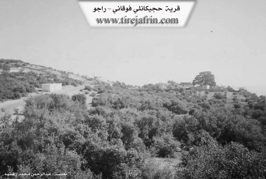
The geography of Hecîka is marked by several specific historical and natural landmarks. The mountain itself is named Çiyayê Emînê after an ancestor named Emîn who was known for his walking stick. A central feature of the village heritage is a 250 year old plane tree called the Çinar which was planted by Hisê Birîm near the historic olive press. Beneath this tree lies an ancient well of indeterminate origin possibly dating back to the Roman era. For generations this well served as a vital water source not only for Hecîka but also for surrounding villages such as Atmana Qude Dêrwîş and Mûskê before modern infrastructure was established. The area also contains three ancient caves from the Roman period and sacred shrines known as Sêbikê and Sêbê Quncik. Today the villagers engage in olive cultivation and stone quarrying extracting black and white stone for export while traditional skills like rope making are maintained by residents such as Meqbûle.
II. Summary of Ĥêcîka Jêrin and Ĥêcîka Jorin from Ax û Welat 2
Source: https://www.youtube.com/watch?v=BczCeGg3I_A
The documentary focuses on the village of Hecîka, located in the Raco district of the Efrîn region. The settlement is divided into two parts, Hecîka Jêrîn (Lower) and Hecîka Jorîn (Upper), situated at an altitude of approximately 800 meters on the slopes of Çiyayê Emînê. The name Hecîka is described as meaning "all places" or a gathering of places, referencing a time when people from various locations settled together. According to the elder Omer, the residents belong to the Şêxan tribe and are tightly knit, with all families being related cousins, primarily descending from the Birîm lineage.
The foundation of the village is attributed to an ancestor named Husê Birîm. Another elder, Seîd, states that Husê Birîm established the village approximately 250 years ago. He is famous for traveling to Kilis to procure stones for a ma'ser (olive press) and bringing back a Çinar (plane tree) sapling. This Çinar tree, now centuries old, stands as a central landmark in the village alongside the ruins of the original olive press. Beneath the tree lies a historic well which, before modern infrastructure, served as a critical water source for nearly ten surrounding villages, including Atmana, Qudê, Dêrwîş, Mûskê, and Banîkê.
The village is home to several historical and sacred sites. Beyond the Çinar and the old ma'ser, there are three ancient caves carved from the Roman era. A unique structure mentioned is Xaniyê bi herya şîr, a house reportedly built using mud mixed with milk. Religious life is marked by the presence of shrines such as Ziyaretkê Hin Sabikê and Sabê Quncik.
Hecîka has produced several notable figures and stories of resistance. Usê Mihemed was a prominent muxtar responsible for resolving disputes across three villages. A local legend recounts the bravery of Hesen Mihemed Huso during the French Mandate; when French aircraft were scouting the region, he allegedly shot one down using his rifle. The village also honors Şehîd Celal, a martyr from the 1990s, and Şehîd Melsa.
Culturally, the village preserves a strong musical tradition. The artist Salah Berim is a native, and he speaks of the influence of local singers like Ehmedê Kêlî and Sidqiyê Bavê Şahîn. Economically, while the community historically relied on charcoal production and livestock, they later transitioned to olive farming. The region is also rich in natural stone resources; villagers like Remezan work in local quarries on Çiyayê Emînê, extracting black, white, and honey colored stone for export.
Transcriptions and Subtitles
| Source | Video | Subtitles | Transcript |
|---|---|---|---|
| Ax û Welat 1 | Watch Video | Download SRT | View Transcript |
| Ax û Welat 2 | Watch Video | Download SRT | View Transcript |
Foundation/Origin Information of Ĥêcîka Jorin
The first settler is identified as Hesenê Birîm, with a second village later established by Hesenê Dewdê.
Source: Ax û Walat Transcript
Oral tradition identifies the first settler as Hesenê Birîm, who founded the lower village. The upper village was established later by subsequent migrants.
Source: Ax û Walat Transcript
The village was originally inhabited by the Mîlan tribe before the Amara tribe later settled there.
Source: Afrin 366 Transcript
Possible Village Name Meaning of Ĥêcîka Jorin
The origin of its name comes from "Haj," a religious title for one of its first residents.
Source: TirejAfrin Site
The name "Hecîka" is a Kurdish word meaning "all the pilgrims," referring to its founding by people who gathered from many different villages.
Source: Ax û Walat Transcript
The name suggests a place where people from many areas gathered. The lower village was originally called "Gundê Hesen."
Source: Ax û Walat Transcript