General Information
Nahiya (Subdistrict)
Şera
Also Known As
'Elkê, Haloubi Large, Sêbira, حلوبي كبير, عَلكي, Ḥilûbiyê, حلوبيه مازن
Tribes
Şikak
Families, Clans, etc.
Bedrî Celûsî, Menan Yazî Celûsî

Photos
Basic Information about Ĥilûbiyê Mezin
Source: Tirej Afrin
Etymology: According to residents, the name is a compound of the Arabic word 'Hilu' (beautiful) and the Kurdish word 'Bî' (willow tree), referring to the large willow trees at the nearby Til Hulubiye site. Also called Gundî 'Elk, a diminutive of the name Elî, the first settler.
Foundation Date/Period: Approximately 200 years ago
Springs: Kaniya Qere Curne
Hills: Til Hulubiye
Trees: Bî
Other Landmarks: Seda 17 Nîsanê
Summaries
I. Summary from TirejAfrin Site (English) of Ĥilûbiyê Mezin
Source: https://www.tirejafrin.com/site/kura%20afrin%20%20sheran%20-%20halubi%20k.htm
It is stated in the book Çiyayê Kurmênc (Efrîn): A Geographical Study regarding Hulubiye: The name means "rising and standing" according to the Koranî dictionary. However, the account of the village residents states that the village name is a compound of two words: "Hilu," which is an Arabic word meaning beautiful, and "Bî," which is the name for the willow tree in Kurdish. Large and beautiful willow trees still exist at the Til Hulubiye archaeological site located next to the village, and the village and its location were known by them.
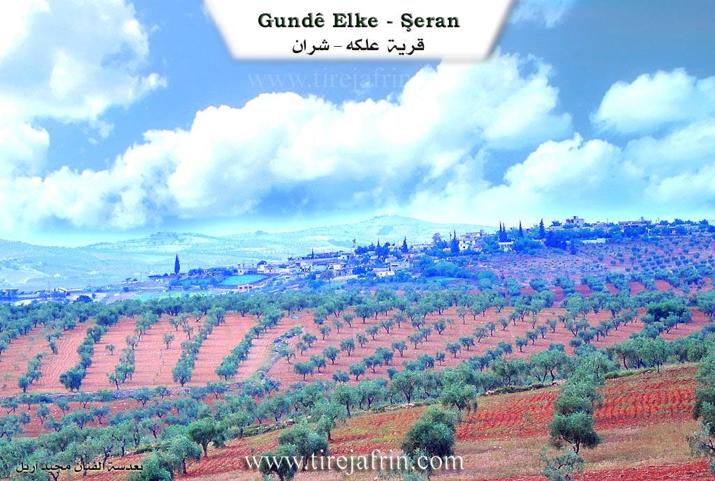
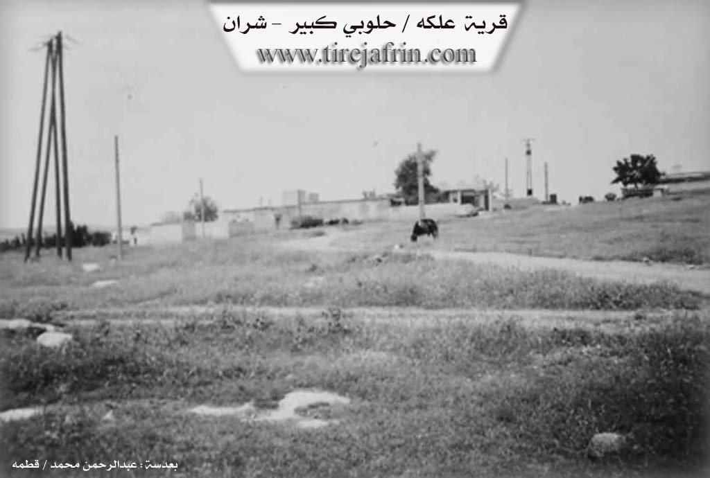
They are two villages: Gundî 'Elk or Hulubiya Mezin (Big Hulubiye). It had 553 inhabitants and is at an altitude of 380 meters. It is also called the village of 'Elk, which is a diminutive of the name Elî, the first person to settle in that place, so the village was named after him. Currently, no one calls it "Big Hulubiye." It was named "Big" not because of its size, but because the Celûsî Aghas of the Şikak tribe lived there.
It is a small village consisting of several houses, situated on the southern bank of the Qere Curne valley.
It is stated in the book Efrîn... Her River and Her Green Hills: Hulubiya Mezin is a village in Çiyayê Kurmênc that belongs to the Şeran sub-district of the Efrîn area in the Heleb governorate. It has 361 inhabitants. It is located on a highland and a plateau that is agriculturally fertile.
It is bordered to the north by the Newala Çemê Efrînê (Afrin river valley), the lake of Seda 17 Nîsanê (17th April Dam) directly, and the town of Meydankê. To the south, it is bordered by a fertile plain, the Riya Meydankê-Kefer Cenê-Bilbil (Meydankê-Kefer Cenê-Bilbil road), the valley of the Qere Curne spring, and the village of Hulubiya Biçûk. To the east, it is bordered by a deep valley, the Riya Kevn a Meydankê (Old Meydankê road), a mountain range, and the village of Kûbelek. To the west, it is bordered by a valley, the lake of Seda 17 Nîsanê, the Riya Nû ya Meydankê (New Meydankê road), the village of Gemrûk, and Ereb Şêxo.
Its old houses are made of stone and mud with wooden ceilings, while the modern ones are made of cement and stone. The number of houses reaches 15, and the age of the village is approximately 200 years. The village has an electricity network, drinking water, a temporary primary school, and offices for the dam administration facility. The road leading to the village is a paved dirt road, while the road to the administrative offices is asphalted.
The residents work in the cultivation of grains, olives, and irrigated summer vegetables from the Efrîn river, as well as sheep herding. The body of the dam is located on the northwestern side of the village, and it is considered one of the most important irrigation projects in the Efrîn region and Heleb governorate, north of the city of Heleb. The foundation stone for the dam was laid in 1980, and it was completed in 2004.
Among the most important families in the village are the Bedrî Celûsî family and the Menan Yazî Celûsî family.
Village Mukhtar: Rif'et Hemo.
Sources of Information:
- Book: جبل الكرد (عفرين) دراسة جغرافية Çiyayê Kurmênc (Efrîn): A Geographical Study by د. محمد عبدو علي Dr. Mihemed Ebdo Elî.
- Book: عفرين .... نهرها وروابيها الخضراء Efrîn... Her River and Her Green Hills by عبدالرحمن محمد Ebdulrehman Mihemed from the village of Qetme.
- Studies of Navenda Tirej Soft / Ebdulrehman Hacî Osman.
- Some residents of the villages.
Preparation and Execution: Manager of the Tirej Efrîn website: Ebdulrehman Hacî Osman, 20/12/2013.
II. Summary of Ĥilûbiyê Mezin from Khalil Sino
Source: https://www.youtube.com/watch?v=eB4ibDI__fA
The documentary features an interview with the Kurdish artist and dengbej Siyamed Efrînî, also known as Kekê Mistefa, who recently returned to the village of Elkê in the Afrin region after spending twenty three years living in exile in Germany. The host visits him to discuss his life, his dedication to Kurdish folklore, and his memories of the region.
Siyamed Efrînî recounts his long career as a musician starting in the nineteen eighties and nineties, during the era of prominent Kurdish musical groups like Koma Armanc, Koma Aştî, and Koma Zozan. He emphasizes the importance of preserving the folklore and traditional songs of Afrin, mentioning classic singers and historical figures such as Cemîl Horo, Reşîdê Mem, Apê Çaçan, Elî Tico, and Bavê Selah. He also speaks of fellow artists he met in Germany, including Xelîl Xemgîn, Evdê Mihemed Çançoran, Elî Xoca, and Elî Sîdo. He performs traditional folk songs, including pieces about Mem û Zîn and Feteh Beg.
The conversation then shifts to the geography and environmental history of the region. They visit Bendava Cûmê, noting the beauty of the landscape and the recent heavy rains. Siyamed Efrînî provides a detailed historical perspective on the water resources of the area. He recalls that sixty years ago, there were no drilled wells in the region. Agriculture relied entirely on natural springs and river valleys, specifically mentioning the valley of Qere Çorne and the plains of Deşta Qamişlê. He describes how water used to be drawn from Qere Çorne through four main irrigation channels. A particularly notable spring he remembers is Kaniya Qebirê Seytan, which flowed from a rocky area but eventually dried up as the region faced severe drought and residents began drilling wells.
Reflecting on the past, Siyamed Efrînî notes how life and health have changed. He shares that in the old days, people lived much longer because they ate natural, seasonal food like dried figs, raisins, and traditional produce. He mentions his own mother, who lived to be a hundred and fifteen years old. During that era, there were no modern hospitals, and people relied on traditional herbal medicine. Towards the end of the video, he shares a traditional folktale set under a walnut tree, involving a king and a witty newborn, highlighting the rich oral storytelling traditions of the region. Finally, he sends his greetings from Çiyayê Mêşê and the rock of Zinarê Mêşê, expressing a deep longing for all displaced people to return to their ancestral villages in Afrin.
Transcriptions and Subtitles
| Source | Video | Subtitles | Transcript |
|---|---|---|---|
| Khalil Sino 1 | Watch Video | Download SRT | View Transcript |
Foundation/Origin Information of Ĥilûbiyê Mezin
The village was the residence of Jillusi aghas from the Shakak tribe.
Source: TirejAfrin Site
Possible Village Name Meaning of Ĥilûbiyê Mezin
"Halubiya" means "gentle and upright". Residents say the name comes from "Halu" (Arabic for beauty) and "Bî" (Kurdish for willow tree). The village is also called `Elkê, a diminutive of "Ali", the first person who settled there.
Source: TirejAfrin Site