General Information
Nahiya (Subdistrict)
Cindires
Also Known As
Zareta Şêx Ebdirehmên, Sheikh Abdulrahman, Zareta Şêx Ebdirehmen, شيخ عبد الرحمن, شيخ عبدالرحمن
Tribes
Emêrat
Families, Clans, etc.
Betal Bekir, Cemo, Hac Ebdo, Hemade, Midewer, Mirad, Sîdo, Sîdo Mîme, Sîdo Mîmî, Îbiş

Photos
Basic Information about Şêx Ebdirehmên
Source: Tirej Afrin
Etymology: The name Kanî Gewrk means "The White Spring" (kanî + gewrk); Şêx Ebdulrehman is named after the nearby shrine of Ebdulrehman bin Ewf
Foundation Date/Period: Approx. 100 years (early 20th century)
Springs: Kanî Gewrk
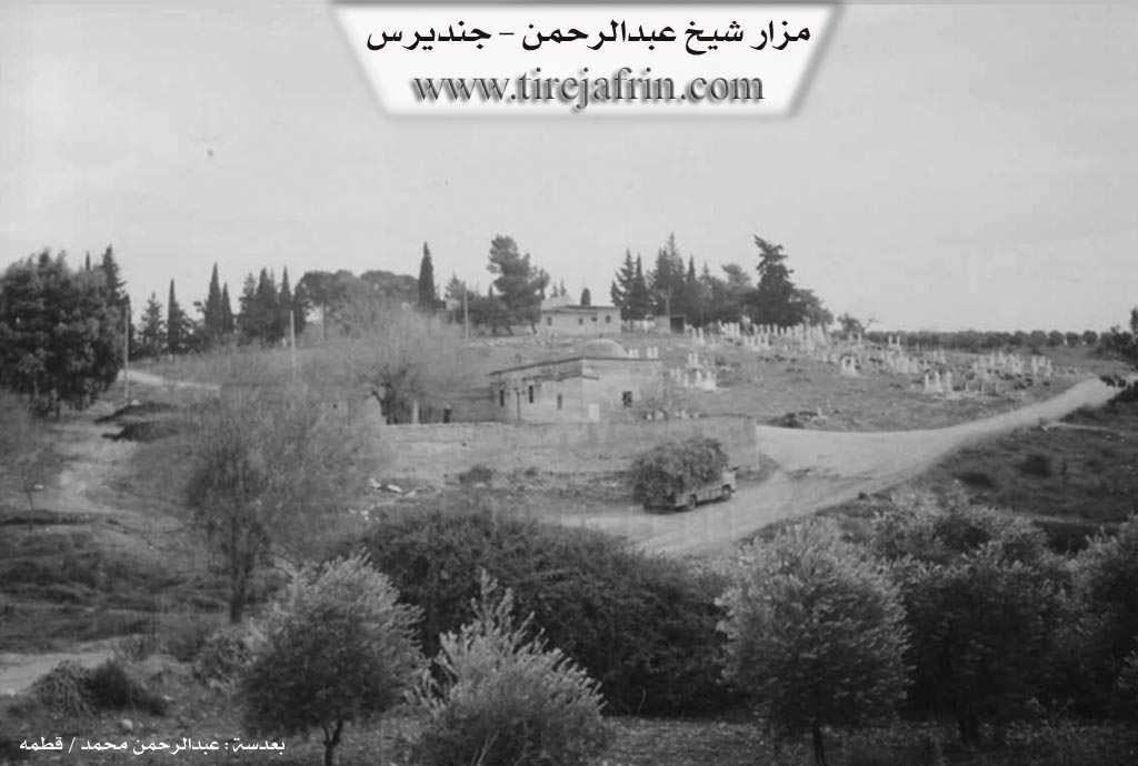
Shrines: Şêx Ebdulrehman
Other Landmarks: Geliyê Şêx Ebdulrehman, Geliyê Kanî Gewrk
Summaries
I. Summary from TirejAfrin Site (English) of Şêx Ebdirehmên
Source: https://www.tirejafrin.com/site/kura%20afrin%20Cindires%20-%20kani%20gewrke.htm
It is stated in the book Çiyayê Kurmênc (Efrîn): A Geographical Study by Dr. Mihemed Ebdo Elî: Kanî Gewrk, Şêx Ebdulrehman /1040 inhabitants 7km 270m/:
Kanî Gewrk: Meaning "The White Spring" (kanî + gewrk). As for Şêx Ebdulrehman: It is the name of the shrine located near it, and it is known by the name of the Companion Ebdulrehman bin Ewf.
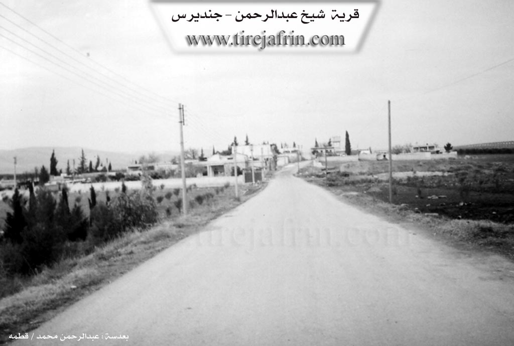
It is a medium sized village located on the eastern bank of the Geliyê Şêx Ebdulrehman (Valley of Sheikh Abdulrahman) coming from the north. It is one of the villages of the Aghas of Sîdo Mîmî and they still inhabit it.
According to the book: Efrîn... Her River and Her Green Hills by the writer Ebdulrehman Mihemed from the village of Qetme:
Şêx Ebdulrehman: A village in Çiyayê Kurmênc following the Cindirês township, Efrîn district, Heleb governorate. It is a small and modern village located at the northeastern edge of the Geliyê Kanî Gewrk (Valley of Kanî Gewrk spring), which heads south to feed into the Çemê Efrîn (River Afrin) at a distance of 2km. The village is 8km away from the town of Cindirês towards the northeast.
It is bordered to the north by a fertile agricultural plain, the Geliyê Kanî Gewrk, the shrine of Şêx Ebdulrehman, and the villages of Qerebaş and Colaqan. To the south by the Geliyê Kanî Gewrk, the Riya Efrîn-Cindirês (Efrîn Cindirês road), and the villages of Tel Hemo and Frêriye. To the west by the Geliyê Kanî Gewrk, an archaeological hill, and the villages of Qorbe and Qoceman. To the east by a fertile plain planted with olive trees, the Enderiye farm, and the village of Tellif.
The number of its houses is about 60 houses and its age is about 100 years. Its old houses are stone and mud with flat wooden roofs, and the modern ones are cement and have expanded north and south. An electricity network is available, as well as a water network connected to the well drilled in the neighboring village of Miskê Jorîn. It has a primary school.
There is an olive press located on the western side of the village belonging to Mr. Hesen Hemade and his children, and their origin is from the village of Qetme. It connects to the center of the township and the district by a paved road. Most of its inhabitants work in the cultivation of olives, grains, and legumes via rain fed and irrigated methods on an area of 665 hectares, and summer vegetables via irrigation from wells (10 hectares), alongside raising sheep and goats. In the western side of the village, there is a small farm belonging to its owner Hesen Hemade and next to it is a modern olive press; it was previously a farm for the peasants of the Sîdo Mîmî Axa family from the nearby village of Colaqan.
Among the scientific and cultural figures are Dr. Mistefa Sîdo, Engineer Kemal Hac Ebdo, Dr. Bêrîvan Sîdo, and many intellectuals and holders of scientific degrees. The village mukhtar is Mirad Izet Mirad.
Sources:
- Book: جبل الكرد (عفرين) دراسة جغرافية Çiyayê Kurmênc (Efrîn): A Geographical Study by د. محمد عبدو علي Dr. Mihemed Ebdo Elî.
- Book: عفرين .... نهرها وروابيها الخضراء Efrîn... Her River and Her Green Hills by عبدالرحمن محمد Ebdulrehman Mihemed from the village of Qetme.
- Navenda Tirej Efrîn / Ebdulrehman Hacî Osman.
- 20/12/2013
II. Summary of Şêx Ebdirehmên from Multi Channel
Founded slightly over a century ago, the village of Şêx Ebdilrehman initially consisted of mud brick houses with wooden roofs and animal stables. Bordering villages include Kocaman to the west, Qîlan, Çolaqan, and Xerzan to the north, and Telef to the east. The lands originally belonged to the Sîdo Mîme family, prominent landowners from Çolaqan, who used the area for orchards and vineyards cultivated by peasant sharecroppers. Over time, it evolved into a permanent settlement. A 90 year old elder, Evdo Midewer, recalls early agricultural development when Armenians arrived, rented land from Xelîl Axa, and used kerosene powered tractors to clear and cultivate the plains stretching from Xelîl to Dêr Belût. Water for these early agricultural projects was brought from Ziyaretê, independent of other channels that went from Birc Ebdalo to Kewkebê. The village historically hosted a commercial khan and shops along the Efrîn to Cindirêsê road to serve travelers journeying between Kilis, Entakya, and Heleb.
The village currently hosts around 130 households. Prominent Kurdish families include Sîdo, Îbiş, Midewer, Cemo, Betal Bekir, and Hemade, living alongside members of the Arab tribe of Emêrat. Today, local residents and internally displaced persons from southern Heleb work closely together, particularly during the intense olive harvest.
The settlement is defined by its proximity to the Çemê Şêx Ebdilrehman, a river which flows south to Tel Hemo and Firêriyê before joining the Çemê Efrînê. A major spiritual and local landmark is the shrine of Ziyarata Şêx Ebdilrehman, which historically featured a functioning water mill known as Aşê Avê. Another significant historical landmark is the old stone bridge called Pira Kevne, originally built over the river by the French and later reinforced with black stone by the British during the Mandate period to support heavy military vehicles. Seasonal flooding is a powerful natural event here, with deep floodwaters gathering from uphill villages like Feqîran, Korkan, Xerzan, and Çolaqan.
The village is deeply agrarian, with 95 percent of its land dedicated to olive groves, exclusively of the Zêtî variety, yielding highly regarded Kurdish olive oil. The seasonal harvest is a festive and critical economic period, drawing seasonal workers who sharecrop by taking one sack for every seven given to the orchard owner. This influx of resources allows locals to pay off debts and fund celebrations. The architectural heritage features spacious courtyards planted with diverse flora like Şemsiyê trees, damask roses, and fruit orchards, reflecting the pastoral and tightly knit community life of the region.
Transcriptions and Subtitles
| Source | Video | Subtitles | Transcript |
|---|---|---|---|
| Multi Channel 1 | Watch Video | Download SRT | View Transcript |
Foundation/Origin Information of Şêx Ebdirehmên
It was previously a farm for farmers of the Sido Mimi agha family from the nearby Julqan village.
Source: TirejAfrin Site
Possible Village Name Meaning of Şêx Ebdirehmên
Kanî Kawrk means "the white spring". Sheikh Abdulrahman is the name of the shrine near it, known by the name of the companion Abdulrahman ibn Awf.
Source: TirejAfrin Site