General Information
Nahiya (Subdistrict)
Cindires
Also Known As
Ashkan East, Aşka, Aşkê Şerqî, Eşka Şerqî, اشكان شرقي, Aşka Rojhilat
Tribes
Aşkan, Aşkî
Families, Clans, etc.
Mala Cimkê, Mala Hec Hemo, Mala Ibê 'Eşo, Mala Kerrê, Mala Mûrê, Mala Pelo, Mala Siwaro, Mala Welî, Mala Xakûra, Mala Îbo, Mistefa, Nasir, Silêman

Photos
Basic Information about Aşkê Şerqî
Source: Ax û Welat
Etymology: Named after the Aşkî tribe from Rojhilatê Kurdistanê
Foundation Date/Period: Approximately 400 years ago
Hills: Girekî Baqir, Çiyayê Hêstiya, Serê Kurê
Shrines: Ziyareta Ebdulrehman Bin 'Of, Ziyaretgeha Alemdarê
Ruins: Xerabê Aşka
Trees: Darê Çinarê
Wells: Bîrgenî, Kirsê Mada Şî
Other Landmarks: Deşta Cûmê
Source: Khalil Sino
Caves: Mexara Dederiyê
Hills: Çiyayê Lêlûn, Çiyayê Parsê
Other Landmarks: Meydankî, Burcê, Eşrefiyê, Qebban, Cindirês
Summaries
I. Summary from TirejAfrin Site (English) of Aşkê Şerqî
Source: https://www.tirejafrin.com/site/kura%20afrin%20Cindires%20-%20ashkan%20shrqe.htm
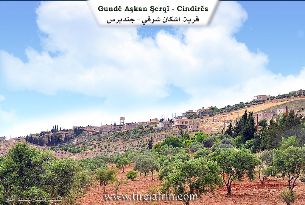
Aşka / Aşkan Şerqî Village Entry
Based on the book جبل الكرد (عفرين) دراسة جغرافية Çiyayê Kurmênc (Efrîn): A Geographical Study by د. محمد عبدو علي Dr. Mihemed Ebdo Elî:
Etymology and History
Aşka or Aşkan: This is the name of a Kurdish tribe mentioned by Şerefxan under the name Aşkî (page 75). The Soviet orientalist Dyakonov (page 229) mentions the name of the Iskît (Scythian) people as deriving from the word "Aşkîda," which means "the ancient relic." This people or tribe was among the populations of the mountains of Kurdistan in the eighth century BC and is considered one of the ancestors of the Kurds. The author believes there is a significant similarity between the name of this people and the name of the Aşkan tribe.
Aşkan Şerqî
(1215 inhabitants / 560 hectares / 10 km distance / 480 m altitude)
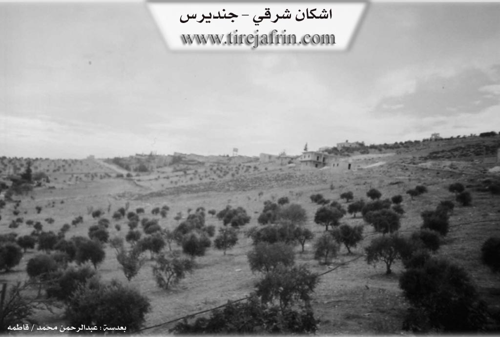
It is a small village situated on a limestone plateau that overlooks the Cûme plain to the south. The perimeter of the village consists of steep slopes on the northern, eastern, and western sides. Adjacent to the village are caves that were used for habitation and sheltering livestock; most of these are man made and date back to ancient eras.
Based on the book عفرين .... نهرها وروابيها الخضراء Efrîn... Her River and Her Green Hills by the writer عبدالرحمن محمد Ebdulrehman Mihemed from the village of Qetme:
Geography and Location
Aşkan Şerqî is a village in Çiyayê Kurmênc that belongs to the Cindirês district of the Efrîn region, Aleppo governorate. It is a large village situated atop a high limestone ridge. It overlooks a deep valley to the west, and to the east and south, it overlooks a spacious plain extending to the valley of the Efrîn river. Its soil is clay and alluvial, suitable for agriculture and grazing. It is located 10 km northeast of the town of Cindirês.
Boundaries
It is bordered to the north by a slope and a deep valley planted with olive and walnut trees, high mountain heights, and the villages of Xalta Şerqî and Xalta Rojjava. To the south, it is bordered by a slope, a wide and fertile plain, and the village of Qoceman. To the west, it is bordered by a slope, a deep valley, a mountain height, and the village of Çeqelê Cûmê. To the east, it is bordered by mountain heights planted with olive trees and the village of Xerzan.
Population and Infrastructure
The number of houses is approximately 80, and the village is about 350 years old according to the residents. The dwellings are made of stone and mud with flat wooden roofs. Modern concrete construction is spreading toward the southeast, constituting 30% of the total buildings. The village has an electricity network and drinking water supplied via a water canal from a network in the village of Miska Jêrîn. There is a primary school, a modern mosque under construction, and a modern olive press.
Landmarks and Economy
There is an old Roman well at the bottom of the valley on the northern side of the village that was previously used for drinking water. The residents work in rain fed agriculture, growing olives, grains, and legumes on an area of 560 hectares, alongside raising sheep and goats. The village is connected to the district center and the region by a paved road.
Notable People
Holders of advanced degrees from the village include:
Ibrahîm Murad: PhD in Chemistry, Germany.
Ismet Cemo, son of Ibrahîm Xelîl: PhD in Electrical Engineering, Russia.
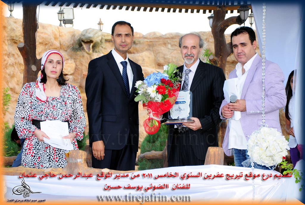
It is noted that the photographic artist Yûsif Huseyn is a native of this village. The village Mukhtar is Celal Mihemed Mihemed.
Sources
Book: جبل الكرد (عفرين) دراسة جغرافية Çiyayê Kurmênc (Efrîn): A Geographical Study by د. محمد عبدو علي Dr. Mihemed Ebdo Elî.
Book: عفرين .... نهرها وروابيها الخضراء Efrîn... Her River and Her Green Hills by عبدالرحمن محمد Ebdulrehman Mihemed from the village of Qetme.
Preparation and Execution:
Manager of Tirej Efrîn Website: Ebdulrehman Hacî Osman
20/12/2013
II. Summary of Aşkê Şerqî from Ax û Welat
Source: https://www.youtube.com/watch?v=c-JxRB5LJwI
The village of Aşka Şerqî, also known as Aşka Rojhilat, is located in the Cindirêsê district of the Efrîn region. It sits at the foot of Çiyayê Hêstiya overlooking Deşta Cûmê. While some locals speculate the name comes from the word for mill, village elders confirm it derives from the Aşkî tribe. This tribe originated in Rojhilatê Kurdistanê and migrated westward before borders existed between the parts of Kurdistan. They were originally nomadic herders living in tents.
The settlement history of Aşka Şerqî spans approximately four centuries. The ancestors first settled near a site called Girekî Baqir close to Ziyareta Ebdulrehman Bin 'Of. They later moved to a location now known as Xerabê Aşka, meaning the Ruins of Aşka. Due to attacks and instability, they moved again to higher ground where caves were available. They relied on a well called Bîrgenî, but its water caused illness. This forced a final move to the current location, where the water quality was superior. The first family to settle the modern site was Mala Îbo, also referred to as Mala Ibê 'Eşo, who initially lived in caves before building homes.
Socially, the village is composed of several families including Mala Welî, Mala Mûrê, Mala Siwaro, and Mala Pelo, the latter having migrated from Çeqelê Cûmê. Historically, the population followed the Zeredaştî or Êzîdî faith. Most families, such as Mala Kerrê, converted to Islam roughly forty five years ago, though Mala Cimkê remains the sole Êzîdî household in the village today.
The area features significant religious and historical landmarks. Ziyareta Ebdulrehman Bin 'Of is a ruin located about three kilometers away. Local historians believe it is actually a Byzantine or Roman site that Kurds renamed with an Islamic title to protect it from destruction. Within the village lies Ziyaretgeha Alemdarê, which houses the grave of Şêx Xelîl Ebû Hesen. Another vital landmark is Kirsê Mada Şî, a well north of the village shaded by a massive plane tree known as Darê Çinarê. This tree is over a century old and serves as a community gathering spot.
Aşka Şerqî is also known for its cultural contributions. It was home to the renowned singer Dengbêj Hemûşê Kûrik and his student Cemîlê Hesenê Kerrê, who preserved Kurdish oral traditions. In modern times, the village has produced educated professionals and political figures like the former parliamentarian Ebdulrehman îbo. The local commune is named after Şehîd Selam, honoring the village's contribution to the national struggle.
II. Summary of Aşkê Şerqî from Khalil Sino
Source: https://www.youtube.com/watch?v=Bpy6ExfeZOs
The transcript documents a cultural exhibition organized by the Ebnaa Zeytûn (also referred to as Xortên Zeytûnê) team in the Efrîn region. While the documentary does not focus on the founding history of a single specific village, it aggregates the history and heritage of several communities across the region. Participants and attendees identify themselves as originating from various locales, including Cindirês, Eşka Şerqî, Şêx el-Hedîd, Şera, Şiyê, and Kurzêlê.
A significant portion of the historical narrative is dedicated to the Mexara Dederiyê (Dederiyeh Cave). This site is located on Çiyayê Lêlûn in the vicinity of the village of Burcê. One speaker, a medical student named Salah El-Dîn Ehmed, details the archaeological importance of this landmark. He explains that a joint Syrian and Japanese expedition conducted excavations there between 1987 and 1993. These excavations led to the discovery of a Neanderthal child's skeleton, estimated to be two years old. The speaker notes that the site provided evidence of ritual burial practices dating back nearly 100,000 years, marking it as a critical historical site for human history in the region.
The social fabric of the area is illustrated through the accounts of the Nasir family from the village of Kurzêlê. Şukrî Nasir, an artist who sculpts using black stone from Çiyayê Parsê, shares the oral history of his ancestor, Hemo. Described as a brave figure ("qebadayî"), Hemo is remembered for his resistance against the French mandate forces and local feudal lords ("axlara"). Şukrî Nasir notes that Hemo was distinct for wearing an Ezazî cap, a specific cultural marker of that era.
The exhibition also serves as a repository for the region's material history. Ehmed Reşîd Mistefa, also from Kurzêlê, presents a collection of traditional tools used by previous generations. These include the "destar" (hand mill) for grinding grain, the "delû" for drawing water from wells, and the "zembîl" (basket) used by shepherds. The narrative emphasizes the deep connection between the people and the land, particularly the olive tree, which is cited repeatedly by speakers like Nûrcanê Silêman and Kifah Murad as a symbol of resilience that regenerates even when cut. The event underscores a collective effort to preserve the heritage of Efrîn amidst changing times.
Transcriptions and Subtitles
| Source | Video | Subtitles | Transcript |
|---|---|---|---|
| Ax û Welat 1 | Watch Video | Download SRT | View Transcript |
| Khalil Sino 1 | Watch Video | Download SRT | View Transcript |
Foundation/Origin Information of Aşkê Şerqî
Next to the village are caves that were used for housing and sheltering livestock, most of them artificial and dating back to ancient times.
Source: TirejAfrin Site
Possible Village Name Meaning of Aşkê Şerqî
Ashkan: The name of a Kurdish tribe mentioned by Sharafkhan under the name Ashki. The Soviet orientalist Diakonov mentions the name of the people "Askit" from the word "Ashkida," which means "the ancient archaeological," and this tribe are from the peoples of the Kurdistan mountains in the eighth century BC, and are considered among the ancestors of the Kurds.
Source: TirejAfrin Site
V. Links
- Tirej Afrin:
https://www.tirejafrin.com/site/kura%20afrin%20Cindires%20-%20ashkan%20shrqe.htm - Ax û Walat:
https://www.youtube.com/watch?v=1KxAMR5qUcg - Link:
https://www.youtube.com/watch?v=c-JxRB5LJwI - drone video:
https://www.youtube.com/watch?v=RWxYTheEFaM - Link:
https://www.youtube.com/watch?v=g2UGvwNXoow - Link:
https://www.youtube.com/watch?v=ja77cochniw - Video:
https://www.youtube.com/watch?v=TwcWBg3JtIg - Khalil Sino:
https://www.youtube.com/watch?v=Bpy6ExfeZOs