General Information
Nahiya (Subdistrict)
Reco
Also Known As
'Etmana, Atmanli, Etmana, عطمان, عطمانلي, عطمونو
Tribes
Etmanekan, Şêxan
Families, Clans, etc.
Bilo, Doyko, Doyêreş, Etman, Fatikê, Mehemedê Betêl, Nehsê, Reşîdê Berîfat, Sê Memo, Îbiş, Şêx Zeynal

Photos
Basic Information about Etmana
Source: Tirej Afrin
Etymology: 'Etmana: Derived from the name 'Osman, one of the first inhabitants of the village. Banîk: The literal Kurdish meaning of the name is: the small high place (ban + îk), referring to its location on a ridge.
Foundation Date/Period: Approximately 500 years ago
Hills: Çiyayê 'Etmana
Other Landmarks: Deşta Balyê, Geliyê Sarisn
Summaries
I. Summary from TirejAfrin Site (English) of Etmana
Source: https://www.tirejafrin.com/site/kura%20afrin%20%20%20Reco%20-%20Etmana.htm
It is stated in the book Çiyayê Kurmênc (Efrîn): A Geographical Study:
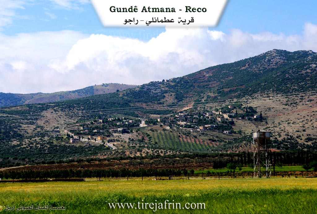
'Etmana, 'Etmanlî, 'Etman / 2055 inhabitants - 458 houses - 3 km - 680 m /:
'Etmana: Derived from the name 'Osman, one of the first inhabitants of the village.
It is a small village located on the northeastern slope of a limestone height called Çiyayê 'Etmana. To the north, it overlooks agricultural lands called the Balyê plain and the town of Reco.
Bank, Banîk, Al-Aliya / 560 inhabitants - 3 km - 660 m /:
Banîk: A diminutive name meaning "The High One" in Kurdish, and the village is located on a high mountainous ridge. The Arabized name is a translation from the Kurdish. It is a small village consisting of a few residential houses, overlooking the Sarisn valley to the north.
It is stated in the book Efrîn... Her River and Her Green Hills:
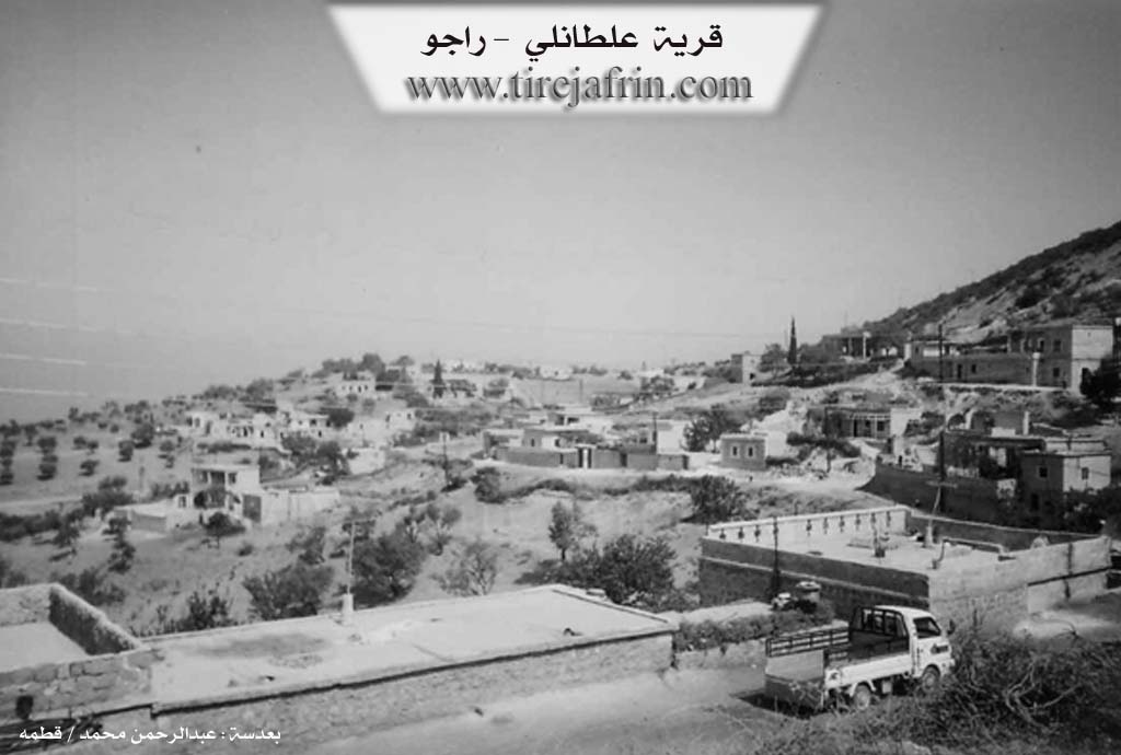
'Etmanlî: A village in Çiyayê Kurmênc following the Reco sub-district, Efrîn region, Heleb governorate. It is a large village located in the central part of the mentioned mountain, on the northeastern slope of a limestone height. It overlooks agricultural lands with clay soil, and the Xeta Hesinî ya Heleb-Reco (Heleb-Reco railway line) cuts through it.
It is located 3 km southwest of the town of Reco. It is bordered to the north by a valley and the villages of Banîk and Hupkanlî; to the south by a valley, a mountain range, and the village of Derwîş Obasî; to the east by a slope, a wide fertile plain, and the villages of Hec Xelîl and Kûran; and to the west by a high mountain range planted with oak, valonia oak, and terebinth trees, and the villages of Hacîkanlî Tehtanî and Hacîkanlî Foqanî.
The number of its houses reaches about 100, and its age is approximately 500 years according to the statements of some elderly residents of the village. Its old dwellings are made of stone and mud with flat wooden roofs, while the modern ones are cement and have extended west and east. An electricity network is available, as well as a drinking water network from a well drilled in the north of the village. It has a primary school and a telephone network taken from the Reco telephone center.
Administratively, the village belongs to the municipality of Hec Xelîl. The village is connected to the region and the sub-district by a paved road up to the center of the village. The farm of Banîk is attached to it. The inhabitants work in rain-fed agriculture (olives, grains, legumes, vines) and raise sheep and goats. The mentioned village is considered one of the old villages in the region, and the village is called 'Etmanlî in relation to one of its ancient inhabitants.
Among the holders of higher degrees in the village:
Ehmed Ehmed / PhD in Electrical Engineering / Russia.
Ehmed Yûsif / PhD in Economics / Heleb.
Village Mukhtar: Nûredîn Doyko.
Sources:
- Book: جبل الكرد (عفرين) دراسة جغرافية Çiyayê Kurmênc (Efrîn): A Geographical Study by د. محمد عبدو علي Dr. Mihemed Ebdo Elî.
- Book: عفرين .... نهرها وروابيها الخضراء Efrîn... Her River and Her Green Hills by عبدالرحمن محمد Ebdulrehman Mihemed from the village of Qetme.
- Studies of Navenda Tirej Soft / Ebdulrehman Hacî Osman.
- Some residents of the villages.
Preparation and Execution: Manager of the Tirej Efrîn website: Ebdulrehman Hacî Osman 20/12/2013.
II. Summary of Etmana from Ax û Welat
Source: https://www.youtube.com/watch?v=Rp_NVb9ge3E
Etmana is a vibrant village located in the Raco district of the Efrîn canton. It rests along the slopes of Çiyayê Etmana. The history of the village stretches back centuries. Originally, the local populations were nomadic herders who lived in tents. The Îbiş and Doyêreş families were among the early inhabitants, initially settling about a kilometer away in areas later known as Xirabê Îbiş and Xirabê Doyêreş. Eventually, an ancestor named Etman, who belonged to the Etmanekan tribe of the broader Şêxan confederation, arrived. The Doyêreş family married their daughter to him, and together they relocated to the current village site. The village was named Etmana in his honor.
The geopolitical events of 1938 split the historical lands of the village when the border between Syria and Turkey was drawn. Several families found themselves on the northern side in Qereqişlê, near Qirixan, which disrupted their daily interactions. Centuries earlier, two men from Etmana, Hebeşê Silh and Heyderê Silh, left to establish the new village of Eltaniya near Çiyayê Qilê. Today, Etmana is home to numerous established families including Bilo, Sê Memo, Nehsê, Fatikê, Şêx Zeynal, and Mehemedê Betêl. Historically, village affairs were guided by respected elders such as Hesenê Elî, Silêmanê Bilo, and Mihemedê Nasê.
The surrounding terrain is rich in landmarks and archaeological remnants. There are ancient ruins and historical places like Rastkevn, Textê Mîr, and Banîkirkê scattered across the mountain. People historically used rock carved cisterns to store grain and later collected water. Natural features include springs like Kaniya Behlûlê and Xalê Hene, caves such as Şikefta Malê Seydê, and lands historically tied to folklore like Erdê Edem and Erdê Kevir. There are also sacred sites like the Mîr Meryem and Sevekal shrines.
Etmana holds a prestigious reputation for its dedication to education and sports. Long before official schools opened, children from neighboring villages traveled there to be taught by learned figures like Ahmedê Şêxê and Şêx Zeynal. This strong educational foundation resulted in an exceptionally high number of university graduates today, including many doctors, pharmacists, and engineers. Additionally, the village is famous for its football team formed in 1970. The Etmana team won multiple regional championships in the decade of the 1980s and continues to supply players to the Efrîn canton team. Literary figures also emerged from the village, notably the late poet Mehemed Bîlal Yûsiv, who wrote in Kurdish and Arabic, cementing the legacy of the village as a cultural and intellectual hub.
Transcriptions and Subtitles
| Source | Video | Subtitles | Transcript |
|---|---|---|---|
| Ax û Welat 1 | Watch Video | Download SRT | View Transcript |
Possible Village Name Meaning of Etmana
Derived from the name Othman, one of the first inhabitants of the village.
Source: TirejAfrin Site