General Information
Nahiya (Subdistrict)
Reco
Also Known As
Al-Dahhak Al-Tahtani, Goliyê Jerin, Gulîo Jorîn, Kuliyan Tahtani, الضحاك التحتاني, كوليان تحتاني, كوليه جيرن
Families, Clans, etc.
Mala Emîn, Mala Mehîbo Pîro, Mala Menan, Mala Teyar Ebû Xelîl, Mala Xelîl

Photos
Basic Information about Goliyê Jêrin
Source: Afrin 366 (Information for Goliyê Jêrin and Goliyê Jorin)
Foundation Date/Period: Over 200 years ago
Shrines: Tirbên Gulîya
Wells: Bîrê gundî
Other Landmarks: Mefreqa Gulîya, Mekteba Gulîya, Berbenda, Tawlê Zehra
Summaries
I. Summary from TirejAfrin Site (English) of Goliyê Jêrin
Source: https://www.tirejafrin.com/site/kura%20afrin%20%20%20Reco%20-%20goliye%20jerin.htm
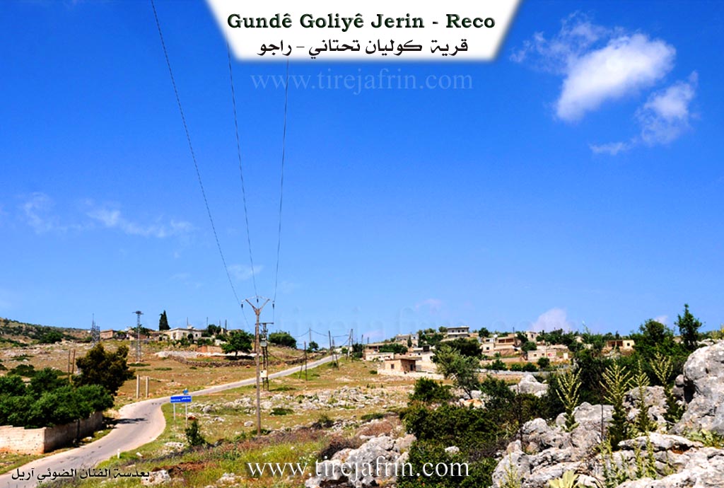
Goliya / Goliya Jêrîn
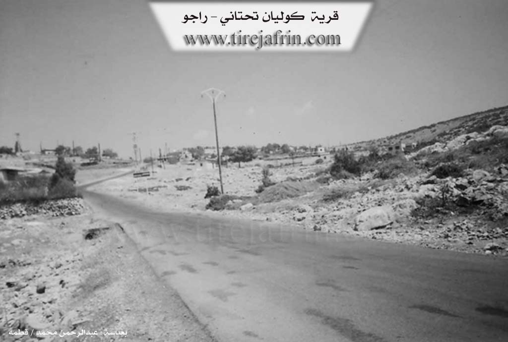
According to the book جبل الكرد (عفرين) دراسة جغرافية Çiyayê Kurmênc (Efrîn): A Geographical Study: Goliya or Goliyan (Arabized as El-Dehhak). The name Goliyan comes from the small artificial collection lake (gol) found near it. There is a tribe in Behdinan named Gol (Lierch, p. 51). The Arabized name has no connection to its Kurdish origin. They are two small villages: Upper and Lower. This entry concerns Goliya Jêrîn (Lower Goliya), Arabized as El-Dehhak El-Tehtanî.
Population: 542 inhabitants (Census 2004).
Area: 106 hectares.
Distance: 15 km.
Elevation: 680 m.
Location: It is located on the southwestern side of Çiyayê Hawar.
According to the book عفرين .... نهرها وروابيها الخضراء Efrîn... Her River and Her Green Hills: Goliyan Tehtanî is a village in Çiyayê Kurmênc following the Reco subdistrict, Efrîn region, Aleppo governorate. It is a small village located in the middle section of the mentioned mountain on a limestone flat, surrounded by mountain slopes furrowed by watercourses that descend to form a valley sloping towards the southwest. Its soil is fertile clay. It is 15 km away from the town of Reco towards the southeast.
It is bordered to the north by a high, rugged mountain range and the village of Şêx Bilal; to the south by a valley, a slope, and a high mountain with the village of Oksizlî at its summit; to the east by a high mountain range, the village of Dax Obasî, and the village of Şêxler Obasî; and to the west by a rugged valley full of rocks and the village of Berbend.
The number of its houses is about 50, and its age is approximately 300 years. Its old residences are stone and mud with flat wooden roofs, while the modern ones are cement and have expanded south and west. A primary school is available, and a paved road passes through its center to several villages up to the village of Dîk Obasî.
It is a poor village, and its lands are rugged and mountainous, unsuitable for agriculture. The residents drink from rainwater collected in cisterns dug in front of the houses. A deep valley divides the village into two parts (lower and upper). There is no electricity network available currently. The residents work in rain-fed agriculture (olives, legumes) on an area of 106 hectares, and they raise sheep and goats.
Village Mukhtar: Mihemed Ebo.
Sources of Information:
- Book: جبل الكرد (عفرين) دراسة جغرافية Çiyayê Kurmênc (Efrîn): A Geographical Study by د. محمد عبدو علي Dr. Mihemed Ebdo Elî.
- Book: عفرين .... نهرها وروابيها الخضراء Efrîn... Her River and Her Green Hills by عبدالرحمن محمد Ebdulrehman Mihemed from the village of Qetme.
- Studies of Navenda Tirej Soft / Ebdulrehman Hacî Osman.
- Some residents of the villages.
Preparation and Execution: Manager of the Tirej Efrîn website: Ebdulrehman Hacî Osman 20/12/2013
II. Summary of Goliyê Jêrin and Goliyê Jorin from Afrin 366
Source: https://www.youtube.com/watch?v=02H5twnAOSo
The documentary captures the social and historical fabric of the interconnected villages of Gulîya Jorîn, Gulîya Jêrîn, and the adjacent hamlet of Berbenda in the Efrîn region. The narrative is driven by interviews with local elders who describe the origins and current state of the community. According to Emîn, a resident of Gulîya Jêrîn born around 1946, the village history spans more than two hundred years. He identifies the founding lineage as Mala Mehîbo Pîro. This family originally migrated from a northern region described as Gûlê şimal, specifically from a location known as Sirtê Hemîşê or Sirtê darê Hemîşê. Emîn recounts that their ancestors were forced to leave that area due to a blood feud and the harsh cold climate, eventually settling in the more temperate environment of the current village.
The social structure is depicted through visits to specific households and communal spaces. In Gulîya Jorîn, the host visits Mewlîd Henan, an elder living in solitude after the passing of his family members. This visit prompts a speech by Bavê Semîr, who urges the diaspora to support the isolated elderly population who remain as guardians of their homes and property. In contrast, the atmosphere in Gulîya Jêrîn is shown to be socially active, with Emîn and his neighbors engaging in a game of backgammon, referring to specific moves or game types like Tawlê Zehra. Emîn notes that the village has grown significantly over the generations, expanding from sixty or seventy households to nearly ninety in the present day.
Prominent locations define the geography of the visit. The tour begins at Mefreqa Gulîya, a crossroads near the Mekteba Gulîya, the village school. The crew also points out Tirbên Gulîya, the cemetery where the ancestors of the community rest. A communal well, Bîrê gundî, is mentioned as a significant contribution made by residents like Mewlîd. The documentary concludes in Berbenda, at the shop of Menan, also addressed as Ebu Henan. He sends greetings to relatives and former villagers currently residing in Nimsê, reflecting the widespread emigration that characterizes the modern reality of the region. Throughout the footage, the residents emphasize the beauty of their land and express a deep desire for their dispersed relatives to return and reconnect with their heritage.
Transcriptions and Subtitles
| Source | Video | Subtitles | Transcript |
|---|---|---|---|
| Afrin 366 1 | Watch Video | Download SRT | View Transcript |
Foundation/Origin Information of Goliyê Jêrin
The village originated as a 'zozan' (summer pasture) for people from the plains. Its settlement began with the founding family of Mehî Bipîro, who were later joined by the families of Hesenê Şêxo, Elî Miho, Hesenê Çerçî, and Henên.
Source: Afrin 366 Transcript
Possible Village Name Meaning of Goliyê Jêrin
Guliyan is one of the small artificial social formations. There is a tribe in Bahdinan named Golî.
Source: TirejAfrin Site
Its name is derived from a local lakelet ('Golîo').
Source: Afrin 366 Transcript