General Information
Nahiya (Subdistrict)
Reco
Also Known As
Al-Dahhak Al-Foqani, Goliya, Goliyê Jorin, Koliya û Berbaniyê, Kuliyan Foqani, الضحاك الفوقاني, كوليان فوقاني, كوليه جورن
Families, Clans, etc.
Mala Emîn, Mala Mehîbo Pîro, Mala Menan, Mala Teyar Ebû Xelîl, Mala Xelîl

Photos
Basic Information about Goliyê Jorin
Source: Afrin 366 (Information for Goliyê Jêrin and Goliyê Jorin)
Foundation Date/Period: Over 200 years ago
Shrines: Tirbên Gulîya
Wells: Bîrê gundî
Other Landmarks: Mefreqa Gulîya, Mekteba Gulîya, Berbenda, Tawlê Zehra
Summaries
I. Summary from TirejAfrin Site (English) of Goliyê Jorin
Source: https://www.tirejafrin.com/site/kura%20afrin%20%20%20Reco%20-%20goliye%20jorin.htm
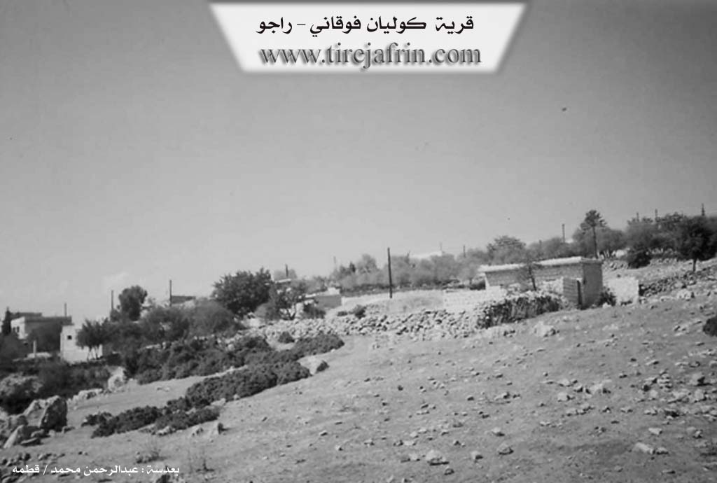
It states in the book Çiyayê Kurmênc (Efrîn): A Geographical Study: Goliya Jorîn, Kolyan Foqanî, Ed-Dehak el-Foqanî /727 people 30 hectares 10km 785m/:
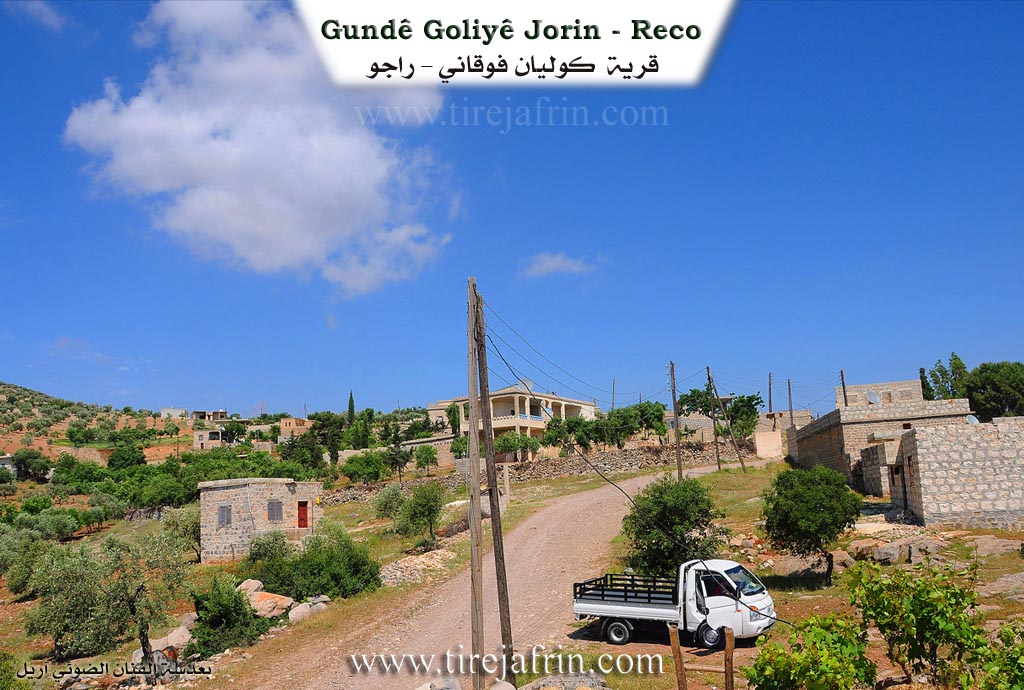
It is a distance of about 1km away from the lower village, on the western face of Çiyayê Hawar.
It states in the book Efrîn... Her River and Her Green Hills: Goliya Jorîn: A village in Çiyayê Kurmênc following the Reco subdistrict, Efrîn region, Heleb governorate. It is a small village located on the slope of a limestone elevation with a slight incline furrowed by water streams. It overlooks the Derbasa Reco-Heleb (Reco-Heleb pass) to the west, where the paved road and the Xeta Trêna Heleb-Meydan Ekbez (Heleb-Meydan Ekbez railway) pass. It is 10 km away from the town of Reco heading southeast.
It is bordered to the north by the village of /Şêx Bilal/, to the south by the village of /Berbend/, to the east by the village of /Goliya Jêrîn/, and to the west by a rugged mountain chain, a very steep slope, a deep watercourse called Geliyê Teyra, and the villages of /Hemşilê/ and /Derwîş Obasî/.
The number of its houses amounts to about 35 houses and its age is about 300 years. Its current houses are mud and stone with flat wooden ceilings. A lack of urban expansion is noted due to migration towards neighboring villages because of the scarcity of resources and the narrow patch of agricultural lands.
A primary school and a dirt road up to the village are available in it. The village drinks from rainwater that collects in cisterns dug next to the houses. The residents work in olive cultivation on limited areas amounting to 30 hectares, and they raise sheep and goats due to the abundance of pastures in the mountains surrounding the village. It is an unserviced village regarding the availability of electricity, water, and communications.
Village Mukhtar: Mihemed Ebo
Sources of Information:
- Book: جبل الكرد (عفرين) دراسة جغرافية Çiyayê Kurmênc (Efrîn): A Geographical Study by د. محمد عبدو علي Dr. Mihemed Ebdo Elî.
- Book: عفرين .... نهرها وروابيها الخضراء Efrîn... Her River and Her Green Hills by عبدالرحمن محمد Ebdulrehman Mihemed from the village of Qetme.
- Studies of Navenda Tirej Soft / Ebdulrehman Hacî Osman.
- Some residents of the villages.
Preparation and execution: Manager of the website Tirej Efrîn: Ebdulrehman Hacî Osman 20/12/2013
II. Summary of Goliyê Jêrin and Goliyê Jorin from Afrin 366
Source: https://www.youtube.com/watch?v=02H5twnAOSo
The documentary captures the social and historical fabric of the interconnected villages of Gulîya Jorîn, Gulîya Jêrîn, and the adjacent hamlet of Berbenda in the Efrîn region. The narrative is driven by interviews with local elders who describe the origins and current state of the community. According to Emîn, a resident of Gulîya Jêrîn born around 1946, the village history spans more than two hundred years. He identifies the founding lineage as Mala Mehîbo Pîro. This family originally migrated from a northern region described as Gûlê şimal, specifically from a location known as Sirtê Hemîşê or Sirtê darê Hemîşê. Emîn recounts that their ancestors were forced to leave that area due to a blood feud and the harsh cold climate, eventually settling in the more temperate environment of the current village.
The social structure is depicted through visits to specific households and communal spaces. In Gulîya Jorîn, the host visits Mewlîd Henan, an elder living in solitude after the passing of his family members. This visit prompts a speech by Bavê Semîr, who urges the diaspora to support the isolated elderly population who remain as guardians of their homes and property. In contrast, the atmosphere in Gulîya Jêrîn is shown to be socially active, with Emîn and his neighbors engaging in a game of backgammon, referring to specific moves or game types like Tawlê Zehra. Emîn notes that the village has grown significantly over the generations, expanding from sixty or seventy households to nearly ninety in the present day.
Prominent locations define the geography of the visit. The tour begins at Mefreqa Gulîya, a crossroads near the Mekteba Gulîya, the village school. The crew also points out Tirbên Gulîya, the cemetery where the ancestors of the community rest. A communal well, Bîrê gundî, is mentioned as a significant contribution made by residents like Mewlîd. The documentary concludes in Berbenda, at the shop of Menan, also addressed as Ebu Henan. He sends greetings to relatives and former villagers currently residing in Nimsê, reflecting the widespread emigration that characterizes the modern reality of the region. Throughout the footage, the residents emphasize the beauty of their land and express a deep desire for their dispersed relatives to return and reconnect with their heritage.
Transcriptions and Subtitles
| Source | Video | Subtitles | Transcript |
|---|---|---|---|
| Afrin 366 1 | Watch Video | Download SRT | View Transcript |
Foundation/Origin Information of Goliyê Jorin
Founded by people who migrated from an ancestral village in Turkey due to a conflict.
Source: Afrin Flo Transcript
Possible Village Name Meaning of Goliyê Jorin
The village takes its name from the nearby lake, 'Gola'.
Source: Afrin Flo Transcript