General Information
Nahiya (Subdistrict)
Mabeta
Also Known As
Al-Ma'sarah, Ma'sarjaq, Me'serkê, المعصرة, معصرجق, معصركه
Tribes
Omerî, Şikakan
Families, Clans, etc.
Domer, El Kêcî, Hebîb, Hec Hemo, Hemdûş, Hemkullek, Mala Ciddû, Mala Ereb, Mala Heddû, Mala Memo, Mala Resûl, Mala Şalîkê, Mistefa, Mistêko, Osman, Topal Hemo, Xelbaşo, Xelîlbaş, Înal
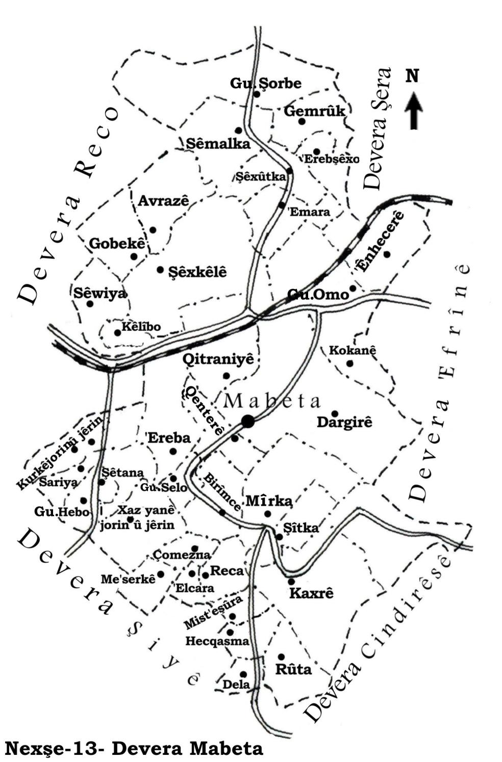
Photos
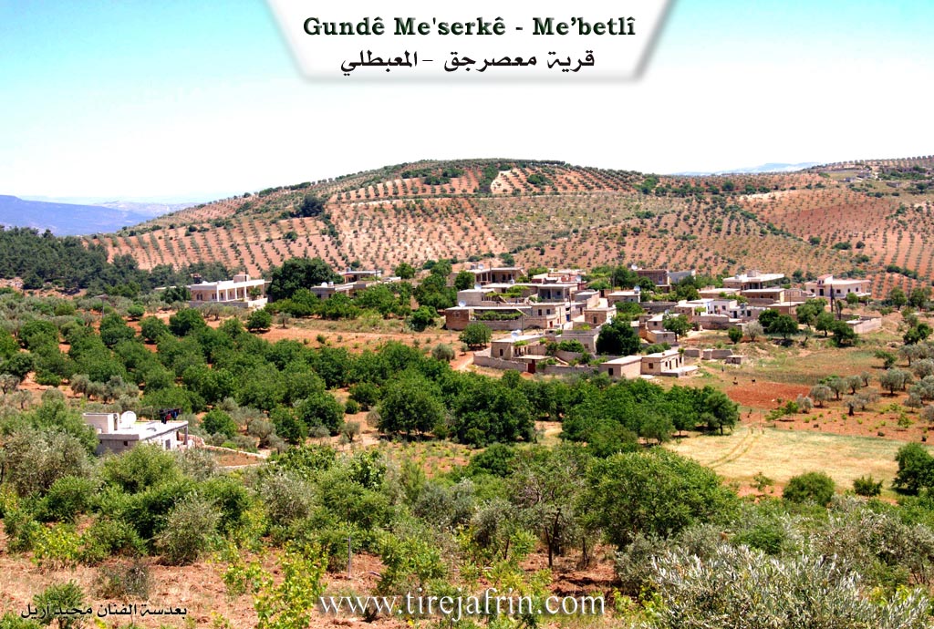
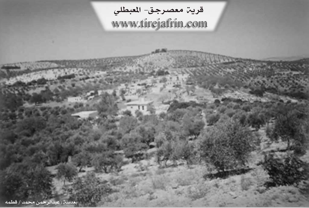
Basic Information about Me'serkê
Source: Afrin 366
Etymology: Keferpêva (meaning Hedîqe or Garden in the language of the Rûm)
Foundation Date/Period: 500 years for Mehserkê
Shrines: Dêr Mişo
Ruins: Keferpêva, Dêr Mişo, Hesen Dêro
Other Landmarks: Şehde, Daryûb
Summaries
I. Summary from TirejAfrin Site (English) of Me'serkê
Source: https://www.tirejafrin.com/site/kura%20afrin%20%20%20mebetli%20-%20meserke.htm
Me'serk / Me'serciq
According to the book جبل الكرد (عفرين) دراسة جغرافية Çiyayê Kurmênc (Efrîn): A Geographical Study by د. محمد عبدو علي Dr. Mihemed Ebdo Elî:
Me'serk, Me'serciq, Al-Ma'sara / 986 inhabitants - 1150 hectares - 15km - 710m /:
The name comes from "Al-Ma'sara" (The Press). It is a small village located on the southern slope of a plateau of Çiyayê Xastiya. It overlooks Geliyê Cercum to the south.
According to the book عفرين .... نهرها وروابيها الخضراء Efrîn... Her River and Her Green Hills by عبدالرحمن محمد Ebdulrehman Mihemed from the village of Qetme:
Me'serciq is a village in Çiyayê Kurmênc, administratively belonging to the Mabeta sub-district, Efrîn region, Heleb governorate. It is a small village located in the central section of the mentioned mountain, on the southern slope of a marly limestone plateau. It overlooks Geliyê Sîlê to the east, which descends towards the south. It is located 15km southwest of the town of Mabeta. Its soil is clay-heavy, covered by forestry and pastures.
It is bordered to the north by a high mountain chain planted with olive trees and forestry, and the village of Xaziyanliya Jorîn. To the south, it is bordered by Geliyê Sîlê, mountainous highlands planted with olive trees and forestry, and the village of Misto Aşûr. To the west, it is bordered by a valley, a mountainous height planted with olive trees, the village of Mixarcik, and the village of Kelanlî. To the east, it is bordered by the deep Geliyê Sîlê and the village of Qişle.
The number of houses reaches approximately 30, and the village is approximately 400 years old. Its old houses are made of stone and mud with flat wooden roofs, while modern cement dwellings have begun to spread around them. An electricity network is available, as well as a water network supplied recently from the well of Elî Caro or from cisterns that collect rainwater in winter. The residents rely on cultivating 1150 hectares of rain-fed land with grains, legumes, and olive trees, alongside raising sheep and goats. It is connected to the sub-district center by a paved road that passes near it and leads to several neighboring villages.
It is one of the old villages in the Mabeta sub-district. There are two modern villas on the southern side of the village and a large banana tree aged 250 years. Among its most important families is the Hec Hemo family, who were the first to inhabit the village. Previously, the following farms/hamlets were attached to it: Misto Aşûr, Cumazanlî, Qişle, Elî Caro, and Hemo Raco; currently, these villages have become independent from the village of Me'serciq.
Among the holders of higher degrees in the village is Saîd Ereb (PhD in Agriculture / Cuba). The village Mukhtar is Remzî Heqî.
Sources
Book: جبل الكرد (عفرين) دراسة جغرافية Çiyayê Kurmênc (Efrîn): A Geographical Study by د. محمد عبدو علي Dr. Mihemed Ebdo Elî.
Book: عفرين .... نهرها وروابيها الخضراء Efrîn... Her River and Her Green Hills by عبدالرحمن محمد Ebdulrehman Mihemed from the village of Qetme.
Navenda Tirej Efrîn / Ebdulrehman Hacî Osman.
20/12/2013
II. Summary of Me'serkê from Afrin 366
Source: https://www.youtube.com/watch?v=HoVgEQBYWZ8
The documentary explores the history and social fabric of two villages in the Afrin region, specifically Mehserkê and Şikate, which are located within the administrative district of Mobata. The narrative begins in Mehserkê, a small village described as being approximately five hundred years old. It is home to thirty two households and is defined by the presence of four specific families: Mala Ereb, Mala Resûl, Mala Memo, and Mala Şalîkê. The village center features a large old tree and stone basins used historically for processing wheat, representing the traditional agricultural life of the inhabitants.
The focus then shifts to the nearby village of Şikate, situated among neighbors such as Tirmîşo, Berko, Çûmasna, Elcora, and Xastora. A knowledgeable elder named Ebû Fîras provides a detailed account of the village's deep history. He reveals that the original name of the site was Keferpêva. According to him, the prefix "Kefer" originates from the language of the Rûm and translates to Hedîqe or garden. He compares this naming convention to other regional locations such as Kefersefrê, Kefercanê, Keferhemra, and Keferbatîx, suggesting the area was historically an agricultural garden or orchard during the Byzantine or Roman era.
While the physical ruins and foundations in Şikate are attributed to the Rûm and are estimated to be between 1,500 and 2,000 years old, the Kurdish settlement history is also significant. Ebû Fîras mentions that the original Kurdish founders of the village belonged to the Omerî tribe, descending from seven brothers who settled there. The current social structure includes families such as Mala Ciddû and Mala Heddû.
The documentary highlights several specific historical landmarks and tools within Şikate. The elder identifies a site called Dêr Mişo (originally Dêr Miş), explaining that "Dêr" signifies a church or kenîse, similar to the site of Hesen Dêro. This indicates a religious history pre dating the current population. Furthermore, the villagers have preserved ancient stone implements, including the Şehde, a stone structure used for pressing olives before the advent of modern presses, and the Daryûb, a stone used for grinding grains like wheat and lentils. These artifacts serve as physical connections to the agricultural heritage of the Omerî tribe and the civilizations that preceded them in the Afrin region.
II. Summary of Me'serkê from Ax û Welat
Source: https://www.youtube.com/watch?v=_KTgDHhOdl4
The village of Me'reskê, also locally known as Gundê Ûsiv, is located in the Şera district of the Efrîn canton, marking the entrance to Çiyayê Kurmênc. The name originates from the word Me'serê or Kuvaşk, referring to the numerous historic grape presses that once existed in the area.
The settlement has deep historical roots. Residents trace their ancestral presence back three to four hundred years, with the population primarily belonging to the Şikakan tribe. The dominant family lineage is Hemkullek, who established themselves in the village around one hundred and fifty years ago. According to oral history, Hemkullek had a brother named Hemdûş who settled in the nearby village of Kefercenê, an area historically referred to as Serî Kaniyê. Over time, the Turkish government assigned various surnames to the Hemkullek lineage, resulting in branches like Topal Hemo, Domer, Înal, Mistefa, Xelîlbaş, Hebîb, and Osman. Other families in the village include El Kêcî. Distant relatives such as the Mistêko and Xelbaşo lineages eventually moved to Xirêbê Şera.
Geographically, the village sits near the beginning of Çiyayê Lêlûnê, a mountain range extending to the Cûmê plain. It shares borders with El Coz to the south and east, and Kefermezê and Meşaleyê to the west. A notable local landmark is Kaniya Kevan, meaning Spring of the Partridges, named because hunters historically gathered there to hunt the birds. Another unique feature is a wind powered water pump built over a local well in the early nineteen eighties by a skilled local blacksmith named Loqiyê.
Agriculturally, Me'reskê is famous for its cherry orchards. The first sour cherry tree was planted in nineteen hundred and seven. Thirty years ago, the village was highly renowned for cultivating specific watermelons known as emrîkî and zêbeşê bûk, but climate change and reduced rainfall prompted farmers to transition heavily to cherries. Villagers use the fruit to produce cherry wine, jam, and a regional dish called kebab keraz, originally influenced by recipes from Rîha and Heleb.
Culturally, Me'reskê is celebrated as a village of intellectuals. A primary school opened in nineteen sixty eight, followed by a new school built by UNICEF in nineteen eighty two. Villagers have been secretly teaching the Kurdish language since the nineteen sixties, utilizing the alphabet developed by Osman Sebrî and the poetry of Cegerxwîn. Today, the village has over one hundred university graduates.
During the recent conflict, the village faced intense attacks. In June two thousand and thirteen, extremist groups including Artêşa Azad, Cebhet el Nusra, and DAIŞ assaulted the area. The villagers chose not to flee. Instead, eighty percent of the women took up arms alongside the YPG and YPJ to defend their homes. Following intense fighting and the loss of four fighters, the attackers were repelled. The community honors its local martyrs Ebo, Sêwas, Amed, and Amanos, and the local commune is proudly named after Sêwas.
Transcriptions and Subtitles
| Source | Video | Subtitles | Transcript |
|---|---|---|---|
| Afrin 366 1 | Watch Video | Download SRT | View Transcript |
| Ax û Welat 1 | Watch Video | Download SRT | View Transcript |
Foundation/Origin Information of Me'serkê
Among its most important families is the Haj Hamo family, the first to inhabit the village.
Source: TirejAfrin Site
Şiketka was founded by seven brothers from the Mala Emêdî family who migrated from the village of Kîrî Joxînê. Meserkê was established by two founding ancestors. Its population is composed of four primary tribes: Mala Ereq, Mala Resûl, Mala Mehmûd, and Mala Şêlîkê.
Source: Afrin 366 Transcript
Possible Village Name Meaning of Me'serkê
Comes from "al-Ma'sarah" the press.
Source: TirejAfrin Site
Şiketka's name is derived from the Kurdish word for "cave" şikeft, as its first settlers lived in them.
Source: Afrin 366 Transcript