General Information
Nahiya (Subdistrict)
Cindires
Also Known As
Miskê jerin, مسكة تحتاني, مسكه تحتاني
Tribes
Bû Silêman, Bû Sultan, Xaltan
Families, Clans, etc.
Cebarcî, Ebdê Mulhim, Hisê Gulke, Mala Ebdî Heskê, Mala Hec Qedûr, Mala Hesen, Mala Heyder Agha, Mala Hiskê, Mala Mûrşid, Mala Seydî, Mala Şêx Ismail Agha, Sîdo

Photos
Basic Information about Miske Jerin
Source: Ax û Welat (Information for Miskê Jorin and Miske Jerin)
Foundation Date/Period: 1517 (according to narrative tradition) or mid-19th century (approx. 150 years ago according to residents)
Hills: Alî Xerbi
Shrines: Şehîdgeha Şehîd Seydo, Barzaret
Ruins: Alî Xerbi
Wells: Bîra Romayiyan, Bîra mala Hesen
Other Landmarks: Deşta Jûmê
Summaries
I. Summary from TirejAfrin Site (English) of Miske Jerin
Source: https://www.tirejafrin.com/site/kura%20afrin%20Cindires%20-%20miske%20jerin.htm
It is stated in the book جبل الكرد (عفرين) دراسة جغرافية Çiyayê Kurmênc (Efrîn): A Geographical Study by د. محمد عبدو علي Dr. Mihemed Ebdo Elî:
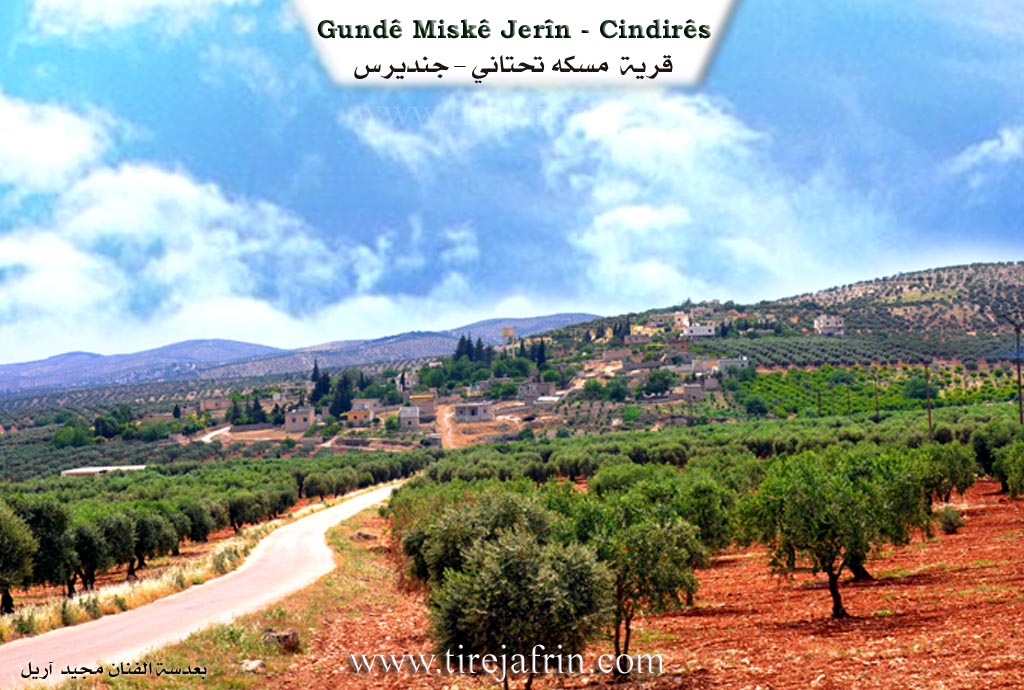
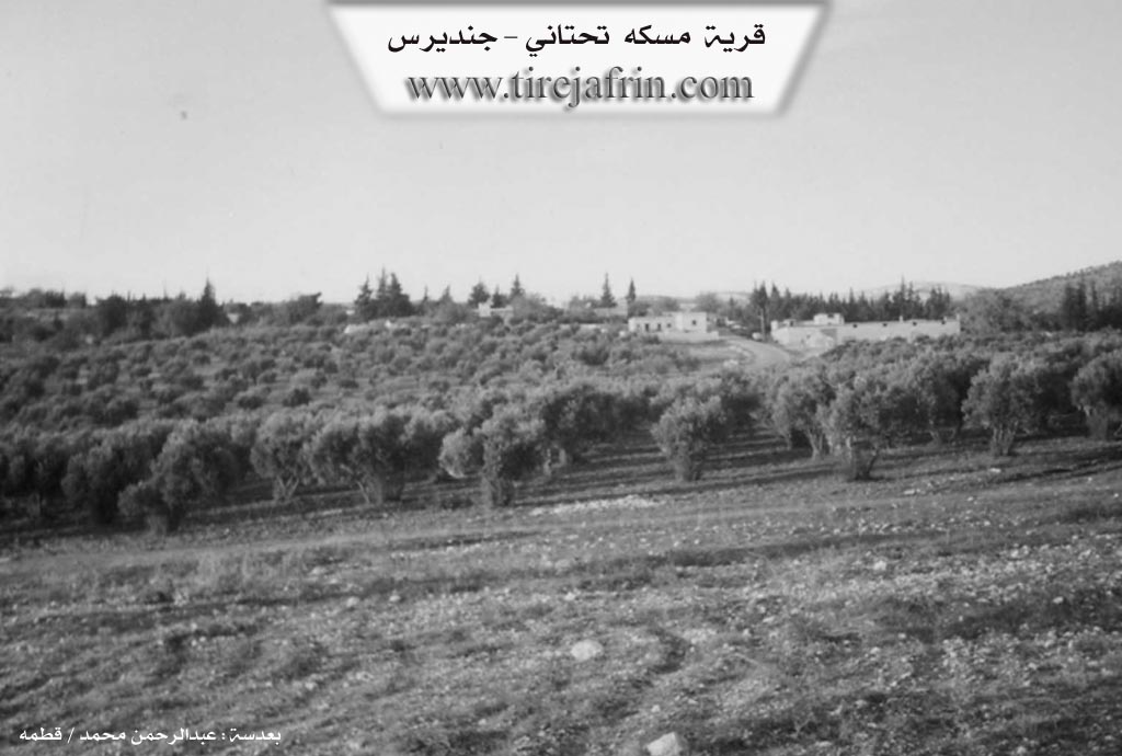
Miske /544 AH/: This is the name of the site on which the village was founded, and we did not know a meaning for it. It consists of two villages: Miske Jorîn and Miske Jêrîn (Lower Miske) /860 inhabitants - 9km - 390m altitude/. It is a small village located on the western side of the Xaltan valley. It overlooks the plain of Cindirês to the south. It contains the house of Xelîl Axa, known from the middle of the last century.
It is stated in the book: عفرين .... نهرها وروابيها الخضراء Efrîn... Her River and Her Green Hills by the writer عبدالرحمن محمد Ebdulrehman Mihemed from the village of Qetme:
Miske Jêrîn: A village in Çiyayê Kurmênc following the Cindirês district, Efrîn region, Heleb governorate.
It is a small village located at the end of the southeastern slope of the aforementioned mountain. It overlooks the Cindirês plain, which has fertile alluvial soil, to the south. It is 10km away from the town of Cindirês heading northeast.
It is bordered to the north by a mountainous elevation planted with olive and walnut trees and the village of Miske Jorîn. To the south, it is bordered by the fertile Deşta Cindirês (Cindirês Plain) planted with olive trees and Geliyê Sîlê (Sîlê Valley), coming from the north towards the eastern side of the village, heading towards Geliyê Efrîn (Efrîn Valley) and the village of Burc Kemoş. To the west, it is bordered by a mountain range planted with olive trees and the village of Kuran. To the east is Geliyê Sîlê, in which water flows from a spring near the shrine of Şêx Mihemed, a mountainous elevation, and the village of Çeqelî Cûm.
The number of its houses is about 55 houses, and its age is approximately 300 years. Its old houses are made of stone and mud with flat wooden ceilings, while the modern ones are concrete and have expanded to the outskirts. An electricity network is available, and the village drinks from the water network of the village of Miske Jorîn or from a spring existing near the village. It has a primary school shared with the village of Miske Jorîn.
The road connecting to it is asphalted and passes through the center of the village reaching the village of Xaltan. It has a single public telephone line and a shrine at the bottom of the valley called Şêx Mihemed. Its residents work in the cultivation of olives (the main crop), grains, and legumes, and in irrigated farming of orchards with apricots, pomegranates, walnuts, almonds, and vegetables from artesian wells, alongside raising sheep and goats. There is a modern olive press and a farmers' cooperative society in the village. The village is surrounded by trees from all directions.
The most important families present in the village are the Sîdo family.
Village Mukhtar: Celal Husên Betal
Preparation and Execution:
Manager of the Tirej Efrîn website: Ebdulrehman Hacî Osman
Sources:
- Book: جبل الكرد (عفرين) دراسة جغرافية Çiyayê Kurmênc (Efrîn): A Geographical Study by د. محمد عبدو علي Dr. Mihemed Ebdo Elî.
- Book: عفرين .... نهرها وروابيها الخضراء Efrîn... Her River and Her Green Hills by عبدالرحمن محمد Ebdulrehman Mihemed from the village of Qetme.
- Studies of Navenda Tirej Soft / Ebdulrehman Hacî Osman.
- 20/12/2013
II. Summary of Miskê Jorin and Miske Jerin from Ax û Welat
Source: https://www.youtube.com/watch?v=t-3p0QqkOiM
The village of Miskê, located in the Cindirêsê district of the Deşta Jûmê, is divided into two sections: Miskê Jêr (Lower) and Miskê Jor (Upper). While local residents estimate the current settlement is approximately 150 years old, historical narratives within the community trace the first arrival to around 1517. The area has a much deeper history, evidenced by the presence of Bîra Romayiyan, a Roman well that served as a primary water source before modern machinery.
The village was founded by Hisê Gulke (also referred to as Heso Gulke), who migrated from the Xaltan region. He initially settled in Miskê Jor. Later, his brother Seyîd and other descendants moved to establish Miskê Jêr. The residents of Miskê Jor are primarily from the Mala Hiskê, while Miskê Jêr includes Mala Seydî, Mala Mûrşid, and descendants of Mala Hec Qedûr, whose original home ruins are located at a nearby site called Alî Xerbi. The village is also home to an Arab community that refers to the village as Mişrîfê. These families, belonging to the Bû Sultan (or Bû Silêman) tribe, arrived from the Mûş region over a century ago. They have fully integrated into the social fabric, speaking Kurmanji and maintaining close fraternal ties with their Kurdish neighbors.
Historically, the region was dominated by the influence of Xelîl Axa (specifically Xelîl Axayê Seydî Mîmo), a wealthy landowner who controlled nearly 13 villages, including Sîndankê, Çeqela, Aşka, and Endîbê. The Agha maintained a guest room (oda) in Miskê, where locals and visitors would gather. Notable figures from this era include Ibrahîmê Tirkoyê, a celebrated singer and the muxtar (headman) of five surrounding villages. The village witnessed the passage of various military forces, including the Ottomans, the French mandate troops, and the British army during wartime maneuvers.
Miskê is renowned throughout Efrîn and beyond for its traditional bone-setters (cebarcî). The Mala Ebdî Heskê family has practiced this folk medicine for over 150 years, treating fractures and sprains. The tradition was passed down from Cebarcî to his son Ebdî Heskê, and continues with grandsons like Nebî and Ebdilrehmanê Heskê. Their reputation was such that they traveled as far as Dêrezor, Şam, and cities in Bakurê Kurdistan like Eyntab and Urfê to treat patients.
Agriculturally, the village sits in the fertile Deşta Jûmê. While olives are the primary crop, Miskê has developed a strong reputation for pomegranates, competing with the famous produce of Basûtê. Farmers like Es'ed note that they introduced pomegranate cultivation in the 1970s, and their harvest is distinct because the fruit ripens later in the season. The village is also known for beekeeping, with producers like Bavê Serxwebûn migrating their hives seasonally to areas like Sorkê and Pîşeraw to produce high-quality honey. Notable landmarks include the Şehîdgeha Şehîd Seydo and a shrine known as Barzaret.
Transcriptions and Subtitles
| Source | Video | Subtitles | Transcript |
|---|---|---|---|
| Ax û Welat 1 | Watch Video | Download SRT | View Transcript |
Foundation/Origin Information of Miske Jerin
The most important family in the village is the Sido family.
Source: TirejAfrin Site
Possible Village Name Meaning of Miske Jerin
A name for the site on which the village was founded, and we don't know its meaning.
Source: TirejAfrin Site