General Information
Nahiya (Subdistrict)
Şera
Also Known As
Al-Qastal, Qastal Kishk, Qestelê Kîšik, القسطل, قسطل كشك
Tribes
Icil
Families, Clans, etc.
Ekaş

Photos
Basic Information about Qestelê Kîşik
Source: Tirej Afrin
Etymology: Qestel means water source, and Kîşk is a Kurdish diminutive for the name of the slope, as the village is located on the slope of a small incline
Foundation Date/Period: About 300 years ago
Springs: Kaniya Kefer Cenê
Ruins: Pira Cûmkê
Other Landmarks: Xeta Hesinî
Summaries
I. Summary from TirejAfrin Site (English) of Qestelê Kîşik
Source: https://www.tirejafrin.com/site/kura%20afrin%20%20sheran%20-%20kstal%20keshak.htm
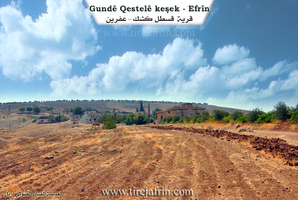
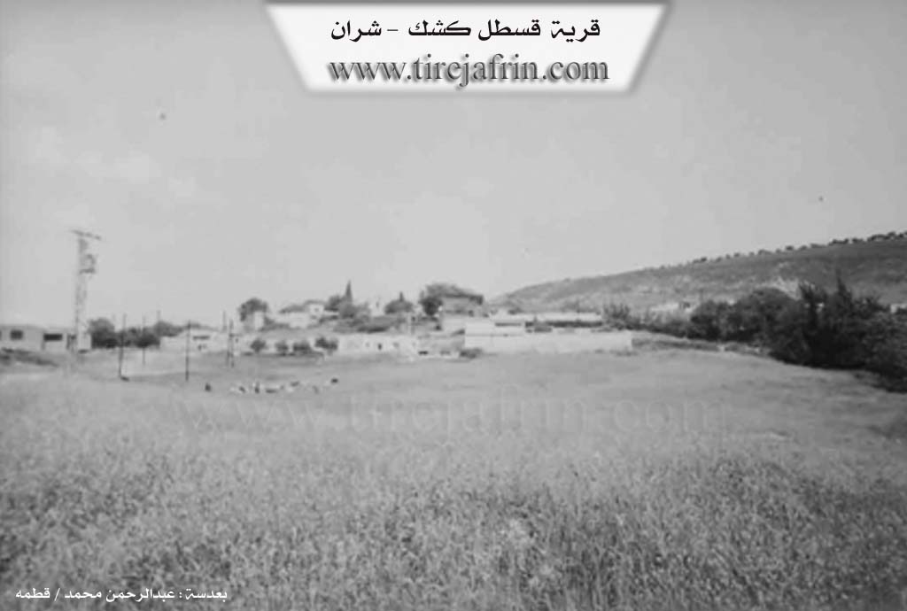
The following is stated in the book جبل الكرد (عفرين) دراسة جغرافية Çiyayê Kurmênc (Efrîn): A Geographical Study: Qestel Kîşk, El-Qestel /539 inhabitants, 480m altitude, 4km/:
The word Qestel means "water source," and "Kîşk" is a Kurdish diminutive for the name of the slope. The village is located on the slope of a small incline. At its northern end, there is a clear spring whose waters flow towards the Efrîn river, and the village took its name from it. It is a small village located on the northern slope of the Cûmkê plateau, about 1km away from the Efrîn river to the east.
The following is stated in the book عفرين .... نهرها وروابيها الخضراء Efrîn... Her River and Her Green Hills: Qestel Kîşk is a village in Çiyayê Kurmênc following the Şeran district, Efrîn region, Heleb province (526 inhabitants). It is located on the western slope of a limestone plateau in the northern part of Çiyayê Simean. A watercourse passes through it, heading west towards the valley of the Efrîn river. Its soil is fertile clay, and it is a very small village.
It is bordered to the north by a slope and valley planted with olive trees and the village of Qurtqulaqê Biçûk. To the south, it is bordered by a highland planted with olive trees and the villages of Cûmkê and Şêx Sîdî. To the east, it is bordered by a slope, a valley, and a mountainous highland planted with olive trees and the village of Qere Tepê. To the west, it is bordered by a slope, the course of the Efrîn river, the Xeta Hesinî (railway line), the antique Pira Cûmkê (Cûmkê bridge) on the Efrîn river, and the village of Estaro located on the western bank of the Efrîn river.
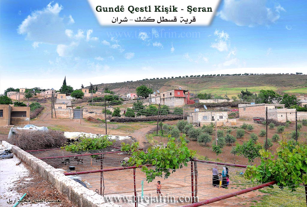
The number of its houses reaches 35 houses, and its age is about 300 years. Its old residences are made of stone and mud with wooden ceilings, and there are some modern houses in it. An electricity network and water are available in it from the Kaniya Kefer Cenê (Kefer Cenê spring). It has a primary school, and it is connected to the district and the region by a paved road. It was named El-Qestel in relation to the spring located in the middle of the village. Its residents work in agriculture on an area of 220 hectares (olives, sheep rearing, and summer vegetables) due to its proximity to the spring of the Efrîn river. The village drinks from a water network connected to the Kefer Cenê spring.
Village Mokhtar: Hikmet Şêx Neesan
Sources of Information:
- Book: جبل الكرد (عفرين) دراسة جغرافية Çiyayê Kurmênc (Efrîn): A Geographical Study by د. محمد عبدو علي Dr. Mihemed Ebdo Elî.
- Book: عفرين .... نهرها وروابيها الخضراء Efrîn... Her River and Her Green Hills by عبدالرحمن محمد Ebdulrehman Mihemed from the village of Qetme.
- Studies of Navenda Tirej Soft / Ebdulrehman Hacî Osman.
- Some residents of the villages.
Preparation and execution: Director of Tirej Efrîn site: Ebdulrehman Hacî Osman 20/12/2013
II. Summary of Qestelê Kîşik from Multi Channel
The documentary explores the village of Qestel Kişk located in the Şera district of the Efrîn region. The village derives its name from the adjacent mountain Çiyayê Kişk which is also known locally as Çiyayê Hene. Overlooking the Efrîn river the village features a beautiful natural landscape filled with olive groves and green valleys.
Qestel Kişk is geographically close to the city of Efrîn separated only by the neighboring village of Cûmkê. Other nearby locations mentioned in the area include Qere Tepe Meydankê and Sorkê. However due to a highly deteriorated unpaved road residents must take a much longer route through Qere Tepe to reach the city center. Basic infrastructure is severely lacking across the board. The village has no medical clinic and lacks a proper sewage system. The local water supply which was originally piped from Kefer Cenê in nineteen seventy two is currently very weak and unreliable.
The settlement is home to a mixed population where Kurdish and Arab communities coexist very closely. The Arab residents primarily belong to the Icil tribe which has a broad presence across roughly twenty three villages in the northern countryside. One prominent household lineage mentioned is the Ekaş family. The communities maintain strong social bonds sharing agricultural duties attending the same social events and frequently intermarrying. Both Kurdish and Arabic languages are spoken interchangeably by the residents. In recent years the village has also taken in displaced people from El His in southern rural Aleppo who now live in an informal camp and work alongside the locals.
Agriculture and livestock represent the vital pillars of the local economy. Original inhabitants and displaced residents alike cultivate olives sugar beets potatoes and pomegranates. A local teacher notes that the village relies on a communal agricultural refrigerator used to store produce during peak harvest times so it can be sold later. Farmers have also recently begun planting crops like cumin coriander lentils and black seed between the olive trees to cope with harsh economic conditions.
Livestock rearing is crucial but is currently facing a severe crisis. Local shepherds report that the village sheep population plummeted from three thousand to fewer than one thousand due to extreme malnutrition and disease. The cost of fodder such as sugar beet pulp imported from Turkey has skyrocketed. This leaves many animals to rely on grazing on river reeds which locals blame for spreading illness among the flocks.
Despite these hardships traditional rural customs endure. Elder women like Zekiye maintain the fifty year old practice of baking traditional flatbread over a heated metal surface using olive branches known locally as Cibir. The village is also rich in folk heritage with local singers like Cuma performing traditional vocal music. His songs celebrate the natural beauty of Çiyayê Hene and express deep lamentations for the struggles of the Syrian people reflecting the enduring resilience of the local community.
Transcriptions and Subtitles
| Source | Video | Subtitles | Transcript |
|---|---|---|---|
| Multi Channel 1 | Watch Video | Download SRT | View Transcript |
Possible Village Name Meaning of Qestelê Kîşik
The word 'qastal' means 'water source,' and 'kîšik' is a Kurdish diminutive of the slope name. The village took its name from a spring at its northern end. It was named Al-Qastal in relation to the spring in the village center.
Source: TirejAfrin Site