General Information
Nahiya (Subdistrict)
Şera
Also Known As
Qastal Ali Jindo, Qastal Jindo, Qestel Cindo, Qestel Cindûnê, Qestela 'Elî Cindo, Qestela Cindo, قسطل جندو
Families, Clans, etc.
Mala Cindo, Mala Elbeskê, Mala Elseydo, Mala Hemîko, Mala Hemîkê, Mala Javkulakê, Mala Kurê, Mala Sûkê, Mala Îso, Omer Elî Cindo, Şêxmendî, Şêxûbekir

Photos
Basic Information about Qestela Cindo
Source: Ax û Welat
Etymology: Named after the Cindo family and the Qestel (spring/fountain) found in the village
Foundation Date/Period: Approximately 600 years ago
Springs: Qestel, Kaniya Boraz
Hills: Çiyayê Parsê, Çiyayê Kurmênc
Shrines: Ziyareta Parsê, Ziyareta Şêx Hemîd
Ruins: Qenateke Romanî
Wells: Bîra Spî
Other Landmarks: Yazibax, Me'rîn, Ezaz
Summaries
I. Summary from TirejAfrin Site (English) of Qestela Cindo
Source: https://www.tirejafrin.com/site/kura%20afrin%20%20sheran%20-%20Qestela%20Cindo.htm
It is stated in the book جبل الكرد (عفرين) دراسة جغرافية Çiyayê Kurmênc (Efrîn): A Geographical Study: Qestela Cindo / 2138 inhabitants - 590 hectares - 8 km - 700 m /:
Its full name is Qestel Elî Cindo, named after one of its early inhabitants. Cindo in the literature of the Êzîdî religion means the believer or the wise one.
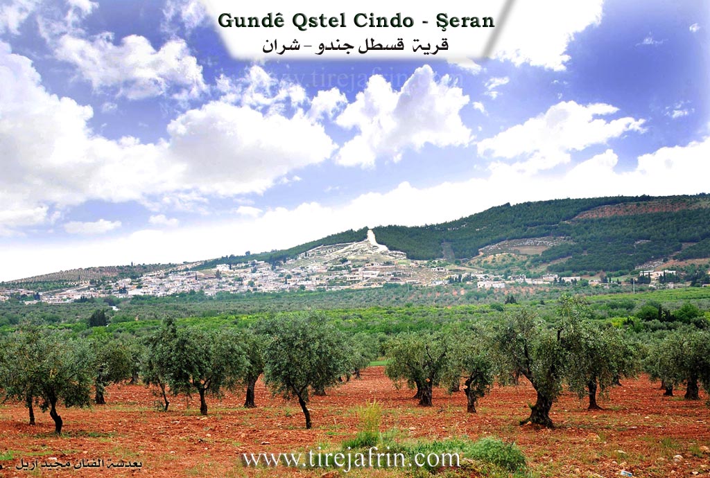
It is a large, populated village located on the southwestern slope of the limestone Çiyayê Parsa (Parsa Mountain). There is a large percentage of early migrants to Germany in the village, which has reflected positively on their economic situation. It is one of the Êzîdî villages.
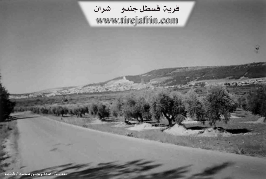
It is stated in the book عفرين .... نهرها وروابيها الخضراء Efrîn... Her River and Her Green Hills: Qestela Cindo is a village in Çiyayê Kurmênc that follows the Şeran district, Efrîn area, Heleb governorate (2094 inhabitants). It is a large village located in the eastern part of the Çiyayê Kurmênc massif, on the southwestern slope of the limestone Çiyayê Parsa. Its agricultural lands slope southward towards Wadî El-Beyadir; its soil is alluvial clay, and the Riya Ezaz-Bilbil (Ezaz-Bilbil road) cuts through it. It is 8 km away from the town of Şeran towards the east.
It is bordered to the north by a valley and fertile mountain chains planted with olive trees and grapevines, and the village of Dîkmetaş. To the south, it is bordered by a wide and agriculturally fertile plain, the city of Ezaz, and the village of Merîn. To the east, it is bordered by a mountain chain called Çiyayê Barsa, which is planted with forest trees, the shrine of Barsa Xatûn, and the village of Yazî Bax (Vineyards). To the west, it is bordered by a valley and a mountain chain planted with olive trees and forest trees, the shrine of Şêx Hemîd, the village of Bafelûn, and the village of Qetme.
The number of its houses reaches about 200, and its age is about 300 years. Its old houses are made of stone and mud with wooden roofs, while the modern ones are concrete, spread along the Riya Giştî ya Ezaz-Bilbil (Ezaz-Bilbil public road) in the form of villas. An electricity network and a water network are available, as well as a paved road with two directions: the first is the Riya Ezaz-Bilbil (Ezaz-Bilbil road) and towards Nebî Hûrî, and the second is towards Riya Qetme-Kefer Cenê (Qetme-Kefer Cenê road). The village contains a primary school, a telephone center, and both modern and traditional olive presses.
The residents of the village work in rainfed and irrigated agriculture, such as olives, grapevines, grains, pistachios, walnuts, vegetables, cherries, and apples, irrigated from artesian wells. The people also work in sheep rearing. The village belongs to the municipality of Qetme. Among its most important families is the family of Omer Elî Cindo, the first to inhabit the village.
The village Mukhtar: Mûrad Omer Cunêd.
Sources of Information:
- Book: جبل الكرد (عفرين) دراسة جغرافية Çiyayê Kurmênc (Efrîn): A Geographical Study by د. محمد عبدو علي Dr. Mihemed Ebdo Elî.
- Book: عفرين .... نهرها وروابيها الخضراء Efrîn... Her River and Her Green Hills by عبدالرحمن محمد Ebdulrehman Mihemed from the village of Qetme.
- Studies of Navenda Tirej Soft / Ebdulrehman Hacî Osman.
- Some residents of the villages.
Preparation and execution: Manager of Tirej Efrîn site: Ebdulrehman Hacî Osman 20/12/2013
II. Summary of Qestela Cindo from Ax û Welat
Source: https://www.youtube.com/watch?v=7GH0xdCVZhA
The village of Qestel Cindo, located in the Şera district of the Efrîn region, stands as a historically significant settlement inhabited by both Êzidî and Misilman Kurds. According to the current headman, Nûrî Xan Cindo, the village was founded approximately 600 years ago. The first settlers belonged to Mala Hemîkê (the house of Şêxê Hemîk), who established the site. They were later joined by Mala Cindo, the family that eventually gave the village its current name alongside the "Qestel" (a reference to the prominent spring or fountain in the area).
The social structure of Qestel Cindo is defined by specific families rather than broad tribal confederations. In addition to the founding lineages, the village is home to families such as Mala Kurê, Mala Hemîko, Mala Îso, Mala Elseydo, Mala Javkulakê, Mala Elbeskê, Mala Sûkê, Şêxmendî, and Şêxûbekir. Leadership has historically passed through a line of mukhtars (headmen), beginning with Avlî and Elî Cindo, followed by Mistû Mihemed, Ebdo Mehmûd, and Mûrad, before passing to the current leader, Nûrî Xan Cindo.
Geographically, the village is situated at an altitude of 825 meters above sea level, nestled against Çiyayê Parsê, which is the eastern section of the greater Çiyayê Kurmênc range. The landscape is marked by ancient water sources and ruins. A spring located in the Boraz area, flowing from the valley of Çiyayê Parsê, once fed a Roman canal that distributed water throughout the village and extended toward Ezaz. Local elder Apê Menan notes that the village still contains ancient cisterns (sarîncên kevin) and relies on the Bîra Spî (White Well).
Religious and spiritual life in Qestel Cindo is anchored by two primary shrines. Ziyareta Parsê is located atop the mountain of the same name, while Ziyareta Şêx Hemîd lies to the west of the village on the road to Qitmê. Culturally, the village is renowned for its agriculture. While originally dedicated to olives and vineyards, the discovery of groundwater shifted the economy toward fruit production. Naîf Oso, the head of the council, explains that the village is now famous for kerez (cherries) and sêv (apples), with the harvest being a communal activity.
Qestel Cindo also holds a strategic and martial reputation in recent history. It is described as the site of the first battle of the war in Rojavayê Kurdistanê. Situated only five kilometers from Ezaz and bordered by Tirkman villages like Yazibax and Me'rîn, the village faced early attacks. However, the residents, described as "miletkî qehreman" (a heroic people), largely refused to flee, maintaining their presence in their homes while supporting the YPG forces stationed on the nearby hills, such as Çiyayê Parsê. The community maintains a strong tradition of collective support, frequently preparing large communal meals, including yaprax, sorman, and dolman, to send to the fighters on the front lines.
Transcriptions and Subtitles
| Source | Video | Subtitles | Transcript |
|---|---|---|---|
| Ax û Welat 1 | Watch Video | Download SRT | View Transcript |
Foundation/Origin Information of Qestela Cindo
The Omar Ali Jindo family were the first to inhabit the village.
Source: TirejAfrin Site
It was established by the Cindo and Hemîkê families, who migrated from surrounding areas.
Source: Ax û Walat Transcript
Possible Village Name Meaning of Qestela Cindo
Its full name is 'Qastal Ali Jindo' after one of its early inhabitants. Jindo in Yazidi religious literature means believer or wise man.
Source: TirejAfrin Site