General Information
Nahiya (Subdistrict)
Bilbilê
Also Known As
Al-Ras Al-Ahmar, Qizilbash, Qizilbaşa, الرأس الأحمر (AR translation), قزلباش, قزل باشه
Families, Clans, etc.
Mala Gurdê, Mala Êmir, Êmer

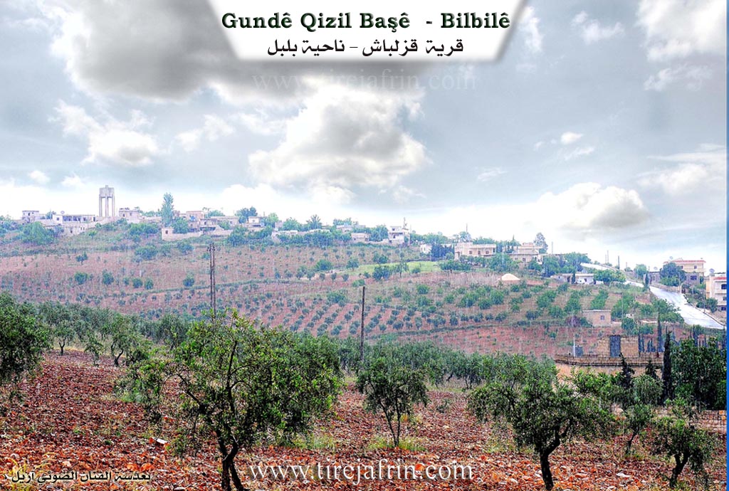
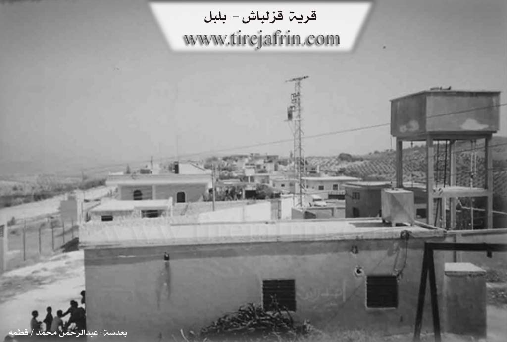
Photos
Basic Information about Qizilbaşa
Source: Tirej Afrin
Etymology: The name means "The Red Headed One" (qizil + baş). Historically, it was a metonym for the soldiers of Shah Ismail Safavi in the late 15th century, whom the Turks called this due to their red headgear. Locally, the name was given to one of the village's early residents who was cruel and rude, so the locals nicknamed him "Qizilbaşa" as a metonym for those traits.
Foundation Date/Period: Approximately 125 years ago (Late 19th century)
Summaries
I. Summary from TirejAfrin Site (English) of Qizilbaşa
Source: https://www.tirejafrin.com/site/kura%20afrin%20%20%20bilbile%20-%20xzal%20bash.htm
It is stated in the book Çiyayê Kurmênc (Efrîn): A Geographical Study: Qizilbaşa Qizilbaş The Red Head / 859 inhabitants - 347 hectares - 19 km - 620 m altitude /:
Qizilbaş: Meaning "The Red Headed One" (qizil + baş), a metonym for the soldiers of Şah Ismaîl the Safavid in the late fifteenth century. The Turks used to apply this name to Shiite Persians in general, describing them as cruel and atheistic. There is a story behind this naming: one of the early residents of the village was cruel and rude, so the locals gave him the nickname "Qizilbaş" as a metonym for those traits. The Arabized name is a literal translation of the popular name.
It is a small village located on the southwestern edge of the surface of a high plateau. Its houses are spread over three small adjacent hills.
It is stated in the book Efrîn... Her River and Her Green Hills:
Qizilbaşa: A village in Çiyayê Kurmênc following the district of Bulbul, in the Efrîn region of the Heleb governorate. It is a small village located north of the middle section of the mentioned mountain, on the southwestern edge of the surface of a limestone plateau covered with clay soil. The Efrîn river passes to the east of it at a distance of 50 km. It is 19 km away from the town of Bulbul towards the southeast. Its houses are spread over three small adjacent hills.
It is bordered to the north by a high mountain range planted with forest trees and the village of Şêx Xoroz; to the south by a deep flood valley, a high mountain range planted with olive trees, and the village of Naza Uşaxî; to the west by a slope and a flood valley, at a distance of 500 m, is the village of Bêlankê; and to the east by a slope, several watercourses, and the village of Qarqîne (or El-Qara).
The number of its houses is about 45, and its age is approximately 125 years. It is a modern village. Its old houses are made of stone and mud with wooden roofs, while the modern ones are cement and have spread to the south and north. An electricity network and a modern primary school are available. The village drinks water from a well belonging to the state or from cisterns that collect rainwater in winter.
Its residents work in rain-fed agriculture on an area of 347 hectares, cultivating olives, vines, and fruit trees, alongside raising sheep and goats. The road from the village to the town of Bulbul is paved up to the center of the village. Its lands are mountainous and sloping on three sides: the western, southern, and eastern. There is also a farm (mezre) on the western side consisting of approximately ten houses belonging to the mentioned village.
Among the families present in the village: The Êmer family.
It is mentioned that the writer and researcher Professor Heyder Omer, who resides in Germany, is from the people of this village.
Village Mukhtar: Ehmed Reşîd Omer.
Sources of Information:
- Book: جبل الكرد (عفرين) دراسة جغرافية Çiyayê Kurmênc (Efrîn): A Geographical Study by د. محمد عبدو علي Dr. Mihemed Ebdo Elî.
- Book: عفرين .... نهرها وروابيها الخضراء Efrîn... Her River and Her Green Hills by عبدالرحمن محمد Ebdulrehman Mihemed from the village of Qetme.
- Studies of Navenda Tirej Soft / Ebdulrehman Hacî Osman.
- Some residents of the villages.
Preparation and execution: Manager of the Tirej Efrîn website: Ebdulrehman Hacî Osman 20/12/2013
II. Summary of Qizilbaşa from Afrin 366
Source: https://www.youtube.com/watch?v=12do3w-IjWs
The documentary explores the village of Qizilbaş, sometimes referred to by the locals as Qizilbaşo, located in the Bilbil district near the border with the Şera district in the Efrîn region. Throughout the episode, the hosts also mention visiting or planning to visit other nearby villages, including Bêlê, Maxalo, Şikêr, Ehmed Misto, and Cûcekan.
The history of Qizilbaş is considered very ancient, and its exact foundation date is lost to time. According to a local elder named Xalê Cemal, nobody knows exactly when the village was first established. The oldest known structure still standing in the village is an old ruined house called Xaniyê Çenqit. The original identity and fate of the Çenqit family remain a mystery to the current residents, and no one knows where they went or who they truly were.
Before the current inhabitants arrived, the land reportedly belonged to a non Muslim population, referred to locally by the religious identifier Gawir. The modern settlement of the village traces back to three brothers who brought their sheep to the area and produced charcoal for a living. Their names were Heso, Xelo, and Silo. Their descendants still point out the locations of their old structures and ancient olive trees among the surrounding lands. According to local oral history, the name of the village derives directly from Heso. Over time, he became known as Qizil Paşa. The surrounding area was initially called Xiskê Qizilbaşa before the name was eventually shortened to Qizilbaş. The villagers note that the term is of Turkish origin rather than Kurdish or Arabic.
Currently, the village is relatively small, comprising about sixty to seventy households. The population primarily consists of two main families: Mala Êmir and Mala Gurdê. The villagers rely heavily on agriculture, with seventy to ninety percent of their livelihood coming from olive cultivation, which is typical for the Efrîn region.
During the interviews, the elders strongly emphasize the importance of preserving the Kurdish language and traditional values among the youth, warning them not to abandon their mother tongue. The documentary captures the scenic beauty of the village, showcasing its old earthen courtyards, local vegetation, and the village school. The hosts repeatedly urge locals and returning visitors arriving from Uropa and Heleb to keep the environment clean, to respect nature, and to refrain from throwing garbage into the fields or out of car windows.
Transcriptions and Subtitles
| Source | Video | Subtitles | Transcript |
|---|---|---|---|
| Afrin 366 1 | Watch Video | Download SRT | View Transcript |
Possible Village Name Meaning of Qizilbaşa
Qizil bash means 'those with red heads,' referring to soldiers of Shah Ismail Al-Safawi. A story says one of the village's first inhabitants was harsh and cruel, so locals gave him the title 'Qizilbash' as a reference to those qualities.
Source: TirejAfrin Site