General Information
Nahiya (Subdistrict)
Reco
Also Known As
Xirab Simaq, Xirab Sinaq, Xirabê Simaq, Xirabî Simaqê, خرابة سماق
Families, Clans, etc.
Mala Bekirî, Mala Betalê, Mala Elîkê Mîno, Mala Elîno, Mala Subhî Mehmedî Elî, Mala Sînê, Mala Xelîl Eppo
Photos
Basic Information about Xirab Simaq
Source: Ax û Welat
Etymology: Named Xirabê Simaq due to the abundance of sumac (simaq) in the area and because the village was ruined (xirabe) and rebuilt multiple times
Foundation Date/Period: approximately 300 years; the current modern settlement was established in 1989
Caves: Şikefta Lûlê
Number of Caves: 5
Springs: Bîra Sorsînê, Kaniya Qestelê
Hills: Çiyayê Kurkê, Çiyayê Reş, Girê Zuwêrekê
Shrines: Ziyareta Çiyayê Kurkê
Ruins: Xirabê Keştiyo, Xirabê Mecîd, Xirabê Kêşûlêr
Wells: Bîra Sorsînê
Other Landmarks: Geliyê Sorsînê, Erdê Dûlê, Deşta Hemqê, Geliyê Tîra, Giya Erebok, Geliyê Sarisîn
Summaries
I. Summary from TirejAfrin Site (English) of Xirab Simaq
Source: https://www.tirejafrin.com/site/kura%20afrin%20%20%20Reco%20-%20xarab%20samq.htm
It is stated in the book Çiyayê Kurmênc Efrîn A Geographical Study: Xirab Simaq, /350m/:
It is an old residential site where sumac shrubs abound, so it was named after that.
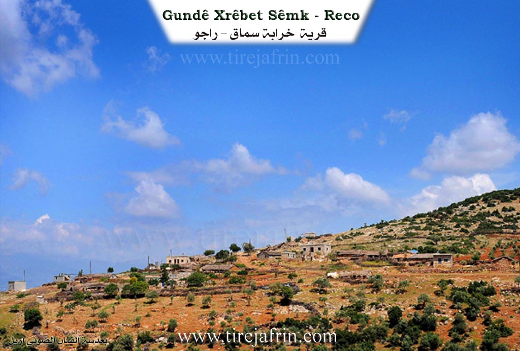
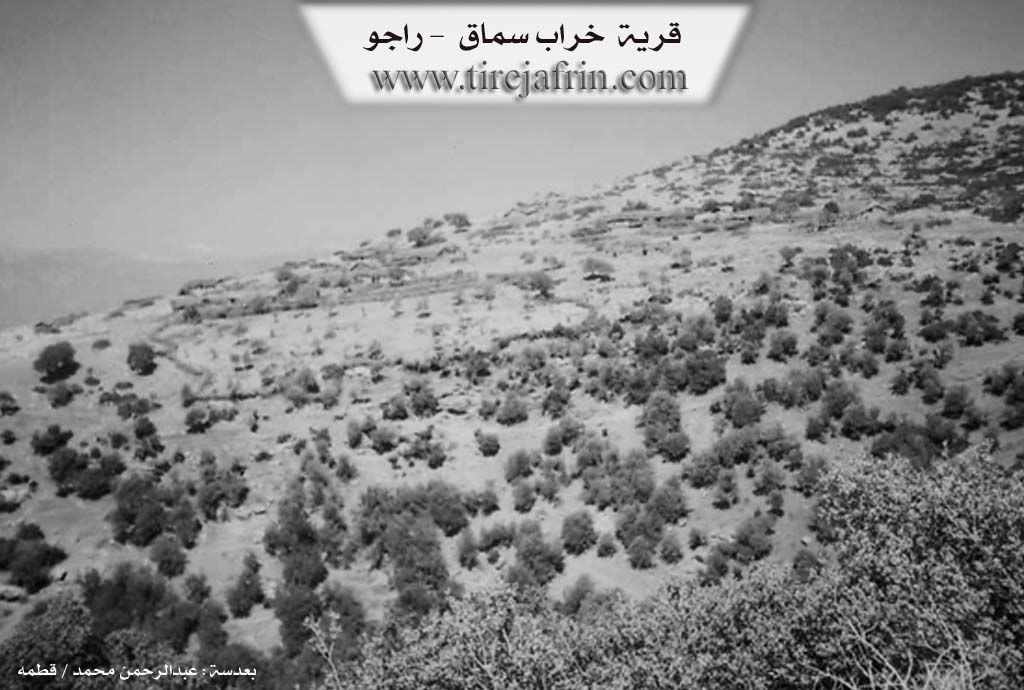
The village consists of approximately fifteen stone dwellings roofed with straw. They are scattered on a mountainous patch covered with forest trees. The village overlooks the plain of Lîçe from the west. It is located on the northern slope of the western end of the valley of Sarisn.
It is stated in the book Efrîn... Her River and Her Green Hills: Xirab Simaq: A farm in Çiyayê Kurmênc belonging to the district of Reco, region of Efrîn, governorate of Heleb.
It is a small farm located on the western slope of Çiyayê Heleb. It is bounded to the north by Xirab Mecîd, to the south by Kaniya Batmanê, to the east by a mountain range and the village of Höpkanlî, and to the west by Deşta Amuqê and Girê Kişûr.
It is currently deserted, completely devoid of residents. Its people do not come to it during the olive season, and no services are available.
Sources:
- Book: جبل الكرد (عفرين) دراسة جغرافية Çiyayê Kurmênc (Efrîn): A Geographical Study by د. محمد عبدو علي Dr. Mihemed Ebdo Elî.
- Book: عفرين .... نهرها وروابيها الخضراء Efrîn... Her River and Her Green Hills by عبدالرحمن محمد Ebdulrehman Mihemed from the village of Qetme.
- Studies of Navenda Tirej Soft / Ebdulrehman Hacî Osman.
- Some residents of the villages.
Preparation and execution: Manager of Tirej Efrîn site: Ebdulrehman Hacî Osman 20/12/2013
II. Summary of Xirab Simaq from Ax û Welat
Source: https://www.youtube.com/watch?v=JAT5PMETNtQ
The song featured in the transcript explores classic themes of love, grief, and the transience of life. The lyrics mention specific characters, including Sêvo and Zelîxan. The singer refers to a figure named Sêvo, who addresses a "handsome young man" (lawikê minî delal) and mentions "ruknê bermaso," a phrase that likely refers to a specific lineage, location, or pillar of strength within the poetic context of the song. The singer also invokes the name Zelîxan, expressing endearment with the phrase "yar bi qurban Zelîxanê" (may the lover be a sacrifice for Zelîxan).
A recurring theme in the performance is the fleeting nature of the world. The singer laments that "dinya fanî" (the world is mortal/transient) and notes that while the world may seem sweet ("dinya xweş e şêrîn e"), it ultimately does not remain for anyone ("dinya namîne ji min û te ra"). The lyrics also touch upon social tensions, specifically accusing a young man of being "fesad" (mischievous or slanderous) and lamenting the state of "gundê me yî xeracî" (our ruined or tribute-paying village), though this appears to be a metaphorical device within the ballad rather than a factual geographic reference to the documentary's subject.
II. Summary of Xirab Simaq from Ax û Welat 2
Source: https://www.youtube.com/watch?v=PC6h8OIFXz8
The village of Xirabê Simaq is situated in the Rajo district of the Çiyayê Kurmênc (Afrin) region, positioned on high ground atop Çiyayê Kurkê. The village's name is derived from two distinct characteristics: the historical abundance of sumac plants (simaq) in the area, and the fact that the settlement has been destroyed or "ruined" (xirabe) multiple times throughout its history. While oral history suggests the site has been inhabited for approximately 300 years, the current iteration of the village was established in 1989. Prior to this modern resettlement, the village had been abandoned and ruined twice due to historical upheavals.
The current population consists primarily of families who migrated from the nearby villages of Hesen, Kurê (also referred to as Gewrê), and Kumreşê. They moved to Xirabê Simaq largely for pastoral reasons, as the lower elevation provided a warmer climate for livestock compared to the snowy heights of their original villages. The first family to settle the modern village was Mala Elîkê Mîno, though they later moved to Şediya. Historical inhabitants who lived there before the village was ruined included Mala Betalê, Mala Xelîl Eppo, and Mala Sînê. Today, residents like Mala Bekirî and Mala Subhî Mehmedî Elî maintain the village's agricultural traditions, cultivating olives and sumac, and raising sheep.
The geography of Xirabê Simaq is defined by its proximity to the border of Bakurê Kurdistan, facing towns like Qirixan and Islahiye and the Çiyayê Amanos range. The village is surrounded by specific landmarks, including the ruins of Xirabê Keştiyo and Xirabê Mecîd, the valley of Geliyê Sorsînê, and the Erdê Dûlê. A notable water source is Bîra Sorsînê (also called Kaniya Sor), and there is a shared spring with the village of Şediya called Kaniya Qestelê. A shrine acts as a namesake for the mountain it sits upon, Ziyareta Çiyayê Kurkê. To the west lies Girê Zuwêrekê, which contains five caves, and the Deşta Hemqê stretches out below.
Historically, the mountains around Xirabê Simaq, particularly near Çiyayê Reş, were mined for iron. Residents recall Bulgarian companies arriving in the 1960s and 1970s to excavate soil and extract minerals, which were transported to Tertûs and Hims.
Architecturally, Xirabê Simaq is distinct for its "zinc" houses, locally called Zinc or Qişle. These structures were built with timber frames and tin roofs covered in grass or straw for insulation. This style was necessitated by strict government regulations that previously banned the construction of permanent concrete or stone buildings in this border zone. Consequently, the villagers adapted by building these semi-permanent structures, which remain a characteristic feature of the village today, alongside newer concrete homes. Despite its development, the village lacks a school, forcing children to travel to Sindir or Kurê for education.
Transcriptions and Subtitles
| Source | Video | Subtitles | Transcript |
|---|---|---|---|
| Ax û Welat 1 | Watch Video | Download SRT | View Transcript |
| Ax û Welat 2 | Watch Video | Download SRT | View Transcript |
Foundation/Origin Information of Xirab Simaq
Established by people who migrated from three other villages—Hesen, Kurê, and Kum Reşê—seeking a defensible location to protect their community from raids and invasions that had left their previous settlement in ruins.
Source: Ax û Walat Transcript
Possible Village Name Meaning of Xirab Simaq
The village's name, meaning "Ruins of Sumac," was derived from the abundance of sumac trees in the area, though an older name for the site may have been "Korkê."
Source: Ax û Walat Transcript
V. Links
- Tirej Afrin:
https://www.tirejafrin.com/site/kura%20afrin%20%20%20Reco%20-%20xarab%20samq.htm - Ax û Welat:
https://www.youtube.com/watch?v=BQz1aTPU5Dw - Drone:
https://www.youtube.com/watch?v=JFEh8S58O4o (no longer available) - Link:
https://www.youtube.com/watch?v=PC6h8OIFXz8 - Ax û Welat:
https://www.youtube.com/watch?v=JAT5PMETNtQ