General Information
Nahiya (Subdistrict)
Reco
Also Known As
Dag Oba Si, Jia, Çiyê, الجبلية, داغ اوبه سي, طاغ أوبه سي, جبلية, جيا, جيه
Tribes
Amka
Families, Clans, etc.
Ademî, Delê Mehmî, Elî Mamê, Mihemed Elo, Qaqo

Photos
Basic Information about Çiyê
Source: Ax û Welat
Etymology: Named after the mountains, specifically Çiyayê Hawarê, due to the high elevation and rugged terrain
Foundation Date/Period: Approximately 400 to 500 years ago
Caves: Şikefta Hisûtê
Hills: Çiyayê Hawarê, Hesen Dêra
Shrines: Zîyaretgeha Gul, Zîyaretgeha Gulgul, Zîyaretgeha Sabê Paçik, Zîyaretgeha Mamedê
Ruins: Kela Hawarê, Qişle Oca, Qişle Engo
Trees: Dara Tûyê
Wells: Bîra gundê Qêsim
Other Landmarks: Geliyê Qudeleq, Geliyê Ertî, Geliyê Kêrîm, Geliyê Gere, Sarînca Şêxdînê, Sarînca Qerece, Bena Kêvir, Bena Şerqî, Bena Xerbî, Deşta Ovarazê, Gola gund
Summaries
I. Summary from TirejAfrin Site (English) of Çiyê
Source: https://www.tirejafrin.com/site/kura%20afrin%20%20%20Reco%20-ciye.htm
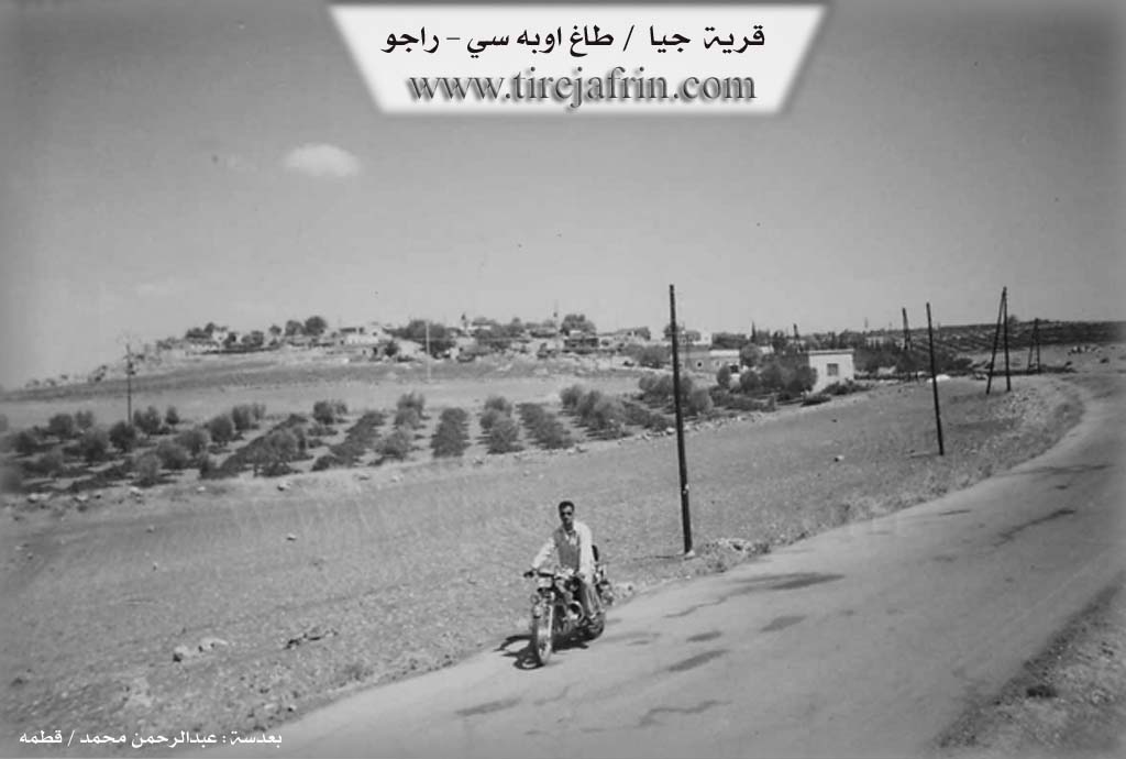
It is stated in the book جبل الكرد (عفرين) دراسة جغرافية Çiyayê Kurmênc (Efrîn): A Geographical Study: Gundê Çiya, Dağ Obasî, Al-Jabaliyah /882 inhabitants - 87 houses - 18km - 960m/:
It means "Village of the Mountain" (Gundê Çiya), which is a Kurdish name denoting the village's location on the summit of Çiyayê Hawar.
It is a small village established on the highest peak in the middle of Çiyayê Hawar. Approximately 1.5 km to the southeast, on a conical forested peak, lie the remains of the foundations of the ancient Kela Hawar (Hawar Castle). The Arabized name of the village is a translation of the Kurdish name. It is the village of the well-known Kurdish politician Hûrik Ehmed.
It is stated in the book عفرين .... نهرها وروابيها الخضراء Efrîn... Her River and Her Green Hills: Dağ Obasî - Çiya: A village in Çiyayê Kurmênc (Mountain of the Kurds) administratively belonging to the Reco district, Efrîn region, Aleppo governorate.
It is a very small village located on the southeastern slope of the highest peak of Çiyayê Hawar. It is located /18km/ southeast of the town of Reco. It is bordered to the north by a mountain range, a deep valley, and the village of Dîkê; to the south by a rugged and harsh mountain range and the villages of Ebraz and Kûbek at the bottom of the mentioned mountain; to the east by a high, rugged mountain range planted with oak forest trees and the villages of Hesen Dêra and Qurî Gol; and to the west by a rugged mountain range and the villages of Şêxor and Goliyên Jêrîn.
The number of its houses is about 15, and its age is about 400 years. Its dwellings are stone and mud with wooden roofs, while modern ones are cement. There is a primary school, an electricity network, and a road paved recently up to the center of the village. The residents work in olive cultivation and sheep breeding. The people drink from pools and cisterns where rainwater is collected in winter. There is an archaeological site on top of a mountain. In general, its lands are mountainous and rugged from all sides and very poor; there are absolutely no agricultural lands around it, so the people of the village rely on charcoal production.
Among the families present in the village: the Qaqo family (Hennan Qaqo Bilâl) and the Mihemed Elo family. It is noted that the Mukhtar of the city of Efrîn, Mr. Ebdulehnan Bilâl, is from the people of this village.
Village Mukhtar: Mr. Mihemed Keno.
Sources of Information:
- Book: جبل الكرد (عفرين) دراسة جغرافية Çiyayê Kurmênc (Efrîn): A Geographical Study by د. محمد عبدو علي Dr. Mihemed Ebdo Elî.
- Book: عفرين .... نهرها وروابيها الخضراء Efrîn... Her River and Her Green Hills by عبدالرحمن محمد Ebdulrehman Mihemed from the village of Qetme.
- Studies of Navenda Tirej Soft / Ebdulrehman Hacî Osman.
- Some residents of the villages.
Preparation and Execution: Director of the Tirej Efrîn website: Ebdulrehman Hacî Osman 20/12/2013.
II. Summary of Çiyê from Ax û Welat
Source: https://www.youtube.com/watch?v=Tqqa6J4bV9k
The documentary details the history and social life of Gundê Çê, also referred to as Gundê Çiyê, a village situated in the mountainous Çiyayê Hawarê region of Efrîn. The village is located approximately 18 kilometers from Raco and 35 kilometers from the city of Efrîn. Its name is derived from its rugged geography, as it is perched on the high slopes of the mountain range. The village was founded roughly 400 to 500 years ago, and its inhabitants belong to the Amka tribe. The narrator and guests identify specific families rooted in the village, including Ademî, Delê Mehmî, and Elî Mamê.
Historically, the isolation and difficult terrain of Çiyayê Hawarê made it a place of refuge. The guests explain that the name Hawar implies a cry for help or a call, and the mountain served as a sanctuary for those fleeing state persecution. Notable figures such as Ehmedê Rûtê sought shelter here while resisting the French mandate and subsequent state pressures. The village was once home to elders and leaders known as rûspî, including Elî Şêxo, Henê Elo, Mihemedê Elo, Henê Qoqe, Mamê Usê, Mehmêd Elo Elî Şêx, Henan Qaqî, and Horikê Osman, who managed community affairs and disputes before the establishment of modern communes.
A defining characteristic of Gundê Çê is the scarcity of water sources. The speakers repeatedly emphasize that there are no natural springs (kanî) in the village. Survival depended on a communal man made pond known simply as Gola gund and rainwater cisterns like Sarînca Şêxdînê and Sarînca Qerece. This pond acts as a sacred site or ziyaret; historically, villagers would perform sacrifices and hold festivals there to ensure its purity and water levels. In times of drought, residents were forced to travel hours to the neighboring Gundê Qêsim to fetch water from a well or melt snow during harsh winters.
The landscape is dominated by Kela Hawarê, an ancient fortress located south of the village. Believed to be around 2,000 years old, the castle is built from large stones and situated within a dense forest of oak, terebinth, and wild olive trees. The area also contains ruins of older settlements called Qişle Oca and Qişle Engo. The village is surrounded by deep valleys such as Geliyê Qudeleq, Geliyê Ertî, and Geliyê Gere. Several shrines are scattered across the mountain, including Zîyaretgeha Gul, Zîyaretgeha Gulgul, Zîyaretgeha Sabê Paçik, and Zîyaretgeha Mamedê. Zîyaretgeha Gulgul is particularly noted for a tradition involving the naming of children to ensure their survival. Despite a history of migration due to economic hardship and state pressure, the remaining residents maintain strong communal bonds and agricultural traditions in this high altitude settlement.
Transcriptions and Subtitles
| Source | Video | Subtitles | Transcript |
|---|---|---|---|
| Ax û Welat 1 | Watch Video | Download SRT | View Transcript |
Possible Village Name Meaning of Çiyê
"Gundî Çiyê" means "village of the mountain" in Kurdish, referring to its location on Hawar mountain.
Source: TirejAfrin Site