General Information
Nahiya (Subdistrict)
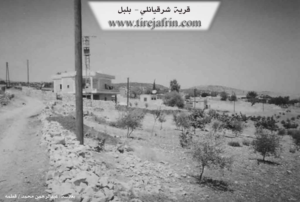
Bilbilê
Also Known As
Şerqiya, Şêrqiya, شرقان, شرقيانلي, شرقيا
Tribes
Biyan, Şerqiya
Families, Clans, etc.
Gudar, Kêlê Isib, Mihemed, Mistû, Qirfê

Photos
Basic Information about Şêrqiya
Source: Ax û Welat
Etymology: Derived from the name of the Şerqiya tribe, although no families from this tribe currently reside in the village
Foundation Date/Period: Approximately 100 years ago (early 20th century)
Springs: Kaniya avê
Hills: Qilê Sîsêk, Gendar, Gazê Hebû
Shrines: Tirbê Hebû, Tekne
Ruins: Kûjêrakê, Dibar, Çetelix
Other Landmarks: Axê Xuriyê, Axê Sor, Kûka Zenter, Geliyê Gucê, Geliye Mûsenkê, Birşeqel, Dibistana gundê Salah
Summaries
I. Summary from TirejAfrin Site (English) of Şêrqiya
Villages of Bilbile District / bilbile
Sharqiyanli (شرقيانلي) - Şêrqiya
===
According to the book 'جبل الكرد' 'Mountain of the Kurds' / Afrin City / Geographical Study:
Şerqiya, Sharqanli (شرقانلي), Sharqan (شرقان) /1121n - 260ha - 7km - 660m/:
- Sharqiya (شرقيا): Name of a Kurdish tribe, found among the Mardin and Urfa tribes /Lerkh, p.58/.
- A small and old village located on a plateau of Sharqiya mountain. When the Muslim army reached Cyrus city and wanted to occupy it, an agreement was made to surrender the city to them with its monk in this village, /Al-Baladhuri, p.163/.
According to the book 'عفرين .... نهرها ورواببها الخضراء' 'Afrin.... Its River and Green Hills':
Sharqanli (شرقانلي): A village in the Kurdish Mountain (جبل الكرد) belonging to Bilbile district, Afrin City region, Aleppo governorate.
It is a small village located on a rocky plateau of the limestone Sharqan mountain in the middle of the northern part of the Kurdish Mountain massif. Streams slope to all its sides, its soil is clay. It is 7km from Bilbile town in the southeastern direction. It is bordered to the north by a stream valley and a high mountain chain and Dobira and Khadriyanli villages, to the south by a chain and hills planted with olive trees and valleys and Bik Oshaghi and Qash Oshaghi villages, to the west by a stream valley and a mountain chain and Barkesha village, and to the east by a valley and mountain hills planted with olive trees and Ukanli village. The number of its houses is 75 houses and its age is about 400 years. Its dwellings are stone-clay with flat wooden roofs and the modern ones are cement that expanded eastward. It has an electricity network and an elementary school. The village drinks from a network connected to a well west of the village and from cisterns that collect rainwater. The road from it to Bilbile town is paved and the branch road to the village is dirt paved. Its inhabitants work in cultivating olives, grains, legumes and vineyards in dry farming on an area of 260 hectares, in addition to raising sheep and goats.
Village mayor: Othman Mohammed Aliko (عثمان محمد عليكو)
II. Summary of Şêrqiya from Ax û Welat
Source: https://www.youtube.com/watch?v=jJpaGKgtxrk
The village of Şerqiya is situated in the Bilbil district of the Efrîn region, specifically located five kilometers south of Bilbil and thirty five kilometers north of the city of Efrîn. While the name of the settlement is derived from the Şerqiya tribe, the narrator notes that no families from this specific tribe currently reside there. Instead, the current inhabitants identify with the Biyan tribe. According to the elder Apê Xelîl, the village was established approximately one hundred years ago when the population moved from earlier settlements located to the north, specifically places known as Kûjêrakê, Dibar, and Çetelix. The village was founded by four individuals named Mistû, Isib, Qirfê, and Mihemed. These founders established the primary lineages of the village, and over time, members of the Mistû and Kêlê Isib families migrated to establish connections in neighboring villages such as Berkaşê, Bîbaka, and Qestelê Mixtêd.
The geography surrounding Şerqiya is marked by specific landmarks and sacred sites that play a role in local belief systems. A prominent location is Tirbê Hebû, also referred to as Gazê Hebû, which serves as a shared burial site and shrine located between Şerqiya and the village of Berkoşê. Another significant site is Axê Xuriyê, also known as Axê Sor, situated in an area called Kûka Zenter near the hill of Qilê Sîsêk. Villagers historically held strong beliefs in the healing power of the red soil found here, visiting the site to treat ailments such as jaundice or shock. Traditional healing practices are still maintained by residents like Siltan and Mihemed Ûsiv, who utilize natural remedies and rituals often performed on Wednesdays to treat illnesses caused by fear.
Culturally, Şerqiya maintains a strong connection to the musical heritage of the region. The singer Nûrî speaks of his relationship to the late musician Elî Tico, noting that he and his cousin Îbrahîm Cemal continue to perform songs and play the tembûr in the style of Elî Tico. The social structure of the village was historically maintained by respected elders such as Xelîlê Kalê, Reşê Hecî Axa, Hisênê Tirfê, and Omerê Kurtanîjî, who were responsible for resolving disputes and preserving social harmony. The village economy is based primarily on olive cultivation in areas such as Geliyê Gucê and Birşeqel, and it contains a school originally built in 1917 known as Dibistana gundê Salah, which is now named Şehîd Şînda.
II. Ax û Walat Book 2
ŞERQIYA
3/12/2017
The village of Şerqiya is affiliated with the Bilbilê district of the Efrînê canton, located 5 km south of the town of Bilbilê and 35 km north of the city of Efrînê.
The name of the village Şerqiya comes from the name of the Şerqiya tribe, but no family from the Şerqiya tribe lives in the village.
Previously, the village of Şerqiya was located north of its current site, which was called (Gêçê). Misto, Kêl Îsib, Qirfê, and Mihmed were the ones who founded the village. Later, the residents of the village moved from Gênçê to the current location of the village and populated it.
There are 4 main families in the village:
106
The families of Misto, Kêl Îsib, Qerfê, and the Hevîdî family. All these families are from the Biya tribe.
Many families left the village; among them, the Misto family went to the villages of Berkaşê and Bîbaka. Some from the Kêl Îsib family moved to the village of Qestelê, and some families settled in the cities of Efrîn, Heleb, and Şam.
The village of Şerqiya contains nearly 90 houses, and about 1500 people live there.
The village school was built in 1970 and is now named after Martyr Jînda.
To the east of the village are olive fields, the Guçê valley, a water spring, Bîrçeqel, the two villages of Uga and Qestela Miqdêd, and the main Efrîn-Bilbilê road. To the south are olive fields, the Mîsenekê valley, and the two villages of Qaşa and Qorta. To the west are vineyards and olive fields, the village cemetery, and the two villages of Qota and Xidriya. To the north of the village are the Gûçê valley, Çiya, and the Teknê shrine.
The people of the village of Şerqiya make their living by cultivating olive fields, and some families also raise livestock. A few people work in various factories in the city of Efrînê. There is a tailor shop in the village where a number of workers are employed. Nearly 20 people work in the institutions and bodies of the Autonomous Administration.
The people of the village of Şerqiya have good and harmonious relations with each other and are helpful and participatory in times of mourning and celebration.
107
There are two presses and a tailor shop in the village.
Xelîlê Kalê, Reşê Heycaxa, Hesenê Qirfê, and Umerê Kurtancî were elders of the village, and they had a prominent role in solving social problems.
Transcriptions and Subtitles
| Source | Video | Subtitles | Transcript |
|---|---|---|---|
| Ax û Welat 1 | Watch Video | Download SRT | View Transcript |
Foundation/Origin Information of Şêrqiya
When the Muslim army reached Cyrus city and wanted to occupy it, an agreement was made to surrender the city to them with its monk in this village.
Source: TirejAfrin Site
The community relocated from a former settlement named Dîna. The entire village is said to be descended from a single family founded by four men: Mistefa, Îsê, Qirfê, and Mihemed.
Source: Ax û Walat Transcript
Possible Village Name Meaning of Şêrqiya
Name of a Kurdish tribe, found among the Mardin and Urfa tribes.
Source: TirejAfrin Site