General Information
Nahiya (Subdistrict)
Bilbilê
Also Known As
Baqchah Qonaq, Baqjah, Bêxçe, Gu. Bêxçe, باقچة قوناق / باقجه, باقچه قوناق, بخجة, بقجة, بيخجه
Tribes
Biran, Gêsyan, Şêx Îsmaîl
Families, Clans, etc.
Ehmed Ce'fer Şêx Îsmaîl Zade Axa, Hemkê, Heyh Hesen, Mala Battal Axa, Mala Cefer Axa, Mala Dadî Kopo, Mala Kufta, Mala Şêx Ismaîl, Momû, Qartê, Şêx Cemalo

Photos
Basic Information about Bêxçe
Source: Tirej Afrin
Etymology: The popular name means 'Village of the Orchard' (Gund + Bexçe). The pre-Arabization name means 'Orchard Mansion' (Baxçe + Qonax).
Foundation Date/Period: Approximately 200 years ago
Hills: Girik, Damrik
Other Landmarks: Mezra Elî Beg
Summaries
I. Summary from TirejAfrin Site (English) of Bêxçe
Gundê Bexçê Baxçe Qonax Buqce
(703 inhabitants, 290 hectares - 7km - 900m)
Etymology and Location
The popular name means "Village of the Orchard" (Gund + Bexçe), as there are many trees and a water spring in it. Its location is mountainous and contains iron minerals. The name prior to Arabization means "Orchard Mansion" (Baxçe + Qonax), while the Arabized name took only half of the Ottoman naming: "Buqce".
Geographical and Social Description
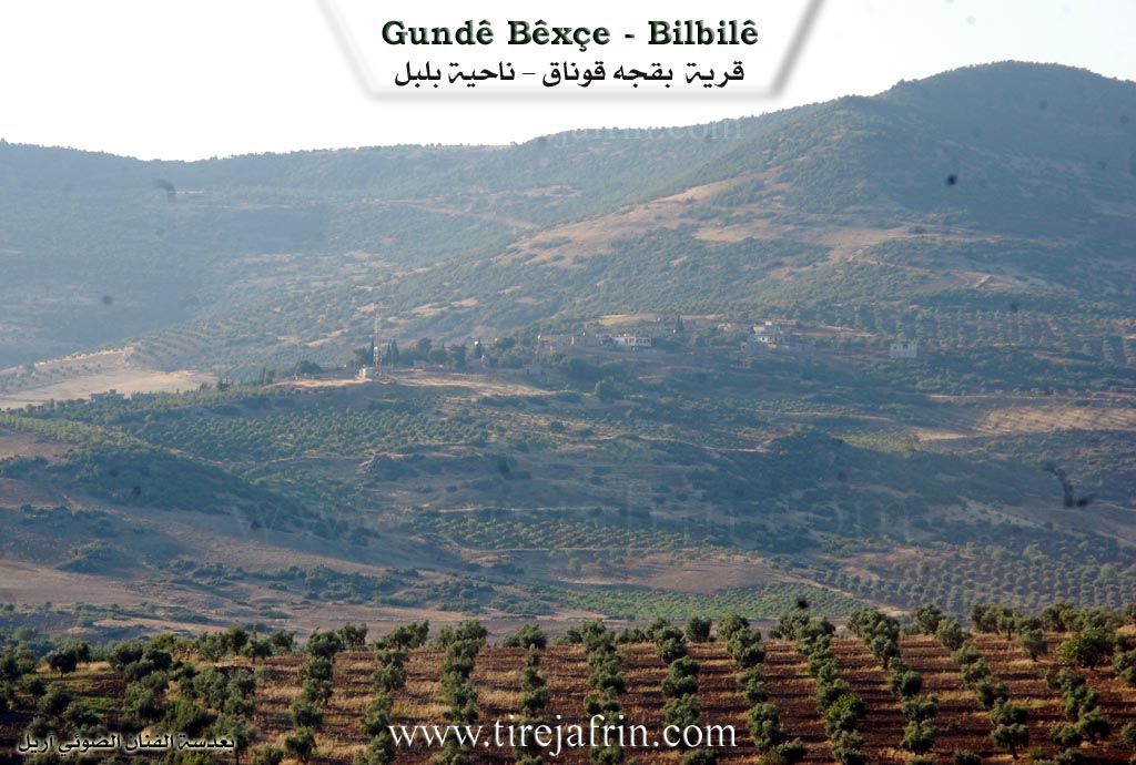
It is a small village located west of the town of Bilbil at the end of the middle southern slope of the mountain Girik (Little Hill), which is covered by green rocks and basalt, containing metallic minerals. There are many small springs near it. Its inhabitants are the Aghas of Şêx Îsmaîl.
Detailed Geography and Boundaries
According to the book Efrîn... Her River and Her Green Hills, Baxçe Qonax is a village in Çiyayê Kurmênc following the Bilbil sub-district, Efrîn area, Heleb governorate. It is a small village situated at the end of the middle, furrowed southern slope of the small, moderately sloping limestone mountain Damrik. Green and basaltic rocks cover parts of it. Its slopes and volcanic soil are suitable for grazing and agriculture, as springs and seasonal watercourses are available there.
It is located to the southwest of the town of Bilbil. It is bordered on the north by a high mountain chain planted with forest trees and the village of Şinkêlê; on the south by a slope, a seasonal valley, the Riya Bilbil-Reco (Bilbil-Reco road), and the village of Çolaqa; on the west by a slope, a seasonal valley planted with olive trees, the farm of Mezra Elî Beg, and Solaqlî; and on the east by a slope, a seasonal valley, and the village of Se'ryanlî.
Infrastructure and Agriculture
The number of houses reaches 20, and its age is approximately 200 years. Its dwellings are made of stone and mud with wooden roofs, and several modern cement houses are spread around them. An electricity network is available. The residents cultivate 290 hectares of rainfed land with grains, olives, and legumes, alongside raising sheep and goats.
Water Sources and History
The village drinks from cisterns where rainwater is collected in winter, in addition to some springs surrounding the village from the southern side. According to the testimony of one of the residents, his father and grandfather used to pull water from the bottom of the mountain via a canal to the orchard in the western side of the village.
Notable Families and Status
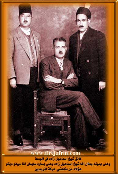
One of its most important families is the family of "Ehmed Ce'fer Şêx Îsmaîl Zade Axa"; they are the true owners of the village. It is connected to the sub-district center by a paved road. It is a beautiful village consisting of three luxurious old villas.
Village Administration
Mukhtar of the village: Ce'fer Şêx Îsmaîl Zade.
Sources
Book: جبل الكرد (عفرين) دراسة جغرافية Çiyayê Kurmênc (Efrîn): A Geographical Study by د. محمد عبدو علي Dr. Mihemed Ebdo Elî.
Book: عفرين .... نهرها وروابيها الخضراء Efrîn... Her River and Her Green Hills by عبدالرحمن محمد Ebdulrehman Mihemed from the village of Qetme.
Studies of Navenda Tirej Soft / Ebdulrehman Hacî Osman.
Some residents of the villages.
Preparation and Execution: Manager of Tirej Efrîn site: Ebdulrehman Hacî Osman 20/12/2013
II. Summary of Bêxçe from Ax û Welat
Source: https://www.youtube.com/watch?v=tOax2VTeOa4
The documentary explores the village of Baxçe, situated on a small hill called Girê Biçûk in the Bilbil district of the Efrîn canton. The village is famously known as Baxçe because its abundant water sources, rivers, and springs naturally made it a place of lush orchards and gardens. Historically, an older settlement known as Alkî existed there. After Alkî fell into ruin, a new village was built on the small hill by around twelve families. Some of the early inhabitants migrated from surrounding areas and ruined villages like Tahtikê, Barcêtin, Kûstatiyê, and Qasim.
During the Ottoman period, the village was referred to as Baxçe Qonax because local aghas established mansions or resting places there. Later, the Arab Baath regime arabized the name and simply called it Qonax. Despite these changes, the locals preserve its traditional name.
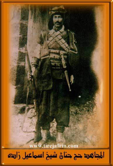
The village has a deep history spanning two to three hundred years. The majority of the residents belong to the Biran tribe. The community is comprised of several prominent families, including Heyh Hesen, Momû, Hemkê, Qartê, and Şêx Cemalo, alongside historical mentions of Mala Dadî Kopo, Mala Kufta, Mala Cefer Axa, Mala Battal Axa, and Mala Şêx Ismaîl. In the past, the village was a vibrant social hub characterized by the presence of significant figures like Battal Axa and Cefer Axa, who hosted many guests in their expansive reception rooms. Battal Axa and Henanê Qertû were well known as wise men and storytellers, entertaining the villagers during long winter nights.
Baxçe is renowned for its vast number of water springs. While there is only one spring directly inside the village itself, the surrounding lands hold more than twenty springs. Some of the named springs include Kaniya Sor, Kaniya Kawa, Çemê Mîran, Tatko, Çixurko, Çemê Şemê, Gundî Holkê, Kaniya Zêrê, Beryarê Pî, Kaniya Heyder, Kaniya Elê, Kaniya Kewan, Kaniya Çîmê Maran, and Kaniya Elkê. In the year 1935, Cefer Axa organized the villagers to build a water channel by hand, bringing water to the village from a spring located near the neighboring village of Seîdiyê. The village is also known for large plane trees, such as the famous Çinarê Pîse.
The surrounding landscape features several notable hills such as Girê Mezin, Girê Hisalkê, and Girê Hebeş, as well as the valley Geliyê Bariya.
The social and cultural life of the village is rich. Both Sunni and Alevi communities are mentioned in the region, with women like Zelîx, Mewlûde, and Hîkmet remembered for preparing and distributing traditional Ashura sweets during the sacred month. Villagers maintain agricultural livelihoods relying on olives, vineyards, and livestock. Furthermore, the village honors its martyrs, naming the local commune after Şehîd Botan and remembering others like Şehîd Xelîl, Şehîd Şêxo, Bavê Xecer, Şehîd Henan, and Şehîd Egîd.
II. Ax û Walat Book 2
94
THE VILLAGE OF BÊXÇE
10.9.2017
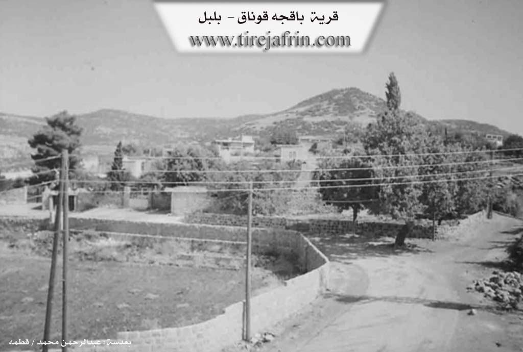
The village of Bêxçe is affiliated with the Bilbilê district, which is part of the Reco area of the Efrînê canton, located 7 km west of the town of Bilbilê.
The village of Bêxçe was built on a small hill. Because the village is rich in water sources from springs and rivers, it became a place of gardens and fields, hence it was named Bexçê (Garden).
Previously, the village was known by the name ((Alkê)). After the village of ((Alkê)) was ruined, about 12 families built a village on a small hill. A portion of the village's residents also came from the village of Tehtka and settled in the village. Most of the village's people are from the Biro tribe.
Nearly 250 people live in the village and there are around 35 houses.
95
There are 8 families in the village, among them:
The family of Mihê Hesen was the first family to settle in the village, followed by the families of Mamo, Hemkê, and Qertê. Later, the aghas came and settled in the village.
To the east of the village are the Sarîk spring and the village of Sariya; to the south are the village cemetery, the Kewan spring, the Çîmê Maran spring, Gaza Himê, and Hesalikê hill; to the west are the village of Tehtka, the Bergira valley, and the village of Elî Bega; and to the north are olive fields, the village of Tahlukê, Hebeş hill, and the Zêrî spring.
Se’bê Dewrîş was a place where the NEWROZ festival was celebrated.
There is no school in the village; previously, the teacher Reşîd Hemo educated the village children. But now the village children study at the school in the village of Qestela Xidriya, which is about 2 km south of the village.
The villagers make their living from cultivating olives, grapes, and gardens, and a few families also raise livestock. Additionally, some people work in the institutions and bodies of the Autonomous Administration.
It is worth mentioning that the village of Bêxçe is famous for its abundance of water springs; there are more than 20 springs, among them: the springs of Heyder, Kewa, Çîmê Maran, Qêwir, and Zêrî.
There is a small castle on the hill.
96
The village is also famous for its cool breeze that pleases and calms the heart.
There are 5 martyrs from the village:
Martyr Botan, Martyr Xelîl, Martyr Şêxo, Martyr Bavê Xeçer, Martyr Henan, and Martyr Egîd. The village's commune is also named after Martyr Botan.
Betal Axa was known as a storyteller; he and the villagers would spend the evenings with his pleasant stories.
Henanê Qerto and Hesenê Miho were respected and famous people in the village.
In the middle of the village, there is a water spring named ((The Village Spring)), surrounded by plane trees. Cefer Axa, with the help of the villagers, brought the water channel from the spring to the village.
Nearly 800 people from the village of Bêxçe are scattered throughout the areas of the Efrînê canton.
Transcriptions and Subtitles
| Source | Video | Subtitles | Transcript |
|---|---|---|---|
| Ax û Welat 1 | Watch Video | Download SRT | View Transcript |
Foundation/Origin Information of Bêxçe
Its residents are from the followers of Sheikh Ismail. Among its most important families is the Ahmed Ja'far Sheikh Ismail Zadeh Agha family, who are the true owners of the village.
Source: TirejAfrin Site
Possible Village Name Meaning of Bêxçe
The popular name means "village of the garden". Its pre-Arabization name "Baqchah Qonaq" means "garden palace".
Source: TirejAfrin Site