General Information
Nahiya (Subdistrict)
Reco
Also Known As
Bilaliko, Bilêlka, Bilêlko, بلالية, بلالية، بلل كوي, بلاليكو, بلليكو
Families, Clans, etc.
Oxler, Reşîd Êbo

Photos
Basic Information about Bilêlko
Source: Ax û Welat
Hills: Qerabîlê
Ruins: Kela Bilîlko
Other Landmarks: Deşta Qerebotan, Deşta Qerebabo
Source: Afrin 366
Trees: Darê meydanê
Other Landmarks: Mefraqê Mamola
Summaries
I. Summary from TirejAfrin Site (English) of Bilêlko
Source: https://www.tirejafrin.com/site/kura%20afrin%20%20%20Reco%20-%20bileko.htm
The following came in the book جبل الكرد (عفرين) دراسة جغرافية Çiyayê Kurmênc (Efrîn): A Geographical Study: Billko, Bilalîko, Bilaliye /2016 inhabitants, 196 hectares, 9 km, 970 m/:
It is a local proper name from: Bilal.
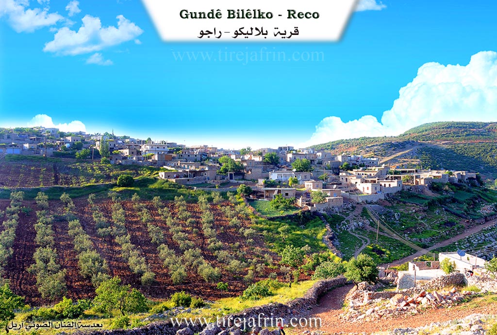
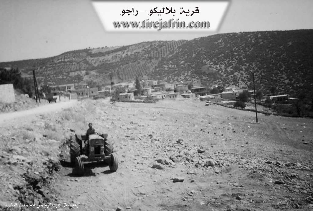
It is a small village located on a rocky flat below the summit of Qere Bl "Black Peak" which rises to 1100 m in the Bilalîko mountain.
The following came in the book عفرين .... نهرها وروابيها الخضراء Efrîn... Her River and Her Green Hills: Bilalîko is a village in Çiyayê Kurmênc belonging to the township of Reco, region of Efrîn, governorate of Heleb. It is a large village located in the northwestern part of the Mountain of Heleb or Kurmênc, sloping towards the Amûq plain to the west. It sits upon a wide rocky flat surrounded by three mountain peaks rising up to 1100 m, 9 km north of the town of Reco.
It is bordered to the north by a watercourse, a high mountain chain, and the village of Edamanlî. To the south by a deep watercourse, a high mountain chain called Mount Bilalîko, and the village of Çeqmaq Mezin and Cîlanlî. To the east by a high mountain chain and the village of Solaklî. To the west by a deep watercourse, a mountain chain, a very steep slope, and the village of Elî Beskî.
The number of its houses is about 100 houses and its age is more than 450 years. It is one of the old villages in the region. Its dwellings were stone and mud with flat wooden roofs, but modern cement dwellings have started to spread around it, constituting 70% of the village construction. An electricity network, a primary school, and a mosque are available in it. The village drinks from cistern water that collects winter rainwater.
The residents work in rain fed agriculture on an area of 196 hectares with the following crops (olives, legumes, vines, other fruit trees), alongside raising sheep and goats. Some of them also work in the charcoal industry from oak forest wood scattered on the slopes. It connects with the township of Reco and the neighboring villages by a paved road. There is also an archaeological fortress near the village.
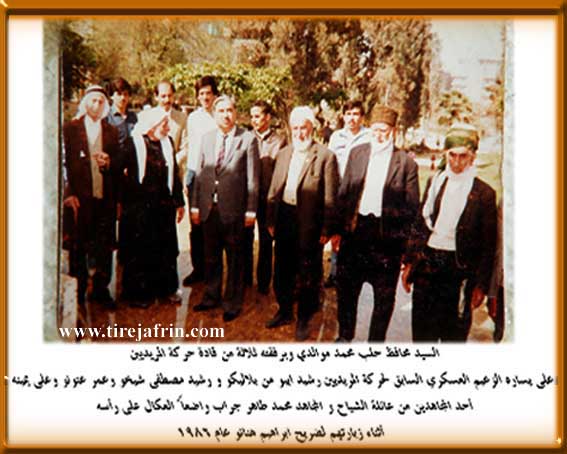
Among its most important families: the family of (the Mujahid Reşîd Êbo) who fought French colonialism in the region.
Village Mokhtar: Ismayîl Hisên
Sources of Information:
- Book: جبل الكرد (عفرين) دراسة جغرافية Çiyayê Kurmênc (Efrîn): A Geographical Study by د. محمد عبدو علي Dr. Mihemed Ebdo Elî.
- Book: عفرين .... نهرها وروابيها الخضراء Efrîn... Her River and Her Green Hills by عبدالرحمن محمد Ebdulrehman Mihemed from the village of Qetme.
- Studies of Navenda Tirej Soft / Ebdulrehman Hacî Osman.
- Some residents of the villages.
Preparation and execution: Manager of the website Tirej Efrîn: Ebdulrehman Hacî Osman 20/12/2013
II. Summary of Bilêlko from Ax û Welat
Source: https://www.youtube.com/watch?v=rNsU6KBgNNE
The village of Bilêlka, located in the Çiyayê Kurmênc region approximately 15 kilometers from Reco, is defined by its high-altitude geography and a traumatic history involving colonial violence. Situated in a mountainous area that experiences significant snowfall, the village has shifted its agricultural identity over time. While historically known for grapes and walnuts, Bilêlka is now renowned throughout the region for its kerez (cherry) orchards, specifically in areas like Qerabîlê.
The history of the village is heavily marked by events that occurred around 1939, during the French Mandate era. According to the elder Reşîd Hemmed, the community was originally small, consisting of only a few households. A religious figure known as Şêxê Berî began to gain influence and gather a large congregation ("cemaet") of followers (mirîd). This rise in local power threatened the Oxler family, a prominent local faction that was aligned with Frensa (the French authorities). The Oxler group, fearing the growing influence of the Sheikh's community, collaborated with the colonial power to suppress them.
This conflict escalated into a military assault where Frensa utilized airplanes ("teyare") to bombard Bilêlka. The aerial attack forced the residents to flee across the border into Tirkiyê. The villagers, who were Kurds, remained in exile for several months. While some returned following a general amnesty ("efû"), others were lost or chose not to return. During the occupation, the French and the Oxler faction burned many homes, particularly those of the common poor ("fighara"). To maintain control, the French military established three posts ("cephe") around the village to monitor the area and prevent incursions.
Dominating the landscape above the village is Kela Bilîlko (the Castle of Bilîlko). The resident Hesen describes this site as a "Kela Rûma" (Roman castle), indicating ancient origins. Although now largely in ruins, the castle site holds historical significance not only as an ancient fortification but also as a strategic point used by Frensa during the mandate. The French military used the steep slopes leading to the castle to transport supplies using mules. Today, traces of the ruins remain, though the site is difficult to access.
Economically, the village underwent a major transformation starting around 1991. While the plains of Deşta Qerebotan and Deşta Qerebabo were once used for traditional farming and grazing, the villagers adapted to the high altitude and cold climate by planting thousands of cherry trees. This shifted the village's reputation from a producer of grapes to a primary source of cherries in the region. The cultural life of the village is preserved by figures like Apê Elî, who maintains the oral traditions through song.
II. Summary of Bilêlko from Afrin 366
Source: https://www.youtube.com/watch?v=b2oN3GEObd0
The documentary footage focuses on the village of Bililko in the Afrin region, capturing a specific moment in its contemporary social life while highlighting the difficult geography that defines the area. While the transcript does not provide deep historical founding dates or etymological origins for the name Bililko, it offers a clear snapshot of the village's physical environment and the hardships faced by its residents. The terrain is described as rugged, with the host emphasizing that the roads leading to the village are particularly difficult ("çetin"), damaged ("xarabe"), and muddy ("herrî"). These conditions severely limit access, making it a challenge for outsiders to document the area thoroughly.
Geographically, the village is situated within a natural landscape characterized by specific local landmarks. The host identifies a location known as Mefraqê Mamola, likely a crossroads or intersection named Mamola, which serves as a navigational point in the vicinity. Furthermore, there is a discussion regarding a path leading to Darê meydanê, which translates to "the tree of the square" or "the tree of the open field." This suggests a notable tree that serves as a gathering place or a recognized landmark within the village structure. The environment is described as having cool air ("hewa hênik"), and the economy appears tied to agriculture, specifically the olive harvest ("aforê zeytûna"), which is central to the livelihoods of the local families.
The primary narrative focus of the transcript is a humanitarian visit to the home of an elderly resident referred to respectfully as Xalû. This visit sheds light on the struggles of vulnerable families within Bililko. Xalû cares for four adult children, three daughters and one son, who all suffer from disabilities described by the host as "moaq" (disabled) or "kûyt." The family lives in poverty, unable to travel or work effectively, relying on the limited support available. The conversation highlights the lack of employment ("şixul nînin") and the dependence on the seasonal olive harvest, during which other family members, including the mother and another son, are away working in the fields.
The documentary concludes with the host apologizing to the people of Bililko for not being able to film the entire village comprehensively. This limitation is attributed to the poor condition of the infrastructure and a desire to respect the privacy of the residents, many of whom were reluctant to appear on camera. Despite these constraints, the footage documents the resilience of residents like Xalû and preserves the names of local landmarks such as Darê meydanê and Mefraqê Mamola, marking them as part of the village's identity.
Transcriptions and Subtitles
| Source | Video | Subtitles | Transcript |
|---|---|---|---|
| Afrin 366 1 | Watch Video | Download SRT | View Transcript |
| Ax û Welat 1 | Watch Video | Not Available | View Transcript |
Foundation/Origin Information of Bilêlko
Among its most important families: the family of (Mujahid Rashid Ibo) who fought French colonialism in the region.
Source: TirejAfrin Site
The village is a Kurdish settlement inhabited by members of the Bîrîm tribe. Before the arrival of the French, Turkish-speaking Sheikhs and officials known as Oxlê collected a share of the harvest. The French Mandate period marked a significant change; French soldiers dissolved the "Great Council" (Cibata Mezin) and redistributed the land to the villagers, thereby ending the oxle system.
Source: Ax û Walat Transcript
Possible Village Name Meaning of Bilêlko
A local proper name from: Bilal.
Source: TirejAfrin Site
V. Links
- Tirej Afrin:
https://www.tirejafrin.com/site/kura%20afrin%20%20%20Reco%20-%20bileko.htm - Local FB page:
https://www.facebook.com/Bilelko12345 - Video:
https://www.youtube.com/watch?v=PxxN1Qku2RQ - Link:
https://www.youtube.com/watch?v=hqrmGCFn-ME - Ax û Welat:
https://www.youtube.com/watch?v=rNsU6KBgNNE - Afrin 366:
https://www.youtube.com/watch?v=b2oN3GEObd0