General Information
Nahiya (Subdistrict)
Cindires
Also Known As
Bircikê, Birj Kamush, Burcikê, Burj Kamoush, Kamoush Tower, برج كموش
Tribes
Micadmî, Şêxmendî
Families, Clans, etc.
Behcet Betal Axa, Dikê, Elî Beg, Hisên Mirîşê, Mamker, Mihemedî Şi'o, Mûsê, Nayîf, Necîr, Reşîdî Gemrûkê, Seydo Memê Xelîl Behçet, Seydê Memê, Sêvkeçelê, Sîdo Mîmî, Îbkê, Şêr

Photos
Basic Information about Bircikê
Source: Ax û Welat
Etymology: Named after a high tower Burc that formerly existed there; later referred to as Kümüşburç by Turks and Burc Kümüş by the Baath regime
Old Names: Kümüşburç
Foundation Date/Period: Over 200 years ago
Hills: Qîlê
Ruins: Burc
Trees: Sindiyankê
Other Landmarks: Qucûma, Qurbê, Bîra Avzê
Summaries
I. Summary from TirejAfrin Site (English) of Bircikê
Source: https://www.tirejafrin.com/site/kura%20afrin%20Cindires%20-%20barj%20kamush.htm
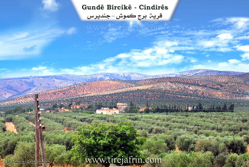
According to the book جبل الكرد (عفرين) دراسة جغرافية Çiyayê Kurmênc (Efrîn): A Geographical Study by د. محمد عبدو علي Dr. Mihemed Ebdo Elî: Bircik, also known as Gumuş Burc or Burc Gumuş /637 inhabitants - 492 hectares - 6km distance - 310m altitude/:
The name goes back to a small tower that was located at the village site. The residents used to call it Birca Zîv (Silver Tower). Gumuş is a Turkish name meaning "Silver." The name was shortened over time to Bircik: The Little Tower (birc + ik).
It is a small village located in the middle of a plain rippling with olive trees. It was one of the villages of Xelîl Axa Sîdo Mîmî before the agrarian reform distributed its fields among the farmers. Its location and the tower that existed there indicate that it has been inhabited since ancient times. Currently, it contains some luxurious residential buildings belonging to the families of Axayên Sîdo Mîmî.
According to the book عفرين .... نهرها وروابيها الخضراء Efrîn... Her River and Her Green Hills by the writer عبدالرحمن محمد Ebdulrehman Mihemed from the village of Qetme:
Burc Gumuş is a village in Çiyayê Kurmênc belonging to the Cindirês district, Efrîn region, Aleppo governorate. It is a small village located in the undulating northeastern plain of Cindirês, which has fertile alluvial soil. It is 7km away from the town of Cindirês. It is bordered to the north by an agriculturally fertile plain, a flood valley, and Miske Tehtanî; to the south by a fertile plain and the nearby village of Qîla; to the west by a flood valley, an agriculturally fertile plain, and the village of Zindikan; and to the east by an agriculturally fertile plain planted with olive trees and the villages of Qoceman and Qurbe.
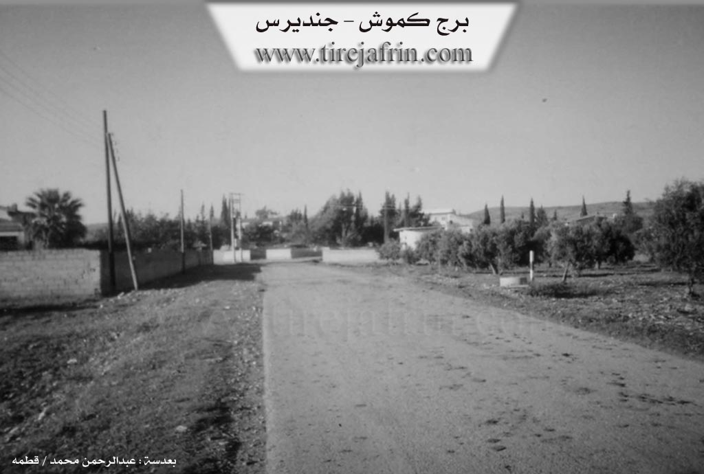
The number of houses reaches about 25, and its age is approximately 85 years. It is a very modern village, founded in 1920 by the family of Behcet Betal Axa, who were the first to inhabit the village. Its old houses are made of stone and mud, while the modern ones are cement and spread along the edges of the village. An electricity network and a primary school are available. It is connected to the district center and neighboring villages by a paved road. The village drinks from artesian wells dug next to the houses.
The residents work in the cultivation of grains, olives, and legumes, both rain-fed and irrigated from artesian wells for the cultivation of summer vegetables, alongside raising sheep and goats. There is a modern olive press and an agricultural cooperative in the village.
Village Mukhtar: Mihemed Hemo Husên
Preparation and Execution:
Manager of the Tirej Efrîn website: Ebdulrehman Hacî Osman
20/12/2013
Sources:
- Book: جبل الكرد (عفرين) دراسة جغرافية Çiyayê Kurmênc (Efrîn): A Geographical Study by د. محمد عبدو علي Dr. Mihemed Ebdo Elî.
- Book: عفرين .... نهرها وروابيها الخضراء Efrîn... Her River and Her Green Hills by عبدالرحمن محمد Ebdulrehman Mihemed from the village of Qetme.
II. Summary of Bircikê from Ax û Welat
Source: https://www.youtube.com/watch?v=VdKDZuUp1GM
The village of Burcêkê, also referred to as Birjike, is situated in the Deşta Cûmê within the Cindirês region of Efrîn. Its name originates from a high tower, or Burc, that once stood as a prominent fortification in the area. According to local elders, the village was established over two hundred years ago by their ancestor Mihemed Axayê Seydê Mêmê, who migrated from the nearby village of Çolaqa. Before his arrival, the site was inhabited by a figure known as Alay Beg, described as a Kurd from Istanbul. The narrator highlights a significant shift in religious identity, noting that fifty years ago, the residents were Êzîdî and identified as Şêxmendî before eventually converting to Islam. Historically, the village served as a grain depot for the region, but as water sources like the stream passing through Miskê diminished, the agricultural focus shifted almost entirely to olive cultivation, with the village now boasting tens of thousands of trees.
The social structure of Burcêkê is characterized by a deep integration of Kurd and Arab families who describe their relationship as living as "one house." The founding family, Seydê Memê, was followed by the arrival of other lineages such as Mala Îbkê, Mala Sêvkeçelê, and Mala Mihemedî Şi'o (also known as Mala Elî Beg). Several families of Arab origin, including Mala Mûsê, Mala Hisên Mirîşê, and Mala Nayîf, settled in the village and fully assimilated into the Kurdish community, intermarrying and sharing the local culture. A shepherd named Hemîd Mûsa Şêr notes that his lineage connects to the Micadmî tribe, with kin distributed across Ezaz, Bab, and Dêr Hafir.
Notable residents and communal efforts define the village's reputation. It is the home of the artist Niyazî from Koma Engîzek, who emphasizes the village's musical culture and the preservation of historical epics like Dewrêşê Evdî. The community actively maintains its identity through a children's commune named after Şehîd Zekeriya and a musical group honoring Şehîd Rifat. Innovation is also present in the village, exemplified by Battal Seydo Memê Xelîl Behçet, a resident who engineered a wind power generator using bicycle parts and a fan to provide electricity for his household. The village boundaries are defined by landmarks such as the Sindiyankê tree and the surrounding locations of Çeqela, Miskê, Qucûma, and the ancient site of Qîlê to the south.
II. Ax û Walat Book 2
BIRCIKÊ
5/9/2017
The village of Bircikê is affiliated with the Cindirêsê area of the Efrînê canton, located 7 km northeast of the city of Cindirêsê.
The village of Bircikê was built on the Cûmê plain. The name of the village comes from the meaning of a high place, and because there was a tower (bircek) in the village, it was named Bircikê. 50 years ago, the people of the village were Yazidis from the Şêx Mendî, but later they became Muslims.
The Seydê Mêmê family was the first family to settle in the village. Seydê Mêmê was known as the agha of the village.
It is said that there were many villages of Seydê Mêmo on the Cûmê plain, such as Çeqela, Kanî Gewrikê, and Birc Ebdelah.
68
The village of Bircikê is composed of both Kurdish and Arab components, and both act as one nation, supporting each other in joy and sorrow.
There are 10 families in the village:
The family of Ebdo Reşîd, Seydê Mêmê, Elî Beg, Reşîdê Kemrokê, Îbikê, Hisênê Reşo Mûsê, and 4 Arab families named: Mûsê, Remedan, Newaf, Hisên, and Hesen Mehmûd Hemûdê.
32 houses and nearly 500 people live in the village, but many people have moved outside the village.
There is a martyr named Ş. Rifet who lost his life in 1993 on the mountains of Kurdistan in the war for freedom.
The village commune is also named after Ş. Rifet, and there is a children's commune in the village named after Ş. Zekeriya.
The people of the village make their living from agriculture, and olive fields are the primary source. In 1969, the Syrian state distributed the aghas' land and fields to the farmers.
Some families also own livestock, and nearly 15 people work as employees in the institutions and bodies of the Autonomous Administration in Cindirêsê and Efrînê.
To the east of the village are the Tetok valley and the village of Qujîma. To the south are the village of Qîlê and the main Efrîn-Cindirêsê road. To the west,
69
are the Xalta valley, the Avzê well, and the two villages of Sîngank and Kefersefrê. And to the north are the Şerê ridge and the two villages of Çeqela and Miskê.
It is worth mentioning that there are nearly 20,000 olive trees around the village, all belonging to the people of the village.
Fewziyê Reşîdê Kumreşkê was one of the elders of the village. He provided many services to his village, and he was a respected figure among the village people.
There are 2 olive presses and a football field in the village.
There is no school in the village, so the village children study at the school in the village of Qîlê.
Transcriptions and Subtitles
| Source | Video | Subtitles | Transcript |
|---|---|---|---|
| Ax û Welat 1 | Watch Video | Download SRT | View Transcript |
Foundation/Origin Information of Bircikê
The village was established in 1920 by the family of Behjat Batal Agha who were the first to inhabit the village.
Source: TirejAfrin Site
The village was established by people from the "Birc" clan. Historically, the village has been home to both Kurds and Arabs living together.
Source: Ax û Walat Transcript
Possible Village Name Meaning of Bircikê
The name goes back to a small tower that was at the village site, and the residents used to call it "the silver tower" (Birca Zîv), so "Kamoush" (Gumûş) is a Turkish name meaning "silver", and the name was shortened over time to "Bircikê": the small tower.
Source: TirejAfrin Site
Its name originates from a prominent tower ("birc") that once stood there, which was said to have a dome made of silver and gold. The village has faced attempts at renaming, first to "Gümüşburç" by Turkish authorities.
Source: Ax û Walat Transcript