General Information
Nahiya (Subdistrict)
Şera
Also Known As
Gabeleka, Gubelê, Koblik, al-Qatira, القطيرة, كوبلك, كوبه لك, كوبالك
Families, Clans, etc.
Mala Heno, Mala Heswatîkê, Mala Sekmên

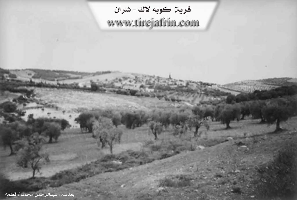
Photos
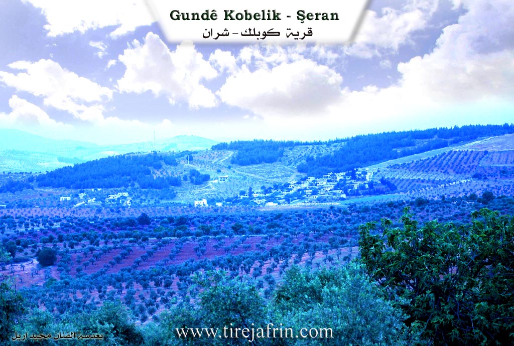
Basic Information about Gubelê
Source: Tirej Afrin
Etymology: The literal Kurdish meaning of the name is: spotted bull (ga + belek). It is also the name of a small bird.
Foundation Date/Period: 250 years ago
Other Landmarks: Qere Curne
Summaries
I. Summary from TirejAfrin Site (English) of Gubelê
Source: https://www.tirejafrin.com/site/kura%20afrin%20%20sheran%20-%20gobalak.htm
It is stated in the book Çiyayê Kurmênc (Efrîn): A Geographical Study: Gabeleka, Gabelek, Al-Qutayrah /522 inhabitants - 460m/:
Gabelek: Its meaning is "the spotted bull" (ga + belek). The village's early inhabitants owned spotted bulls grazing in those parts, so the village became known by it. It is also the name of a small bird. It is a small village on the southern slope of a plateau that descends towards the valley south of the village.
It is stated in the book Efrîn... Her River and Her Green Hills:
Kobelek: A village located in Çiyayê Kurmênc, following the Şeran district, Efrîn region, Heleb governorate. It is a small village located on the western slope of a limestone plateau in the northern part of Çiyayê Seman (Mount Simeon). A watercourse passes through it heading west towards the valley of Çemê Efrîn. Its soil is clay.
It is bordered to the north by a mountain range planted with forest trees and the villages of Elî Bezan and Meydankê. To the south by a deep valley, a mountain range planted with olive trees and vines as well as walnuts, the Riya Meydankê-Bilbil (Meydankê-Bilbil road), and the villages of Helûbiyê Biçûk and Metîna. To the east by a valley, a plain, a mountain range, the village of Xerabê Şeran, and the town of Şeran. To the west by a valley planted with walnut and olive trees, the valley of Helûbiyê Mezin named Qere Curne, the village of Helûbiyê Mezin, and Çemê Efrîn.
The number of its houses is about 35, and its age is 250 years. Its old houses are mud and stone with flat stone roofs, while modern building around it extends towards the east and west on both sides of the main road. The electricity network, state drinking water, telephone, and a primary school are available in it. A paved road branches off from the Riya Bilbil (Bilbil road) reaching the center of the village.
The residents work in the cultivation of olives, grains, and vines, and sheep rearing. It is considered one of the beautiful villages in the region due to the abundance of trees surrounding it. The number of its souls reached (504 people) on the date 31/12/2004.
Village Mukhtar: Elî Ebdulqadir
Sources of Information:
- Book: جبل الكرد (عفرين) دراسة جغرافية Çiyayê Kurmênc (Efrîn): A Geographical Study by د. محمد عبدو علي Dr. Mihemed Ebdo Elî.
- Book: عفرين .... نهرها وروابيها الخضراء Efrîn... Her River and Her Green Hills by عبدالرحمن محمد Ebdulrehman Mihemed from the village of Qetme.
- Studies of Navenda Tirej Soft / Ebdulrehman Hacî Osman.
- Some residents of the villages.
Preparation and Execution: Director of the Tirej Efrîn site: Ebdulrehman Hacî Osman 20/12/2013
II. Summary of Gubelê from Ax û Welat
Source: https://www.youtube.com/watch?v=nCBQfb6PPd8
The documentary provides an in depth look into the history and daily life of Gobeleka, a village situated in the Şera district of Efrîn. The village was founded approximately 400 years ago. Its first settler was a shepherd named Sekman, who migrated south from Bakurê Kurdistanê. Upon settling, he named the new location Gobeleka after his original village in the north. Initially, the founding families took shelter in a cluster of seven or eight caves because the area offered abundant water sources for their flocks of sheep. Over time, the land was cleared and the wilderness was transformed into agricultural fields.
Following Sekman, another family established themselves in the settlement. Today, the village consists of roughly 60 households primarily comprising two main lineages: Mala Heno and Mala Sekmên. The locals note that Mala Sekmên is also currently known as Mala Heswatîkê. The village elder Pîr Nebî served as the host for the community gathering during the documentary. The residents pride themselves on their high level of education, boasting that despite the village being small, it has produced numerous doctors, engineers, and pharmacists.
The geographical and historical center of the village revolves around its natural landmarks. The early cave dwellings were strategically located near Gola Keraşiya, a spring and pool where the village women traditionally washed clothes. Another significant site is Qerecorn, a nearby cave that also featured its own spring. In modern times, the village is defined by its proximity to Gola Meydankê. Located just two kilometers away, the lake and dam provide essential resources, supporting local agriculture and supplying drinking water to the city of Efrîn.
Economically, the village has undergone a major transition. In the past, residents relied on livestock, wheat, barley, and extensive vineyards used to produce molasses and other grape products. They utilized traditional presses housed in the caves. Over time, these crops were entirely replaced by olive orchards. The village still contains a historical olive press built around the year 1925 by the local mukhtar's father. This traditional press, which operated with animal power and natural stone, served the village and surrounding settlements for decades before modern machinery was introduced. Other minor agricultural activities remain, such as beekeeping practiced by Behrî Mihemed.
Culturally, the village embraces its Kurdish identity. Following the establishment of the autonomous administration in Rojava, the local school was named Dibistana Şehîd Rojhilat, allowing children to learn in their native tongue. The village is also home to a local music ensemble, Koma Şehîd Çekdar, which performs songs dedicated to Kurdish resistance, honoring Kobanî and the broader struggle in Bakurê Kurdistanê. Through traditional children games like Makê Tepê and continuous agricultural practices, Gobeleka preserves its deep historical roots while adapting to the present.
Transcriptions and Subtitles
| Source | Video | Subtitles | Transcript |
|---|---|---|---|
| Ax û Welat 1 | Watch Video | Download SRT | View Transcript |
Possible Village Name Meaning of Gubelê
Gabelek means 'spotted bull'; the early village residents owned spotted bulls that grazed in the area, so the village became known by them. It is also the name of a small bird.
Source: TirejAfrin Site