General Information
Nahiya (Subdistrict)
Bilbilê
Also Known As
Kêla, السمحة, كيلانلي, كيلو
Families, Clans, etc.
Mala 'Ebdu 'Elû, Mala 'Elû, Mala Xalê Evdo, Mala Xolû, Mihemed Hebeş
Photos
Basic Information about Kêla
Source: Afrin 366
Etymology: According to a villager, the name is not derived from a fortress (Kel), but was named Kelo, potentially linked to the Mala 'Elû family who settled there.
Other Landmarks: Mekteb, Nav Baîva
Summaries
I. Summary from TirejAfrin Site (English) of Kêla
Source: https://www.tirejafrin.com/site/kura%20afrin%20%20%20bilbile%20-kela.htm
It is stated in the book جبل الكرد (عفرين) دراسة جغرافية Çiyayê Kurmênc (Efrîn): A Geographical Study: Kêla, Kêlanlî, El-Semha / 1231 inhabitants - 230 houses - 22km - 660m /:
Kêla: Meaning "the bald ones." Some residents of the village say regarding the source of the name that it is the name of a village in the environs of Mêrdîn, from which some of its inhabitants came. As for "El-Semha," it is a modern Arabized name.
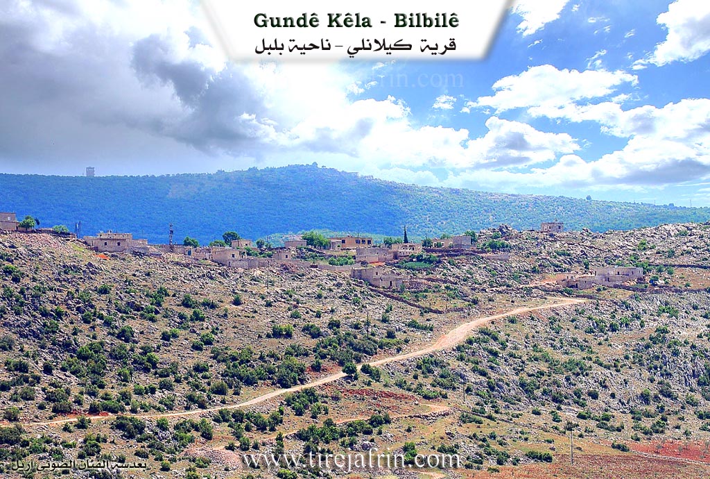
It is a medium-sized village located on the southern slope of one of the heights of Çiyayê Simaq. It consists of two parts: Upper and Lower.
It is stated in the book عفرين .... نهرها وروابيها الخضراء Efrîn... Her River and Her Green Hills: Kêlanlî: A village in Çiyayê Kurmênc following the township of Bilbil, region of Efrîn, governorate of Heleb.
It is a large village established upon a rocky flat on the southeastern slope of a limestone mountain located in the middle of the northern part of the mentioned mountain mass. The village is barren, surrounded on all sides by rugged rocks. It is bordered on the north by a high, rugged rocky mountain range and the village of Kurzêl; on the south by a slope, the Riya Reco-Kotanlî (Reco-Kotanlî road), Bendava Eşonê (Eşonê dam), and the village of Dîk Obasî at the top of the mountain; on the west by Geliyê Sîlê (Sîlê valley), a plain planted with olive trees and vines, and the mountainous village of Zarkanlî; and on the east by a rugged mountain range and the village of Sagir Obasî.
The number of its houses is about 100 and its age is about 400 years. Its old houses are stone and mud with flat wooden roofs, while the modern ones are cement and have spread south and west. An electricity network and a primary school are available in it.
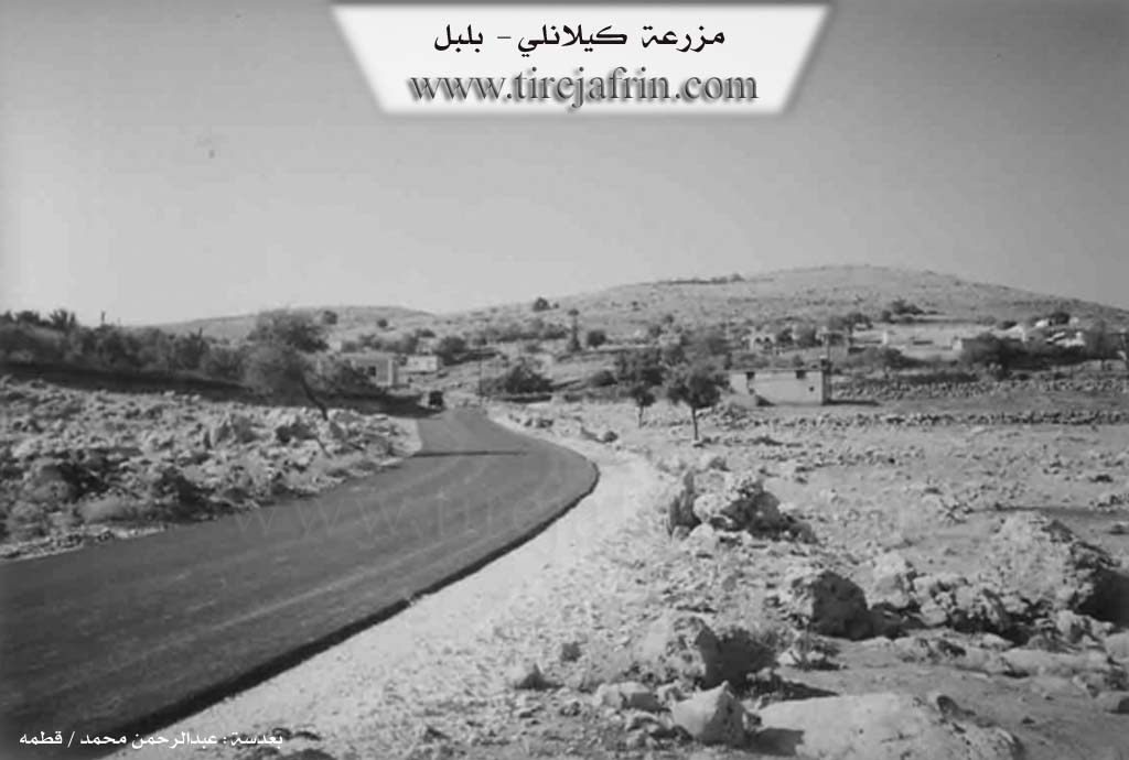
The village drinks from cisterns in which rainwater collects in winter, and currently from artesian wells dug next to the houses. Its residents work in rain-fed agriculture (grains, legumes), alongside raising sheep and goats. It is connected to the public road and to the center of the township by a road that was newly asphalted in 2006.
Village Mukhtar: Mistefa Me'mo
Sources of Information:
- Book: جبل الكرد (عفرين) دراسة جغرافية Çiyayê Kurmênc (Efrîn): A Geographical Study by د. محمد عبدو علي Dr. Mihemed Ebdo Elî.
- Book: عفرين .... نهرها وروابيها الخضراء Efrîn... Her River and Her Green Hills by عبدالرحمن محمد Ebdulrehman Mihemed from the village of Qetme.
- Studies of Navenda Tirej Soft / Ebdulrehman Hacî Osman.
- Some residents of the villages.
Preparation and execution: Manager of the site Tirej Efrîn: Ebdulrehman Hacî Osman 20/12/2013
II. Summary of Kêla from Afrin 366
Source: https://www.youtube.com/watch?v=9FFQol3F9BE
The documentary focuses on the village of Kêla, located in the Afrin region. The village is geographically divided into two distinct sections: an upper section known as Kêla jor and a lower section known as Kêla jêr. The settlement is substantial, with the host and residents estimating the population to consist of approximately 175 households.
During an interview with an elderly resident named Ebû Ehmed, the origins of the village name were discussed. When asked if the name Kêla was derived from a castle or fortress ("Kel"), Ebû Ehmed clarified that it was not a fortress ("ne kel bî"). Instead, the name Kelo was applied to the site, which is historically associated with the Mala 'Elû family. This family is identified as the group that originally settled in the area, and they remain a prominent lineage in the village's social memory. Specifically, the Mala 'Ebdu 'Elû branch is described by the host with high regard, referred to metaphorically in the context of being guardians or foundational pillars of the community.
Economically and agriculturally, Kêla is renowned for its produce. The village is particularly famous for its black figs (hêjîrê reş), which are highly praised for their quality. In addition to figs, the village lands are cultivated with pomegranates (hinar) and olives (zeytûn), typical of the wider region's agriculture.
The documentary highlights the current social atmosphere and the challenges of the local climate. Due to the intense heat, the streets were largely empty during the visit, with residents remaining indoors. The filming team attempted to visit specific residents, including Mala Xalê Evdo and Mala Xolû. However, they found that the family of Xalê Evdo was away in Raco, and they were unable to locate Mala Xolû near the area referred to as Nav Baîva. The host noted the presence of a school (Mekteb) located in the upper part of the village. The narrative concludes with the team planning to move on to neighboring villages, specifically mentioning Zivingê and Aşûnê as their next destinations.
Transcriptions and Subtitles
| Source | Video | Subtitles | Transcript |
|---|---|---|---|
| Afrin 366 1 | Watch Video | Download SRT | View Transcript |
Possible Village Name Meaning of Kêla
"Kîla" means "bald." Some residents say it is a name for a village in the Mardin regions, from which some of its inhabitants came.
Source: TirejAfrin Site