General Information
Nahiya (Subdistrict)
Efrîn
Also Known As
Kîmarê, كيمار
Families, Clans, etc.
Al Ebdulhemîd, Al Mîrza Dado, Al Nibo, Al Xelîl

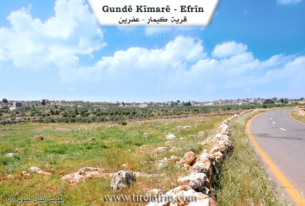
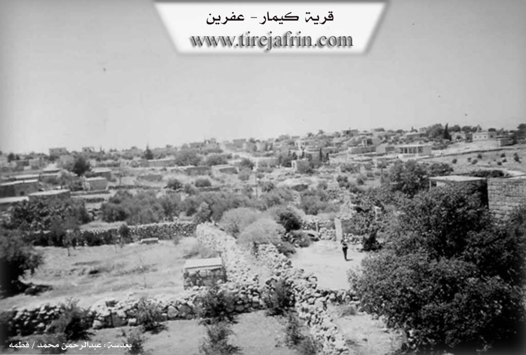
Photos
Basic Information about Kîmarê
Source: Afrin 366
Springs: Kaniya Kîliya, Kaniya Bosûtê
Shrines: Tirba Gindyo, Tirba Miqdad Hisên, Tirba Miqdad Henan, Tirba Henan Nasir
Ruins: Birc, Kelê, Tawus
Trees: Darê Zoratê
Other Landmarks: Geliyê Lûlkê, Geliyê Kerzêlê, Soxanek, Çiyayê Midîye
Summaries
I. Summary from TirejAfrin Site (English) of Kîmarê
Source: https://www.tirejafrin.com/site/kura%20afrin%20markaz-%20K%C3%AEmar.htm
It is stated in the book Çiyayê Kurmênc (Efrîn): A Geographical Study by Dr. Mihemed Ebdo Elî: Kîmar / 2214 inhabitants - 400 hectares - 15 km - 555 m /: "K", "key", or "keye" means "Master" or "Lord" in the Median language, and "Mar" means "Saint" in Syriac, so the origin of the word is "The Saint Master." There is another opinion stating that in Syriac, it means the hermit, the ascetic, or the sad one (source:- Ebdullah Hecar, p. 177).
- It is a large village located on a rocky plateau in the central part of Çiyayê Şêrwan. It overlooks the valley of Çemê Efrîn (Efrîn River) and the village of Basûte from the west with a captivating view. It contains the remains of church walls, palaces, a market, tombs, and cisterns carved into the rock, as well as a large number of columns, capitals, lintels, and the remains of a large quarry, all dating back to the Greek eras. Its air is abundant and fresh, and its location is beautiful.
- It is stated in the book Efrîn... Her River and Her Green Hills by the writer Ebdulrehman Mihemed from the village of Qetme: Kîmar is a village in Çiyayê Lêlûn, following the sub-district of the Center villages of the Efrîn region, Heleb governorate. It is a large village located on a rocky limestone plateau in the middle of Çiyayê Lêlûn. It is surrounded by three mountain peaks from the east, south, and west, and it overlooks the Efrîn valley, the village of Basûte, and the Çemê Efrîn (Efrîn River) south of the city of Efrîn.
- It is bordered to the north by a rugged mountain chain called Çiyayê Lêlûn and the village of Dêr Mişmiş; to the south by the rocky Çiyayê Seman chain and the village of Berad; to the east by the Çiyayê Lêlûn chain and the villages of Soxanekê and Zer'entiyê; and to the west by the Çiyayê Seman chain, a deep and harsh valley and slope, the tourist town of Basûte, and the course of the Çemê Efrîn.
- The habitation of the area is ancient, evidenced by the remains of church walls, palaces, a market, tombs, rock cisterns, a large number of archaeological columns and capitals, lintels, and remains of quarries dating back to the Roman era. Its houses are stone with wooden roofs, and currently, the roofs have become reinforced concrete. The number of its houses is approximately 100, and the age of the village is about 700 years. Its houses are made of stone and clay with flat wooden roofs, and there are a few modern dwellings.
- The village spreads to the north and south. It has a primary school and an asphalt road that connects to the village of Basûte, Efrîn, and Heleb. A modern electricity and telephone network is available. The residents rely on rain-fed agriculture for their livelihood on an area of 400 hectares, growing grains, fruit trees, and olives. They also raise sheep and cattle. The people of the village drink from cisterns and collected rainwater. There is a mosque in the village located on the western side. It is one of the old and archaeological villages in the region.
- Among the families present in the village are: Al Nibo, Al Mîrza Dado bin Xidir bin Hesen bin Dawûd, Al Xelîl bin Cum'e bin Yûsif bin Ebdo bin Husên, and Al Ebdulhemîd. There is an oak tree (Dara Sindiyan) in the village that is more than five hundred years old.
- Village Mukhtar: Şarîzad Nibo.
- Sources:
- Book: جبل الكرد (عفرين) دراسة جغرافية Çiyayê Kurmênc (Efrîn): A Geographical Study by د. محمد عبدو علي Dr. Mihemed Ebdo Elî.
- Book: عفرين .... نهرها وروابيها الخضراء Efrîn... Her River and Her Green Hills by عبدالرحمن محمد Ebdulrehman Mihemed from the village of Qetme.
- Studies of Navenda Tîrêj Soft / Ebdulrehman Hacî Osman.
Preparation and Execution:
- Manager of Tîrêj Efrîn website: Ebdulrehman Hacî Osman
- 20/12/2013
II. Summary of Kîmarê from Afrin 366
Source: https://www.youtube.com/watch?v=Skx8fB6syT8
The village of Kîmarê, located in the Şêrawa district of the Efrîn region, stands as a settlement deeply layered with history and antiquity. While the documentary does not specify an exact founding date for the current habitation, the village is built directly upon and amidst extensive ruins from ancient eras. Speakers identify these ruins variously as Romani (Roman) and Bîzentîn (Byzantine). However, one villager disputes the sole attribution to these empires, pointing to sun symbols (ro) carved into the stone as evidence that Kurds were present in the region before the arrival of Romans or Byzantines.
The architectural landscape of Kîmarê is defined by its massive stone structures. Notable historical landmarks include a high structure referred to as Birc (the Tower) and the remains of a fortress known as Kelê. Residents have integrated these ancient stones into their daily lives, using the solid masonry for their own homes and stables. One prominent ruin is a church (Kinîsê), which the locals call Tawus because of a peacock relief carved into the stone. The village also features extensive underground cisterns and ancient wells carved into the rock, which were historically used for water storage and keeping livestock.
Water scarcity played a significant role in the oral history of the village. An elderly woman recounts the severe hardships faced in the past, describing how women had to travel great distances to fetch water from Kaniya Kîliya or sources in Geliyê Lûlkê (also associated with Geliyê Kerzêlê and located at the foot of Çiyayê Midîye). Clothes and lentils were washed at Kaniya Bosûtê. Despite these hardships, the elder generation speaks of a strong communal bond.
In modern times, Kîmarê has grown to approximately 300 to 350 households (hewş). The residents have preserved their heritage while adapting to new conditions. For instance, a house built by an individual named Hamo in 1956 bears detailed inscriptions, including religious verses and his name, showcasing the continuation of stone masonry skills. Another house is noted as belonging to Hacer Teyr. The village also hosts a biweekly market, identified as the market of Sûsiyê, which has been relocated to Kîmarê and serves as a commercial hub for the area.
The documentary highlights several sacred and memorial sites. A specific request was made by a viewer to visit Tirba Gindyo, a significant tomb in the area. The filming crew also visited the village cemetery, noting the deep roots of the community through the graves of individuals such as Miqdad Hisên, Miqdad Henan, and Henan Nasir, some dating back to the 1970s. The village is described by its residents and the host as a place of high elevation, rich nature, and profound historical depth, where every house and wall seems to hold a piece of the ancient past.
Transcriptions and Subtitles
| Source | Video | Subtitles | Transcript |
|---|---|---|---|
| Afrin 366 1 | Watch Video | Download SRT | View Transcript |
Foundation/Origin Information of Kîmarê
One of the old and archaeological villages in the area.
Source: TirejAfrin Site
Possible Village Name Meaning of Kîmarê
From Median "Kî" (master) and Syriac "Mar" (saint), meaning "Master Saint." Or in Syriac, meaning the hermit, ascetic, sad one.
Source: TirejAfrin Site