General Information
Nahiya (Subdistrict)
Nubl
Also Known As
Kilote, Kilotê, Kilûtê, Klotê, كالوته, كلوتا شيراو
Tribes
Şerwan
Families, Clans, etc.
Bekir, Elîwî
Photos
Basic Information about Kilotê
Source: Ax û Welat
Etymology: From 'Gel', meaning the gathering of people
Foundation Date/Period: Approx. 200 years ago (current settlement); 2500-3000 years ago (ancient site)
Hills: Çiyayê Lêlûn
Ruins: Bradê, Xerabê Şemsê, Burc Qasê
Summaries
I. Summary from TirejAfrin Site (English) of Kilotê
Source: https://www.tirejafrin.com/site/kura%20afrin%20markaz-%20kilote.htm
The following is stated in the book جبل الكرد (عفرين) دراسة جغرافية Çiyayê Kurmênc (Efrîn): A Geographical Study by د. محمد عبدو علي Dr. Mihemed Ebdo Elî regarding Kilot / Kalotê (535m):
Kilot is a nickname used by Kurds to express attributes of laziness and dependency. It was stated in the book "In the Lands of Mar Maron page 6" that it is a Syriac name meaning: the scarce chrism cup.
It is a small village situated on one of the hills of Çiyayê Lêlûn known as Şêrwan. It contains two archaeological churches. One is in the middle of the village, and the other is on an elevation west of the village called a "castle" dating back to the year 398 AD. During the Crusades, it was transformed into a fort surrounded by a wall. In its inner courtyard, there are several rock box tombs with their stone lids dating back to ancient Greek eras.
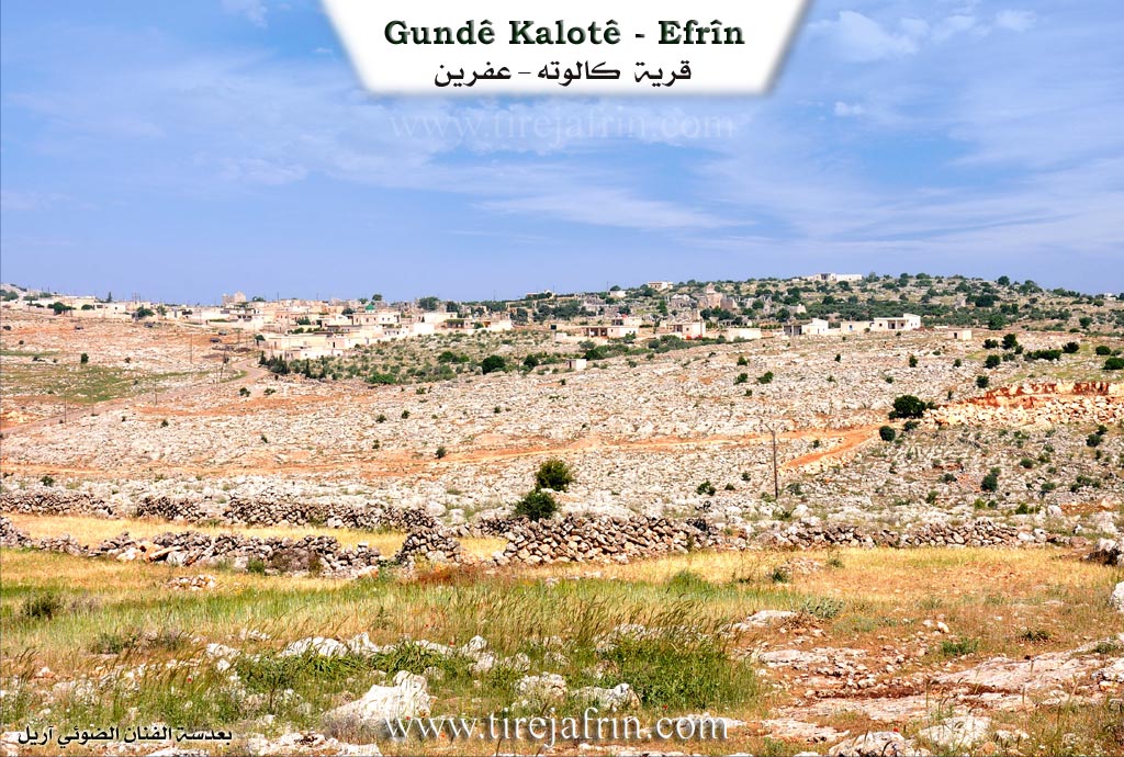
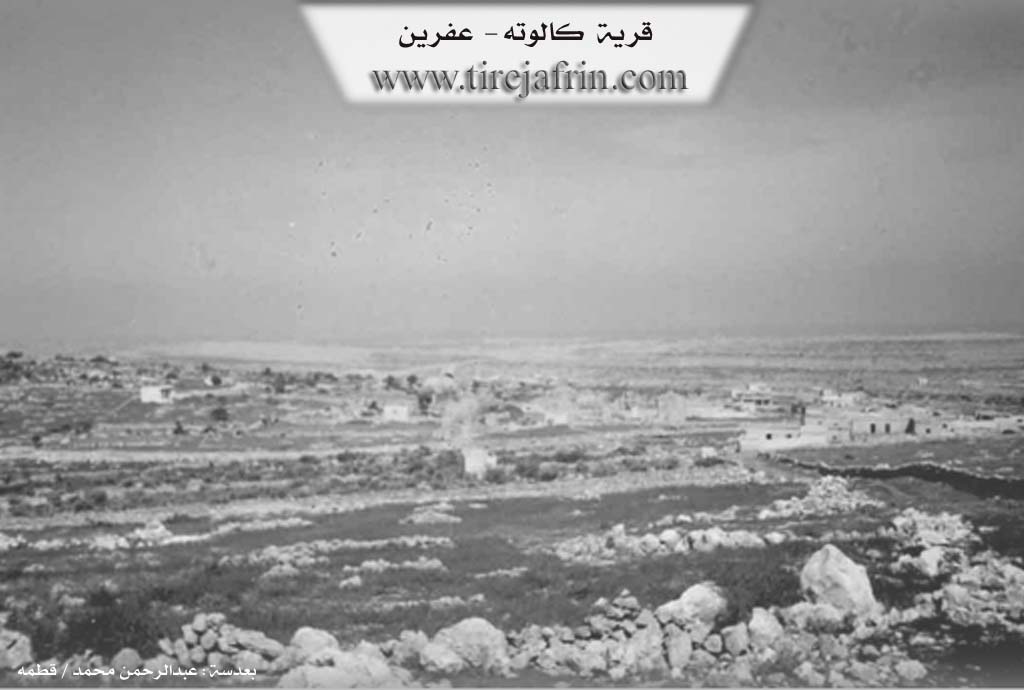
The following is stated in the book عفرين .... نهرها وروابيها الخضراء Efrîn... Her River and Her Green Hills by the writer عبدالرحمن محمد Ebdulrehman Mihemed from the village of Qetme:
Kalotê is a village in Çiyayê Lêlûn belonging to the central villages subdistrict of the Efrîn area in the Heleb governorate. It is a small village located on the southeastern slopes of Çiyayê Lêlûn. It is bordered to the north by a mountain range, a deep rocky valley, and the village of Burc Elqas. To the south, it is bordered by a valley, a rugged mountain range, and the village of Zewqa Mezin. To the east lies a rugged mountain range, and at the bottom of the plain are the towns of Nubl and Zehra. To the west lies a mountain range of western Çiyayê Lêlûn and Seman, and the nearby village of Kefernebo and Burc Heyder.
The number of houses is approximately 10, and the age of the village is about 80 years. Its dwellings are made of stone and cement. The settlement of the area is ancient, indicated by the remains of churches, a large number of columns, and rock cut wells dating back to the Roman and Byzantine eras. There are 16 archaeological sites or points. There is also a large church with four doors and a courtyard on a mountain elevation located 500 meters west of the village. In the church courtyard, there are four tombs dating back to the Roman and Byzantine eras.
The village has a temporary school, a modern electricity network, and a paved road up to the center of the village connected with the village of Zewqa Mezin. The residents work in agriculture and the raising of sheep and cows. Administratively, it was attached to Ezaz within the Nubl subdistrict in 1980.
Sources:
- Book: جبل الكرد (عفرين) دراسة جغرافية Çiyayê Kurmênc (Efrîn): A Geographical Study by د. محمد عبدو علي Dr. Mihemed Ebdo Elî.
- Book: عفرين .... نهرها وروابيها الخضراء Efrîn... Her River and Her Green Hills by عبدالرحمن محمد Ebdulrehman Mihemed from the village of Qetme.
- Book: "In the Lands of Mar Maron".
Preparation and execution:
- Manager of the Tirej Efrîn website: Ebdulrehman Hacî Osman
- 20/12/2013
II. Summary of Kilotê from Ax û Welat
Source: https://www.youtube.com/watch?v=2sODKj8zLn8
The village of Kilûtê (also referred to as Klotê or Keletiyê) is situated in the Şêrawa region of Efrîn, specifically within the rocky, mountainous terrain of Çiyayê Lêlûn. Unlike the fertile, tree-covered plains typical of Efrîn, Kilûtê is defined by a harsh landscape of cliffs, boulders, and stone. The village lies on the contact line between the Efrîn region and the lands towards Heleb (Aleppo), near the towns of Zehra and Nuble.
Historically, Kilûtê is built upon ancient foundations. Speakers estimate the site dates back 2,500 to 3,000 years, linking its origins to the Mîtanya, Mîdya, and Hûriya civilizations. While the village contains ruins often attributed to the Rom (Roman) or Crusader eras, local elders and poets insist the core identity is Kurdî, pointing to engravings of Tawûs Melek (the Peacock Angel) on ancient stones as evidence of its indigenous Hûri roots. The name Kilûtê is locally believed to derive from the word "Gel," signifying a gathering of people, suggesting it was once a significant population center comparable to a city.
The modern settlement, however, was established approximately 200 years ago. The current inhabitants belong primarily to two families: Bekir and Elîwî. These families migrated from Gundê Mezin, a nearby village described as the oldest in the hinterland of Şêrawa (about 400 years old). They identify as part of the Şerwan tribe, specifically the Şengal branch. The residents maintain close ties with Gundê Mezin, to the point that their official identification is often still registered there.
Life in Kilûtê revolves around the stone that surrounds them. Due to the lack of soil for extensive agriculture, the local economy depends heavily on livestock and stone quarrying. Men and young boys work in the meqle (quarries), splitting rocks with wedges and hammers to produce building materials sold as far away as Heleb and Şam. Because trees are scarce in this rocky terrain, women like Gulê prepare tepik (dried dung cakes) to use as fuel for heating water and cooking.
Culturally, the village preserves the tradition of the dengbêj. A notable elder, Apê Bekir, serves as the village bard, reciting historical epics such as the story of Derwêşê Evdî and recounting the village's oral history. He speaks of a past figure, Kolkê me (also named Bekir), who was a renowned poet in the era before technology. Other historical figures mentioned include Hamo Hamo (or Hamo yê Bekir), a patriarch whose old stone house resembles a fortress. Despite its proximity to the conflict line and frequent shelling by the Tirk state and mercenaries, which has resulted in civilian martyrs, the residents of Kilûtê emphasize their determination to remain on their ancestral land.
Transcriptions and Subtitles
| Source | Video | Subtitles | Transcript |
|---|---|---|---|
| Ax û Welat 1 | Watch Video | Download SRT | View Transcript |
Foundation/Origin Information of Kilotê
Annexed administratively to Nabul District in Azaz Area in 1980.
Source: TirejAfrin Site
Possible Village Name Meaning of Kilotê
"Kalutah" is a title used by Kurds to express laziness and dependence. It was also mentioned as a Syriac name meaning: the cup of correct myrrh.
Source: TirejAfrin Site