General Information
Nahiya (Subdistrict)
Efrîn
Also Known As
Kokebê, كوكبة
Tribes
Bû Şeaban, Efadile, Emêrat
Families, Clans, etc.
Boxaz, Ebas, Eclan, Erne, Fawût, Hesen Dawûd, Kerbûc, Mala Axa, Mutered, Osman

Photos
Basic Information about Kokebê
Source: Tirej Afrin
Etymology: Believed to be of Syriac/Aramaic origin; from Kawkaba meaning Star or Planet
Foundation Date/Period: Approximately 150 years ago
Hills: Bozîke, Bûsêt
Other Landmarks: Çemê Efrînê
Summaries
I. Summary from TirejAfrin Site (English) of Kokebê
Source: https://www.tirejafrin.com/site/kura%20afrin%20markaz-%20Kokebe.htm
The following details appear in the book جبل الكرد (عفرين) دراسة جغرافية Çiyayê Kurmênc (Efrîn): A Geographical Study by د. محمد عبدو علي Dr. Mihemed Ebdo Elî:
Kokeb /1392 inhabitants - 7km - 340m/:
It is believed that the name is of Syriac origin. Al-Asadi mentioned, citing Father Armaleh, that the name comes from Aramaic: Kawkaba, meaning "The Star" (or Planet).
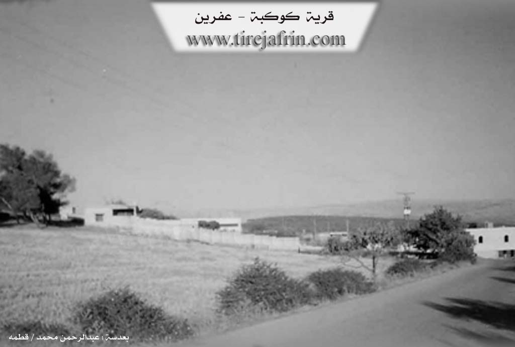
It is a small village with a beautiful location, consisting of several residential houses. It is located on the southern slope of Mount Bozîke.
In the book عفرين .... نهرها وروابيها الخضراء Efrîn... Her River and Her Green Hills by the writer عبدالرحمن محمد Ebdulrehman Mihemed from the village of Qetme, it is stated:
Kokeb is a village in Çiyayê Kurmênc, administratively belonging to the sub-district of the Efrîn center and region in the Heleb governorate. It is a small village situated on the middle southwest slope of the Bûsêt elevation, southeast of the aforementioned mountain. Its lands slope slightly towards the southwest and are furrowed by streams that feed into valleys ending at the Çemê Efrînê (Efrîn River). It is 13km away from the city of Efrîn in a southwesterly direction.
It is bordered to the north by a mountainous elevation planted with olive trees, the farm of Bozîke, and the village of Betîtê. To the south, it is bordered by a wide, fertile plain planted with olive trees, the village of Kefîr, and the course of the Çemê Efrînê (Efrîn River). To the west, it is bordered by a wide plain planted with olive trees, a fertile elevation planted with olive trees, and the village of Tililf. To the east, it is bordered by a mountainous elevation of black stones, the course of the Çemê Efrînê (Efrîn River), and the village of Basûte.
The number of houses reaches approximately 25, and its age is about 150 years. Its old residences are built from black basalt stones, while the modern ones are built with stones and reinforced concrete along the path of the public road. An electricity network is available, as well as drinking water from the Me'ratê well and artesian wells. It has a primary school and a paved road leading up to the center of the village.
The old village was inhabited by the Armenian community coming from Turkey; they later migrated from the village to the city of Heleb. It was then settled and inhabited by shepherds of sheep and livestock. Currently, the residents work in rain-fed agriculture on an area of 965 hectares (olives, grains, and legumes), and mainly in sheep breeding.
Among the families present in the village: The Erne family.
The mukhtar of the village: Ebdulmihemed bin Elî (Erne).
Sources:
- Book: جبل الكرد (عفرين) دراسة جغرافية Çiyayê Kurmênc (Efrîn): A Geographical Study by د. محمد عبدو علي Dr. Mihemed Ebdo Elî.
- Book: عفرين .... نهرها وروابيها الخضراء Efrîn... Her River and Her Green Hills by عبدالرحمن محمد Ebdulrehman Mihemed from the village of Qetme.
- Prepared and executed by the manager of the Tirej Efrîn site: Ebdulrehman Hacî Osman.
- 20/12/2013
II. Summary of Kokebê from Multi Channel
The village of Kokebê gets its name from a local legend about a girl named Kokeb who died of sorrow after her father demanded impossible tasks from her suitor. She was buried on the site which was then named in her honor. The village features traditional basalt architecture best exemplified by the historic Mala Axa which is more than a century old and retains its original black stone structure and courtyard. While the village has older roots its current demographic makeup shifted significantly when the Emêrat tribe settled there. Originally hailing from Yemen and later migrating to the Cizîrê region near Sirîn and Pira Qereqozaq these Arab pastoralists fled to the Efrîn region around two centuries ago following a conflict with the Efadile tribe. They lived a nomadic lifestyle around the mountains of Raco until 1964. At that time policies under Cemal Ebdilnasir restricted grazing in Daristana Raco prompting the tribesmen to sell much of their livestock purchase land and settle permanently in Kokebê and neighboring villages like Bablît Betîtê Tel Tewîl Istêro and Kefirê.
The population is predominantly Arab belonging to the Emêrat tribe which is part of the larger Bû Şeaban confederation. While they maintain a Bedouin Arabic dialect decades of integration mean most residents also speak Kurdish fluently. The Emêrat tribe consists of several lineages including Osman Fawût Hesen Dawûd Boxaz and Mutered. Other prominent local families include the Ebas Eclan and Kerbûc. In recent years displaced families from the southern countryside of Heleb such as Zirbe and Ebû Zuhûr have arrived weaving new cultural and agricultural practices into the local fabric.
Beyond the historic Mala Axa the village is surrounded by four primary agricultural hamlets namely Mezreya Hesûn Bozikê Ekaşîn and Mezreya Eclan. While the community historically relied on a local spring they now draw water from wells and a channel connected to Bendava Meydankê with flocks occasionally grazing near the banks of Çemê Efrînê.
Kokebê is renowned for its fertile soil and sprawling orchards boasting over 100,000 olive trees. Historically dependent on sheep and goat herding the village economy is now firmly rooted in agriculture. This transition was recently accelerated by displaced farmers who introduced intensive agriculture. New arrivals planted pistachios safflower and black seed alongside snake melons between the olive groves transforming the agricultural output of the village. Despite this agricultural boom the pastoral heritage of the Emêrat endures with residents keeping small flocks of sheep to produce traditional dairy staples ensuring their Bedouin legacy remains alive. Notable individuals reflecting the village diversity include Ebdîn Kerbûc who preserves the tribal oral history local farmer Eliya Mihemed who tends to the olive groves and Meyûf Casim Ebû Mihemed a displaced shepherd from Ebû Zuhûr who maintains a large extended family and flock on the outskirts.
Transcriptions and Subtitles
| Source | Video | Subtitles | Transcript |
|---|---|---|---|
| Multi Channel 1 | Watch Video | Download SRT | View Transcript |
Foundation/Origin Information of Kokebê
The old village was inhabited by an Armenian community coming from Turkey, then they migrated to Aleppo and sheep and cattle herders settled in it.
Source: TirejAfrin Site
Possible Village Name Meaning of Kokebê
Believed to be of Syriac origin. From Aramaic: Kokaba, meaning the star.
Source: TirejAfrin Site