General Information
Nahiya (Subdistrict)
Efrîn
Also Known As
Mêremînê, مريمين
Tribes
Rûbarî
Families, Clans, etc.
Cuneyd, Ebdo, El Niêmî, El Yasîn, El-Bekrî, El-Xetîb, Elî, Hacî Hesen, Hesen Meryemînî, Qasim, Qedûr, Seîd, Xelîfe, Yasîn, Zeydan

Photos
Basic Information about Mêremînê
Source: Tirej Afrin
Etymology: Named after the "Meryemîn" tree
Hills: Çiyayê Lêlûn, Çiyayê Seman
Shrines: Ancient mosque from the era of Omar bin al-Khattab, Old shrine (mazar)
Summaries
I. Summary from TirejAfrin Site (English) of Mêremînê
Source: https://www.tirejafrin.com/site/kura%20afrin%20markaz-%20Meremin.htm
According to the book جبل الكرد (عفرين) دراسة جغرافية Çiyayê Kurmênc (Efrîn): A Geographical Study by د. محمد عبدو علي Dr. Mihemed Ebdo Elî:
Meryemîn (Mremn) / 6320 inhabitants - 680 hectares - 17km - 580m /:
It took its name from the "Meryemîn" tree. Yaqut al-Hamawi says about it: It is one of the famous villages of Heleb (Part 2, p. 326). It used to contain an important fortress.
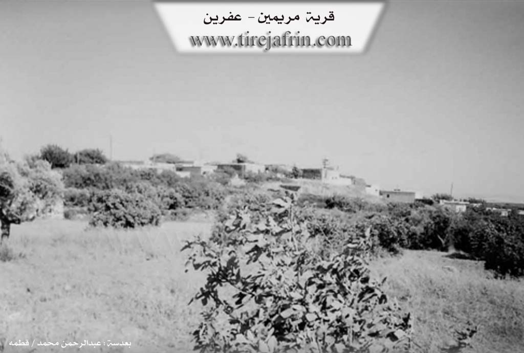
It is a large village located in the area of the Rûbarî tribe on Çiyayê Lêlûn. In the village, there are remains of ancient building walls and tombs carved into the rock from the Roman and Byzantine eras. Some beautiful dwellings have started to appear there. Its inhabitants speak Arabic.
According to the book عفرين .... نهرها وروابيها الخضراء Efrîn... Her River and Her Green Hills by the writer عبدالرحمن محمد Ebdulrehman Mihemed from the village of Qetme:
Meryemîn: A village in Çiyayê Lêlûn, administratively following the Central Villages sub-district of the Efrîn area, Heleb governorate. It is a large town located in the far south of a limestone plateau, at the end of the northern part of Çiyayê Seman and Lêlûn. It is covered by limestone and volcanic soil and is about 9km away from the city of Efrîn towards the northeast.
The habitation of the area is ancient, indicated by the presence of remains of massive limestone building walls and tombs carved into the rock, all dating from the Roman and Byzantine eras.
It is bordered to the north by the village of Şewarxa Guz and Me'erset el-Xetîb, to the south by the village of Enab at a distance of 200m, to the west by a wide fertile plain and the villages of Kefêr Mêz and Xalidiye, and to the east by a wide plain and the villages of Şewarxa Erz and Malikiye. Limestone rocks are available there, indicated by its buildings from the ancient Roman and Byzantine eras.
The number of houses in the village reaches about 600, and its age is about 800 years or more. Its dwellings are made of stone and mud with wooden roofs, while the modern ones are concrete, spreading on both sides of the public road to the city of Efrîn.
An electricity network is available, as well as water taken from Malikiye, primary and preparatory schools, and currently, a modern police station and a modern municipality house have been built. There is an ancient mosque from the era of Omar bin al-Khattab, other modern mosques, and a new telephone center. It has 3 main streets.
Its inhabitants work in rain-fed agriculture on an area of 680 hectares, producing grains, olives, vines, and cherries. Its people drink from a network that derives its water from the well located next to the Malikiye farm in the northeast of the village. An asphalted road reaches it from Efrîn and Heleb, passing through its center. There is an old shrine (mazar) in the center of the village.
Among the families present in the village are: Hacî Hesen, Qedûr, El-Bekrî, Ebdo, Hesen Meryemînî, El-Xetîb, Yasîn, Xelîfe, and Qasim. Among the holders of higher degrees in the village is Dureid El-Xetîb (PhD in Economics), and there are many holders of university degrees. The Mukhtar of the village is Zekerya El-Bekrî.
Sources
Book: جبل الكرد (عفرين) دراسة جغرافية Çiyayê Kurmênc (Efrîn): A Geographical Study by د. محمد عبدو علي Dr. Mihemed Ebdo Elî.
Book: عفرين .... نهرها وروابيها الخضراء Efrîn... Her River and Her Green Hills by عبدالرحمن محمد Ebdulrehman Mihemed from the village of Qetme.
Preparation and Execution:
Manager of Tirej Efrîn website: Ebdulrehman Hacî Osman
20/12/2013
II. Summary of Mêremînê from Multi Channel
Meryemîn is a historically rich agricultural village located approximately forty kilometers northwest of Heleb and fifteen kilometers from the Turkish border in the Efrîn region. It is bordered by several neighboring settlements, including Enab to the south, Mezre to the north, Şewarxa and Malikiyê to the east, and Çiyayê Qîbar and Eşqîbar to the west. The village has deep historical roots dating back to the Greek and Roman eras. Local tradition states that the village is named after Marîn, a Roman queen who once ruled the area. The term aqaba, meaning an obstacle or steep ascent, was historically added to its name due to the rugged, elevated pathways required to reach the settlement.
Sitting at an elevation of roughly seven hundred meters, the cool climate of Meryemîn mirrors that of famous mountainous towns like Slenfê or Blûdan. This environment on the slopes of Çiyayê Lêlûn and Çiyayê Seman provides ideal conditions for rainfed olive cultivation. A local farmer, Îbrahîm El Yasîn, notes that the village contains around two hundred thousand olive trees, some of which are over five hundred years old. The lands yield exceptional harvests, particularly the Kurdish Zêtî olive, which boasts a thirty three percent oil yield, alongside the Xelxalî variety used for curing. The village economy is supported by three active olive presses, including one modernized by Ebdulmecîd Qedûr, also known as Ebû Semra. Beyond agriculture, the community has a strong professional and industrial sector. The Tiya garment factory, managed by Eymen El Niêmî, produces clothing for local markets and exports to Iraq and Lebanon, utilizing solar energy to circumvent ongoing electricity and fuel shortages.
In recent years, the social fabric of Meryemîn has evolved as it became a sanctuary for those fleeing conflict. The village hosts around three hundred displaced families, primarily from the western and southern countryside of Heleb, including towns like Bêsirtûn, Ancara, and Yaqid El Edes. A makeshift camp in the village, directed by Hesen Seîd, shelters thirty of these families in extremely harsh conditions. Residents of the camp, such as former stonemason Ehmed Esed Zeydan, struggle to secure basic needs due to a lack of viable employment. Children in the camp, including Hesna Seîd, Merwe Hesen Elî, and young Îman Mihemed Nûr Zeydan, who suffers from an untreated hip condition, have been entirely cut off from education. A vendor displaced from the El Amiriyê neighborhood of Heleb also shares the economic challenges of displacement and paying rent. The camp suffers from poor sanitation, with rudimentary sewage systems cut into the rocky earth, leading to health crises like Leishmaniasis. To survive, the camp relies on limited aid from organizations like Behar. Despite these immense challenges, displaced residents like Werde El Casim Cuneyd, who purchased land and integrated into the community, express deep gratitude for the welcoming and cohesive nature of the Meryemîn locals, highlighting a strong spirit of mutual support and solidarity during difficult times.
Transcriptions and Subtitles
| Source | Video | Subtitles | Transcript |
|---|---|---|---|
| Multi Channel 1 | Watch Video | Download SRT | View Transcript |
Foundation/Origin Information of Mêremînê
A large village located in the Roubarai tribe area on Mount Lilon. Contains remains of archaeological building walls and tombs carved in rock from the Roman and Byzantine periods. Among the families in the village: Al Haji Hassan, Al Qadour, Al Bakri, Al Abdo, Al Hassan Marimini, Al Khatib, Al Yassin, Al Khalifa, Al Qasim.
Source: TirejAfrin Site
Possible Village Name Meaning of Mêremînê
It took its name from the "al-Marimeen" tree. Yaqut al-Hamawi says it is one of the famous villages of Aleppo.
Source: TirejAfrin Site