General Information
Nahiya (Subdistrict)
Bilbilê
Also Known As
Qornê, Qurnê, قورنه
Tribes
Biyan, Rûşkan
Families, Clans, etc.
Ecar, Ehmedî Elû, Hebî Ewnê, Heskê û Rû, Qelî, Qemerzade, Qemerê Mûrê, Reşkêlo, Sila, Tirkê, Tînî, Xelîlê Sêkî, Zengil

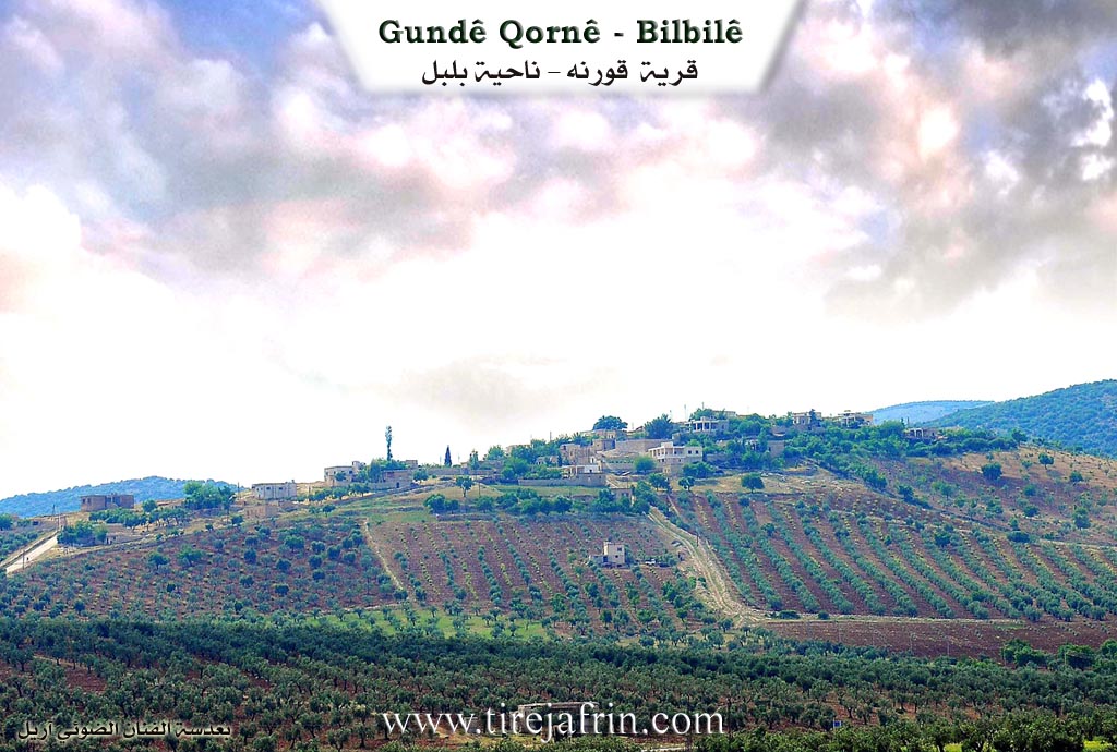
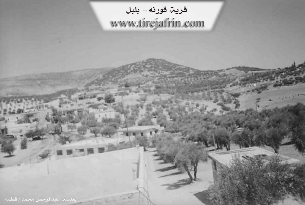
Photos
Basic Information about Qornê
Source: Tirej Afrin
Etymology: The name Qurnê means "the corner" in Kurdish (qurn/qunc), as the village is located at the extreme southeastern corner of the mountain Gir Mezin
Foundation Date/Period: Approximately 400 years ago
Hills: Gir Mezin, Damerik
Trees: Oak
Other Landmarks: Mehmûdiye (farm)
Summaries
I. Summary from TirejAfrin Site (English) of Qornê
Source: https://www.tirejafrin.com/site/kura%20afrin%20%20%20bilbile%20-%20qorna.htm
The book جبل الكرد (عفرين) دراسة جغرافية Çiyayê Kurmênc (Efrîn): A Geographical Study states regarding Qurnê:
Population: 1437. Area: 380 hectares. Distance: 4km. Elevation: 720m.
The name Qurnê means "the corner" in Kurdish (qurn/qunc), as the village is located at the extreme southeastern corner of the mountain Gir Mezin (Big Hill). It is a large village consisting of two parts, Upper and Lower, and is located 2km from the Turkish border.
The book عفرين .... نهرها وروابيها الخضراء Efrîn... Her River and Her Green Hills states:
Qurnê is a village in Çiyayê Kurmênc, administratively belonging to the Bilbil district of the Efrîn area in the Heleb governorate. It is a small village situated at the end of the gently sloping southeastern foothills of Mount Damerik. This mountain features calcareous marl rocks, covered in most sections by green basaltic rocks, and contains the highest peak in the Heleb governorate at 1269 meters. A valley passes through the village heading south. It is 2km from the Turkish border and 4km east of the district center.
The village is bordered to the north, 1km away, by the village of Balî Koy. To the south, it is bordered by a slope, a plain, a deep flood valley, mountainous highlands, and the village of Okanlî. To the west, it is bordered by the highest peak of Mount Damerik, the town of Bilbil, and the village of Zecre. To the east, it is bordered by a slope, a plain planted with olive trees, and the village of Mehmûd Obasî.
The number of houses in the village is approximately 65, and its age is about 400 years. The dwellings are made of stone and mud, while modern ones are cement and stone; the village has expanded to the west and east. An electricity network, a primary school, and an agricultural cooperative society are available. The village obtains drinking water from state-supplied water or from cisterns that collect rainwater.
Most inhabitants work in rain-fed agriculture, cultivating olives, grains, and legumes on an area of 380 hectares, alongside raising sheep and goats. Some residents work in the charcoal industry using oak trees scattered around the village. The road from the village to Bilbil is paved and passes through the center of the village toward the village of Balî Koy and the Mehmûdiye farm. There is a border police station in the village.
Sources of Information:
- Book: جبل الكرد (عفرين) دراسة جغرافية Çiyayê Kurmênc (Efrîn): A Geographical Study by د. محمد عبدو علي Dr. Mihemed Ebdo Elî.
- Book: عفرين .... نهرها وروابيها الخضراء Efrîn... Her River and Her Green Hills by عبدالرحمن محمد Ebdulrehman Mihemed from the village of Qetme.
- Studies of Navenda Tirej Soft / Ebdulrehman Hacî Osman.
- Some residents of the villages.
Preparation and Execution: Manager of the Tirej Efrîn website: Ebdulrehman Hacî Osman 20/12/2013
II. Summary of Qornê from Ax û Welat
Source: https://www.youtube.com/watch?v=ovDu3T5Y1dI
The village of Qurnê is located in the Bilbilê district of the Efrîn canton near the border with Bakur. Its origins trace back approximately eight hundred years. An early ancestor named Qemerzade initially settled at a nearby location called Rîşê. However, due to a shortage of water, the inhabitants relocated to the current site. Before the village was established, the land served as a cemetery, earning it the name Gorn or Goristan. When the Ottoman authorities arrived, their inability to properly pronounce the Kurdish word led them to record it as Qurnê, a pronunciation later adopted by the Arab administration. In earlier times, the village was also formally known as Cemîl.
The community comprises around one hundred and fifty households. The population predominantly belongs to the Biyan and Rûşkan tribes. The foundation of the village was laid by three main families: Qemerzade, Tînî, and Qemerê Mûrê. Over the generations, they were joined by several other lineages, including Sila, Zengil (also referenced as Ehmedî Elû or Hebî Ewnê), Reşkêlo, Heskê û Rû, Xelîlê Sêkî, Qelî, Ecar, and Tirkê. These families maintain strong kinship ties with people just across the border in Cûqo, Mar Cûqo, Pêrtax, and Balyo.
The area is rich in history and notable landmarks. Looming over the village is the mountain Gir, which reaches an elevation of over twelve hundred meters. At its peak are the ruins of Kela Gir, a fortress that historically supported Kela Hûrî and Kela Sîros during the times of the Rûm and Hûrî periods. Additionally, ruins of an ancient wall are visible near the Bereka site, locally associated with a female ruler named Ferha.
Water has always been vital to Qurnê. The primary sources are Kaniya Tûbeyliyê and Kaniya Biçûk. Historically, the women of the village endured great hardship carrying water from Tûbeyliyê in animal skin bags. This burden was finally eased in the 1940s when a local mayor named Ebdilhemîd organized the construction of a pipeline to bring the water directly to the village.
The village is home to sacred sites and local legends. On the western side sit the shrines of Şêx Bî Çeqel and Derwêş Qasim. According to village elders, these men were Êzîdî fighters from the east who fell in battle defending the territory. Their legacy was confirmed in 2006 when a delegation from Şengal visited to verify their history. Another sacred site is Kevirê Qul, a special rock with a hole in it. Villagers and visitors from surrounding areas visit this stone on Friday mornings, passing sick children through the hole in search of healing.
A prominent historical event in the collective memory of Qurnê occurred in 1932. A group of four hundred bandits led by Heydikî attacked the village. The villagers fought back, and although three locals were killed, they managed to exact revenge by slaying Heydikî, causing his remaining forces to flee. Today, the village continues its traditional way of life, centering around olive harvesting, communal gatherings, and sharing meals, as seen at the home of Mistefayê Zengîl.
Transcriptions and Subtitles
| Source | Video | Subtitles | Transcript |
|---|---|---|---|
| Ax û Welat 1 | Watch Video | Download SRT | View Transcript |
Possible Village Name Meaning of Qornê
Qornî means 'corner' in Kurdish, as the village is located at the furthest southeastern corner of Girê Mezin mountain.
Source: TirejAfrin Site