General Information
Nahiya (Subdistrict)
Mabeta
Also Known As
Gu.Selo, Salu Farm, Selo, Silo, Sulaiman, سلو, سليمان, سالو
Families, Clans, etc.
Silêman, Şêx Henan

Photos
Basic Information about Selo
Source: Khalil Sino
Etymology: Named Selû after its founder Silêman, who was nicknamed Selû; officially known as Mezre'et Silû
Foundation Date/Period: Approximately 200 to 300 years ago
Wells: Bîra Gēlê, Bîra d'avê
Other Landmarks: Mabeta
Summaries
I. Summary from TirejAfrin Site (English) of Selo
Source: https://www.tirejafrin.com/site/kura%20afrin%20%20%20mebetli%20-%20%20selo.htm
According to the book جبل الكرد (عفرين) دراسة جغرافية Çiyayê Kurmênc (Efrîn): A Geographical Study by د. محمد عبدو علي Dr. Mihemed Ebdo Elî: Gu. Selo, Mizrea Selo, Sileman /490 souls, 4km, 560m/:
It is named after its first inhabitant, called Sileman, and the changing of the name Sileman to Selo is found among the Kurds.
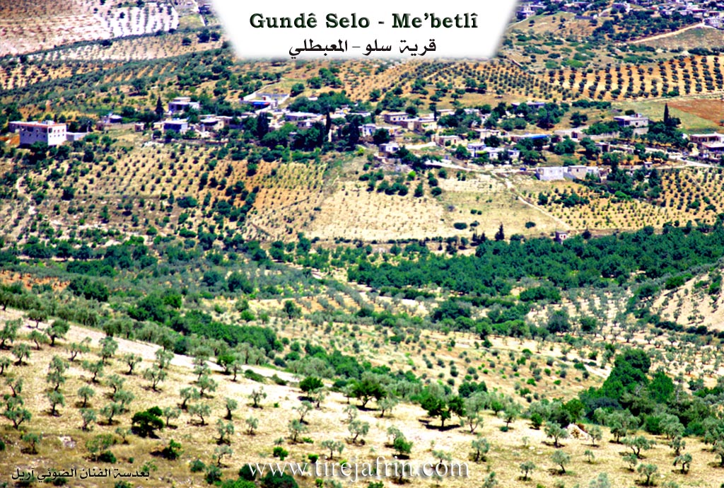
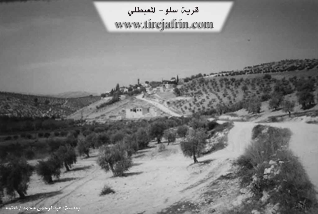
It is a small village located to the east of the village of Berimce by about 2km. Its location is between the highlands and is not conspicuous.
It states in the book: عفرين .... نهرها وروابيها الخضراء Efrîn... Her River and Her Green Hills by the writer عبدالرحمن محمد Ebdulrehman Mihemed from the village of Qetme:
Mizrea Selo: A farm (hamlet) in Çiyayê Kurmênc, following the subdistrict of Mabeta, district of Efrîn, governorate of Heleb. It is a small farm located in the middle section of the mentioned mountain, on the southwestern slope of a limestone plateau whose lands slope toward the west and south. Its soil is clay.
It is bordered on the north by mountainous heights planted with olive trees and the village of Ereb Uşaxî; on the south by Newala Sîlê and the village of Berimce at the top of the mountain; on the west by a slope, Newala Sîlê, mountainous heights planted with olive trees, and the village of Xaziya Jorîn and Xaziya Jêrîn; and on the east by a mountain slope, several watercourses, the village of Dar Gire, and Qenterê.
The number of its houses reaches about 30 houses, and its age is about 150 years. Its dwellings are stone and mud with wooden roofs, and the modern ones are concrete. An electricity network is available in it, as well as a water network from a well south of the mentioned village. The residents work in the cultivation of olives, vines, and fruit trees (walnuts and almonds), alongside raising sheep and goats. There is a modern primary school in it. It connects with the public road via a leveled dirt road that is not currently paved.
Preparation and execution:
Manager of the Tirej Efrîn site: Ebdulrehman Hacî Osman
20/12/2013
Sources:
- Book: جبل الكرد (عفرين) دراسة جغرافية Çiyayê Kurmênc (Efrîn): A Geographical Study by د. محمد عبدو علي Dr. Mihemed Ebdo Elî.
- Book: عفرين .... نهرها وروابيها الخضراء Efrîn... Her River and Her Green Hills by عبدالرحمن محمد Ebdulrehman Mihemed from the village of Qetme.
II. Summary of Selo from Khalil Sino
Source: https://www.youtube.com/watch?v=E6okLpMmmjA
The village of Selû, officially referred to as Mezre'et Silû, is a small settlement located in the Mabeta district of the Efrîn region. According to the elder resident Bavê Cengîn (also known as Mihemed), the village was founded approximately 200 to 300 years ago. Its origins are traced back to a single individual named Silêman, who arrived in the area, dug a well, and established a homestead. Silêman was affectionately nicknamed Selû, and over time, the settlement growing around his descendants adopted this name. While the government later designated it Mezre'et Silû (The Farm of Silû), the locals retain the original Kurmanji name.
Geographically, Selû sits on elevated ground (bilindî), roughly four to five kilometers from the district center of Mabeta. It is bordered by the villages of Xazyana to the west, Gundê Hisê, Şîtka, Kaxrê, and Ze'bin. To the east lies the area of Erebo. The village economy is deeply agrarian, dependent on the cultivation of Zeytûn (olives), Rez (vineyards), Gûz (walnuts), and Simaq (sumac). Residents like Dayika Kawa (named Zelîxa) describe the seasonal labor of harvesting grape leaves (çilû), which are packed and sold in the markets of Efrîn.
Historically, daily life in Selû revolved around communal water sources. Dayika Kawa recalls a time before modern amenities when women would carry clothes down to Bîra Gēlê (The Well of the Gēlê), a landmark located below the village near a tree, to wash laundry and socialize. While the village now has electricity and modern appliances, the elders lament the loss of the deep interpersonal trust (emanet) that characterized the older generations.
Culturally, Selû is noted for its spiritual connections and a surprising modern development. The village is home to a family claiming Ocax status, a spiritual lineage associated with healing and prayer. One resident, Alan, mentions that his family performs prayers and recitations from the Quran for the sick, referencing the famous Şêx Henan lineage of Efrîn as a standard of religious reputation. Despite its small size and lack of services, having only one school, one shop, and no barber, Selû has gained a reputation for its high concentration of content creators. The village hosts five active YouTubers, including Husam (of the channel Afrin Tube) and Alan (of Aîlet Alan), who document traditional rural life and share the folklore of Selû with the broader Kurdish diaspora.
Transcriptions and Subtitles
| Source | Video | Subtitles | Transcript |
|---|---|---|---|
| Khalil Sino 1 | Watch Video | Download SRT | View Transcript |
Foundation/Origin Information of Selo
Named after its first inhabitant called Sulaiman.
Source: TirejAfrin Site
Possible Village Name Meaning of Selo
Named after its first inhabitant called Sulaiman, and the alteration of Sulaiman's name to "Salu" exists among Kurds.
Source: TirejAfrin Site