General Information
Nahiya (Subdistrict)
Bilbilê
Also Known As
Al-Khadr, Khadryanli, Xidiriya, الخضر, خضريانلي
Tribes
Milan, Reşwan, Xidranlû
Families, Clans, etc.
Behçeyê, Dadê, Ebdoyî, Hacî Omer, Ibrahîmî Huçû, Mihemedî Zêtê, Misreşan, Niqê, Qerê, Reşkutê, Samiye, Silehpotî, Sîno, Sûlikê, Xoce Hesê, Çelebî, Çepzerava

Photos
Basic Information about Xidiriya
Source: Tirej Afrin
Etymology: Xidranlû is the name of a clan from the large Kurdish Reşwan tribe; some say they are from the Milan tribe
Foundation Date/Period: Approximately 500 years
Hills: Semaq
Other Landmarks: Qestel Xidriyanlî
Summaries
I. Summary from TirejAfrin Site (English) of Xidiriya
Source: https://www.tirejafrin.com/site/kura%20afrin%20%20%20bilbile%20-%20%20Xidiriya.htm
It is stated in the book جبل الكرد (عفرين) دراسة جغرافية Çiyayê Kurmênc (Efrîn): A Geographical Study: Xidiriya, Xidriyanlî, El-Xidir /2628 inhabitants - 435 hectares - 8km - 750m/:
Xidranlû: This is the name of a clan from the large Kurdish Reşwan tribe. Some say that they are from the Milan tribe. Members of it can be found near Mount Ararat /Zekî, Vol 1, p. 432/.
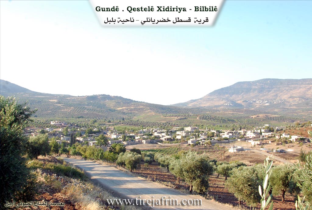
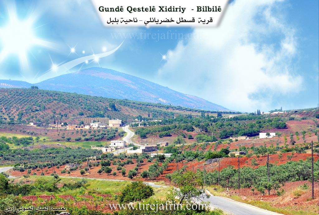
It is a medium-sized village located on the northeastern slope of Mount Semaq. Some of its inhabitants displaced to a new site 1km away towards the north where water is available; the new village is called: Qestel Xidriyanlî.
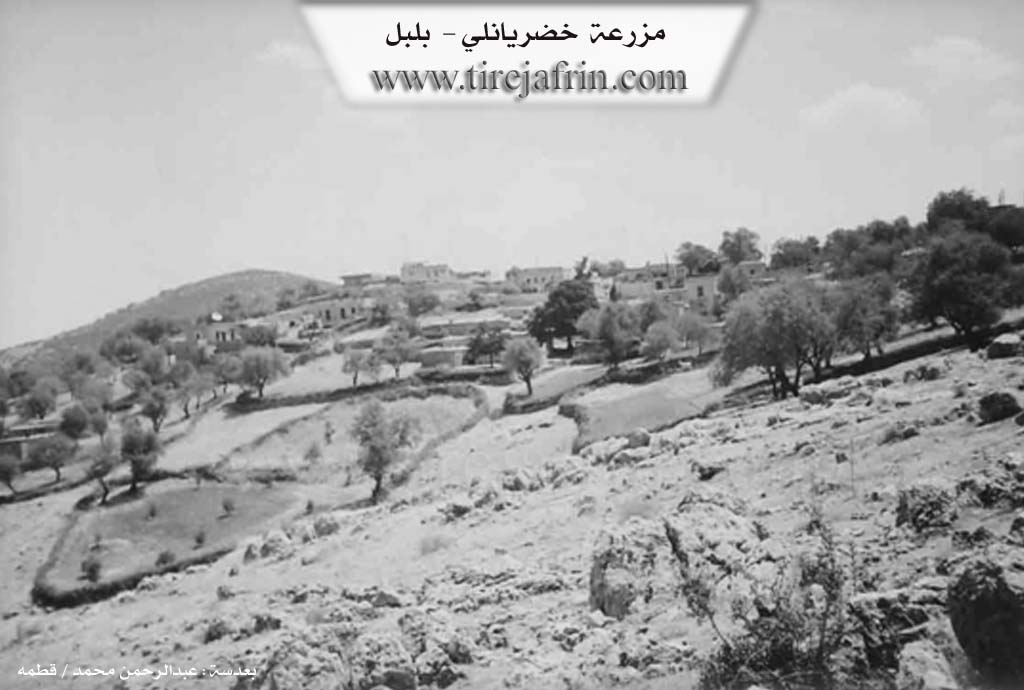
It is stated in the book عفرين .... نهرها وروابيها الخضراء Efrîn... Her River and Her Green Hills: Xidriyanlî: A village in Çiyayê Kurmênc following the sub-district of Bilbile, district of Efrîn, governorate of Heleb. It is a large village located on the northeastern slope of the limestone Mount Semaq in the northern section of the aforementioned mountain block. It is 8km southwest of the town of Bilbile.
It is surrounded by agricultural lands with fertile clay soil, and seasonal streams flow down around it in various directions. It is bordered to the north by several seasonal streams, a fertile agricultural plain, Qestel Xider, and the villages of Hêyamli and Se'riyanlî. To the south, it is bordered by a high, rugged mountain range and the villages of Berkeşlî and Şerqiyanlî. To the west, it is bordered by a seasonal valley (wadi), rugged mountain heights, and the villages of Çolaqlî, Hadir, and Dibirû. To the east, there is a deep seasonal valley, a rugged mountain chain, and the village of Okanlî.
The number of its houses reaches about 100, and its age is approximately 500 years. Its residences are made of stone and mud with flat wooden roofs, while modern ones are of stone and cement. Some of its inhabitants displaced to a new site 1km to its north called Qestel Xidriyanlî due to the availability of water there. An electricity network, a primary school, and a mosque are available in the village. The village drinks from water in cisterns where rainwater is collected.
There is an agricultural cooperative in the village. Most of its inhabitants work in rain-fed agriculture on an area of 435 hectares, growing olive trees, grains, vines, and legumes, alongside raising sheep and goats. Its lands are mountainous, rugged, steep, and poor; therefore, most of its inhabitants have displaced to the cities of Efrîn, Heleb, and Bilbile due to a lack of resources. It is connected to the town of Bilbile by a paved mountain road that is 8km long. The farms of Dibirû, Hadiro, and Çolaqlî are dependencies of the village.
Village Mukhtar: Bekir Bekir Remezan
Sources of Information:
- Book: جبل الكرد (عفرين) دراسة جغرافية Çiyayê Kurmênc (Efrîn): A Geographical Study by د. محمد عبدو علي Dr. Mihemed Ebdo Elî.
- Book: عفرين .... نهرها وروابيها الخضراء Efrîn... Her River and Her Green Hills by the writer عبدالرحمن محمد Ebdulrehman Mihemed from the village of Qetme.
- Studies of Navenda Tirej Soft / Ebdulrehman Hacî Osman.
- Some residents of the villages.
Preparation and Execution: Director of the Tirej Efrîn website: Ebdulrehman Hacî Osman 20/12/2013
II. Summary of Xidiriya from Ax û Welat
Source: https://www.youtube.com/watch?v=At5_aPSdk3Y
The village of Xidriya is located seven kilometers west of Bilbilê in the mountainous terrain of the Efrîn region. Situated near the border, the village historically had strong commercial ties to the market in Kilîs in Bakurê Kurdistanê before modern borders separated them. According to village elders, the settlement is over five hundred years old. Before moving to its current location, the original community lived at an ancient ruined settlement called Xirabata. During its early days, there were other nearby villages that are now ruins, such as Du pîra and Ebidîn. Fetching water was once a grueling task that took women five to seven hours as they had to travel down to areas like Geliyê Guvcê while facing wild animals, before cisterns were eventually built.
The social structure of Xidriya is entirely built on interconnected family lineages, with all residents considering themselves blood relatives. The foundational lineage is the Xoce Hesê family, which began with several brothers who established the current village. They were soon joined by the Silehpotî group along with the Sûlikê and Qerê families. Over time, other families arrived and integrated into the community, including the Sîno, Çepzerava, Hacî Omer, Dadê, Çelebî, Behçeyê, Misreşan, Niqê, and Mihemedî Zêtê lineages. Later migrations brought the Ebdoyî family from the village of Alkê, and about sixty years ago, the Ibrahîmî Huçû family arrived from Bêkê. The Samiye and Reşkutê families are also noted as early historical residents whose names are tied to local landmarks.
The community holds deep reverence for ancient sacred sites in the surrounding landscape. About one kilometer west of the village lies Kevirê Kuxikê, a massive natural stone arch situated in what was historically an Êzîdî cemetery. Villagers consider this place an ocaq or holy site. On Wednesdays, individuals suffering from severe coughs or winter illnesses visit the stone, pass underneath it three times, leave coins, and tie pieces of cloth to the nearby Dara Mirazan to ask Xwedê for healing. Another highly venerated site is Şikefta Reşkutê, a large cave reaching fifty meters deep. Deep inside grows a sacred fig tree known as Dara Tîpê that never sees sunlight. Parents bring children suffering from hernias to this cave before sunrise on Wednesdays. They split a branch of the tree, pass the sick child through the gap three times, and bind the branch together, believing that as the tree heals, the child will also be cured. The reputation of these sites is so widespread that visitors come from as far away as Mêrdîn and Çarçiya to seek miracles.
Xidriya is also known for its preservation of ancestral agricultural tools. The villagers still maintain a giant communal stone mortar called a sûqî. Although modern mills are available, locals like Mihemed Mistefa, Asya Reşîd, and Asya Ebdoy still take pride in using heavy wooden mallets to pound wheat and prepare traditional meals. The elders also share fond memories of the days before electricity arrived thirty years ago, recalling how weddings were celebrated with musicians brought from neighboring places like Xalko and Kurîf.
Transcriptions and Subtitles
| Source | Video | Subtitles | Transcript |
|---|---|---|---|
| Ax û Welat 1 | Watch Video | Download SRT | View Transcript |
Foundation/Origin Information of Xidiriya
Some of its inhabitants migrated to a new location 1km north of it where water is available, and the new village is called: Qastal Khadryanli.
Source: TirejAfrin Site
Possible Village Name Meaning of Xidiriya
Khadryanlu: Name of a clan from the large Kurdish Rashwan tribe, and some say it is from the Milan tribe.
Source: TirejAfrin Site