General Information
Nahiya (Subdistrict)
Nubl
Also Known As
Zarneta, Zernê'îtê, Zernêetê, Zinarê Rût, Zeyn Arîş, Zirênîtê, زعرنيتا, زعر لينا
Tribes
Awn, Usûsî
Families, Clans, etc.
Metkê, Naso, Qamber
Photos
Basic Information about Zirenîtê
Source: Ax û Welat
Etymology: Zinare Rûyt (Naked Cliff) or Zênarîş
Foundation Date/Period: Approximately 200 years ago
Hills: Çiyayê Lêlûn
Other Landmarks: Tiliqro, Ehrez, Zinare Rûyt
Summaries
I. Summary from TirejAfrin Site (English) of Zirenîtê
Source: https://www.tirejafrin.com/site/kura%20afrin%20markaz-%20zarneta.htm
And it is stated in the book: عفرين .... نهرها وروابيها الخضراء Efrîn... Her River and Her Green Hills by the writer عبدالرحمن محمد Ebdulrehman Mihemed from the village of Qetme:
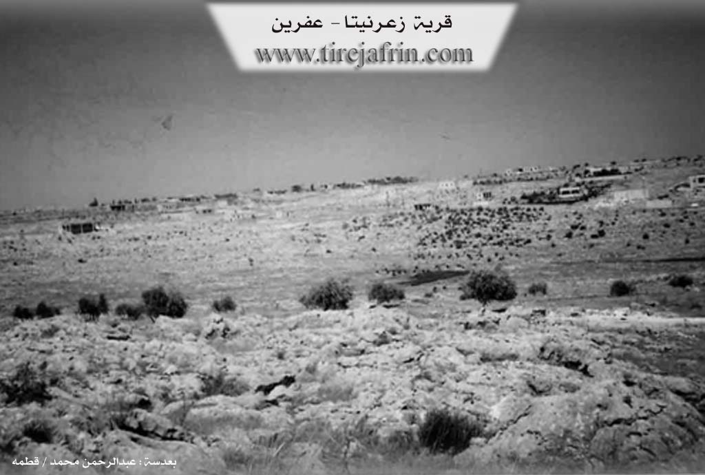
Zernîte: A farm in Çiyayê Lêlûn, following the sub district of the villages of the center and region of Efrîn, Heleb governorate. It is a small farm located on a mountainous elevation of the eastern Çiyayê Lêlûn chain, following the sub district of the villages of the Efrîn region.
It is bordered to the north by a rugged mountain chain of rocks and the village of Soxanek and Eqîbê; to the south by a mountain slope, a rugged mountain chain, and the town of Nubl at the bottom of Çiyayê Lêlûn; and to the west by a watercourse and a mountain chain of rugged rocks and the village of Meyasê at a distance of 500m.
The number of its houses reaches about 35 houses, and its age is about 80 years. They came from the town of Sirîn Kobanê and bought these lands. Its dwellings are modern, made of stones and cement. An electricity network is available in it, as well as a leveled dirt road connecting to the town of Nubl. It has a primary school. The residents drink from pools and cisterns from gathered rainwater. Its inhabitants work in grain cultivation and the raising of sheep and cows primarily. Currently, it administratively follows the Nubl sub district, Ezaz region, since the year 1980.
Sources
Book: عفرين .... نهرها وروابيها الخضراء Efrîn... Her River and Her Green Hills by عبدالرحمن محمد Ebdulrehman Mihemed from the village of Qetme.
Preparation and execution:
Manager of Tirej Efrîn site: Ebdulrehman Hacî Osman
20/12/2013
II. Summary of Zirenîtê from Ax û Welat
Source: https://www.youtube.com/watch?v=59fBqC2SC24
The village of Zernêîtê (also referred to as Zirnaîtê) is located in the Şêrawa region of Efrîn, situated upon Çiyayê Lêlûn. While the village is geographically and culturally integrated into the Kurdish landscapes. Its residents speak Kurmanji and wear the traditional black dress characteristic of Şêrawa. Its origins are distinct. According to the elder Apê Îbrahîm, the village was founded approximately 200 years ago by five brothers from the Usûsî tribe (specifically the Awn lineage). These founders were originally Arabs from Sirîn. Their migration path took them through Deşta Cûmê and the eastern plains, stopping in locations such as Minx, Pişta Arê, Timb, and Aqîb, before they eventually purchased the land for Zernêîtê from the people of Kurzêl. Over the last two centuries, the Usûsî settlers became completely "Kurdified" (bûne Kurd), adopting the language and customs of their neighbors.
Historically, the village was known as Zinarê Rûyt, meaning "Naked Cliff," or Zênarîş. A defining feature of the village's architectural history is the Qop (or Qube), traditional conical domed houses built from stone and clay. In the past, the village consisted almost entirely of these structures, and families lived communally within them. Residents like Mihemed and Xaltîka Fatma describe a time when extended families, sometimes including multiple married couples, shared a single Qube, using curtains to separate sleeping quarters. The Metkê and Qamber families are specifically mentioned in relation to these traditional living arrangements. The largest Qop historically served as the guesthouse (odê) and was associated with the late elder Elî Hesen, who was a central figure in resolving social disputes.
Culturally, Zernêîtê is a repository of traditional arts and knowledge. The village is known for its singers (dengbêj), most notably the late Hesenê Dengbêj. His son, Apê Ehmed, continues this oral tradition, reciting epics such as "Genc Osman," though he notes that he is the last of his family to do so. The village is also a hub for traditional medicine; Apê Hesen and his wife Xaltîka Eyş (of the Naso family) are renowned for preparing Mêrstone, also known locally as Hebba Salê or Hebba Helebê. This herbal paste, made from burnt wheat oil and other ingredients, is used to treat boils and burns.
Economically, the villagers engage in agriculture and beekeeping. Beekeepers like Kekê Brahîm manage dozens of hives, a trade learned from the teacher Merwan Bereket. They practice migratory beekeeping, moving their hives to areas like Tiliqro and Ehrez when possible. However, the community faces significant difficulties due to the conflict in the region. Residents report that much of their agricultural land is currently inaccessible due to the control of the "Turkish state and mercenaries" (Dewleta Tirk and Çeteyan), limiting their ability to farm. Despite these challenges, the people of Zernêîtê remain deeply connected to their identity as residents of Çiyayê Lêlûn.
Transcriptions and Subtitles
| Source | Video | Subtitles | Transcript |
|---|---|---|---|
| Ax û Welat 1 | Watch Video | Download SRT | View Transcript |
Foundation/Origin Information of Zirenîtê
They came from Sarin town/Ein al-Arab/ and bought these lands.
Source: TirejAfrin Site