General Information
Nahiya (Subdistrict)
Bilbilê
Also Known As
Bali, Bali Koy, Baliya, Balya, بالي, بالي كوي, بالي كوي فوقاني, باليا
Tribes
Baliya, Biya
Families, Clans, etc.
Balikê, Beko, Heso, Horo, Xelo, Şabo

Photos
Basic Information about Baliya
Source: Ax û Welat
Etymology: Turkish origin, meaning "honey," reflecting the village's historical reputation for beekeeping during the Ottoman era
Old Names: Gawidahat
Springs: Kaniya Reş, Kaniya Osmaniyan, Qere Hincar, Qere Pîngarê, Kaniya Mala, Kaniya Geli, Kaniya Koçê, Kaniya Sifkê, Kaniya Bûlix
Hills: Girê Bilbilê, Çiyayê Gir
Shrines: Şêx Hemze
Ruins: Keleha Çiyayê Gir
Other Landmarks: Deşta Dûlê, Geliyê Heskêlê, Geliyê Dîlîv, Bana Çirkê
Summaries
I. Summary from TirejAfrin Site (English) of Baliya
Source: https://www.tirejafrin.com/site/kura%20afrin%20%20%20bilbile%20-%20Baliya.htm
The following is found in the book جبل الكرد (عفرين) دراسة جغرافية Çiyayê Kurmênc (Efrîn): A Geographical Study regarding Baliya, Balî Koy, or Balî /1054 inhabitants, 140 houses, 4km distance, 800m altitude/:
Bal in Kurdish means "the high rise" or "high elevation," which is a description that applies to the location of the village. Furthermore, Baliya is the name of a Kurdish tribe found near Xoy in Eastern Kurdistan. There is no connection between the Arabized name "Bal" and the ancient name, except in terms of pronunciation.
It is a small village consisting of two parts. The upper part is large, located next to the border, and is the old section. The lower part is small and was established after some residents preferred to descend from the rugged slope to facilitate access to services and to move away from the Turkish border guards. The distance between the two villages is about 1km. Its location is fortified on the eastern slope of the mountain Gir Mezin.
The book عفرين .... نهرها وروابيها الخضراء Efrîn... Her River and Her Green Hills states: Balî Koy is a village in Çiyayê Kurmênc following the Bilbile district, Efrîn region, Heleb governorate. It is a very small village, and the name in the local language means "Village of Honey." It is located near the current Turkish border in a fortified position on the middle northeastern slope of the limestone mountain Damerik, which is covered with green rocks and basalt. Its soil is volcanic calcareous clay, rich in water and forests.
It lies in the northern part of the Heleb mountain block, 3km northeast of the town of Bilbile. It is bordered to the north by a torrential valley, a mountain range, and the Turkish border directly just meters away. To the south, it is bordered by a mountain range and the nearby village of Qurne at a distance of 1km. To the west lies Damerik mountain, which is the highest peak in Çiyayê Kurmênc and Heleb with a height of 1269m, and the village of Zecre. To the east, there is a deep torrential slope and valley, the Turkish border, and the villages of Hay Oxlî and Mehmûd Obasî.
The number of its houses is 25 houses (note: this contradicts the statistical header), and its age is approximately 350 years. Its dwellings are made of stone and mud with flat wooden roofs, while modern ones are of cement blocks. An electricity network is available. A clear and cold water spring flows from the bottom of the high mountain on the western side, and its drinking water is considered among the purest in terms of taste.
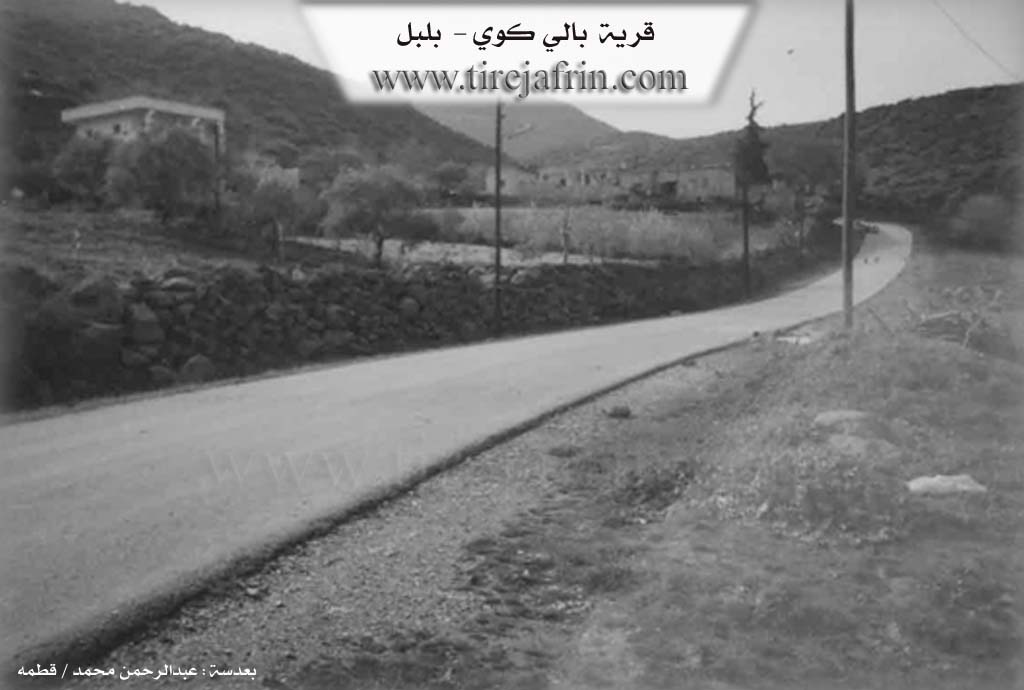
Its residents work in rainfed agriculture on an area of 130 hectares, producing olives, grains, and vines. They practice irrigated agriculture from the spring and artesian wells on an area of 10 hectares, producing summer vegetables and fruit trees alongside raising sheep, goats, and bees. The village drinks from springs located to the east of the village or from cisterns that collect rainwater. There is a border police station in the village. A paved mountain road 6km long connects it to the town of Bilbile. It is very close to and overlooks the Turkish villages, separated from them by a very deep torrential valley.
Village Mukhtar: Hikmet Xelo Mihemed
Sources of Information:
- Book: جبل الكرد (عفرين) دراسة جغرافية Çiyayê Kurmênc (Efrîn): A Geographical Study by د. محمد عبدو علي Dr. Mihemed Ebdo Elî.
- Book: عفرين .... نهرها وروابيها الخضراء Efrîn... Her River and Her Green Hills by عبدالرحمن محمد Ebdulrehman Mihemed from the village of Qetme.
- Studies of Navenda Tirej Soft / Ebdulrehman Hacî Osman.
- Some residents of the villages.
Preparation and Execution: Manager of Tirej Efrîn website, Ebdulrehman Hacî Osman, 20/12/2013
II. Summary of Baliya from Ax û Welat
Source: https://www.youtube.com/watch?v=AtXT5umQrNc
The village of Baliya, located in the Bilbilê district of the Efrîn region (also known as Çiyayê Kurmênc), is a settlement defined by its rugged geography and the political partition of Kurdistan. Situated on the slopes of Çiyayê Gir, a mountain characterized by black volcanic rock and an elevation of 1,300 meters, the village sits near the border with Turkey. The name Baliya is of Turkish origin, meaning "honey," reflecting the village's historical reputation for beekeeping during the Ottoman era. Prior to this, the village was known as Gawidahat, a name referencing the oxen used for plowing in the area.
The history of Baliya is deeply intertwined with the ancient heritage of the region. A fortress, Keleha Çiyayê Gir, once stood atop the mountain, with history tracing back to the Horî (Hurrian) and Mîtannî eras; kings of these civilizations reportedly spent their summers on the cool peaks of Çiyayê Gir. However, the modern history of the village is marked by separation. In 1928, the border between Turkey (North) and Syria (South) was established, splitting the community in two. The northern section became known as Berecûqê (or Cûqa), while the southern section remained Baliya (specifically Balyana Jorîn). A third settlement, Alke (or Balyana Jêrîn), lies one kilometer to the south and is inhabited by the same tribe, the Biya.
The imposition of the border had severe consequences for the residents. Villagers like Apê Mihemed and Ismet describe how their ancestral lands, such as Deşta Dûlê, were cut off by wires and landmines ("bombe"). Access to these lands is prohibited, and residents speak of the danger posed by Turkish soldiers and mines that have caused injuries and loss of livestock. Despite these hardships, the village maintains a distinct social structure comprising six main families: Heso, Xelo, Horo, Beko, Şabo, and Balikê, all belonging to the Biya tribe.
Water is a central feature of Baliya, which is renowned for its numerous springs. The most prominent include Kaniya Bûlix, Kaniya Mala (located inside the village), and Qere Hincar (also associated with Kaniya Reş and Kaniya Osmaniyan). These springs provide drinking water and irrigate the orchards and vegetable gardens that sustain the community. The water from Kaniya Mala is particularly prized for its purity.
Culturally, the village preserves specific culinary traditions, such as the preparation of Şûrbî Kaşkê, a soup made from dried yogurt and wheat, though elders like Dayika Elîf note that such traditional dishes are becoming less common. The village is also home to the Şêx Hemze shrine, marking the beginning of the Çiyayê Gir range. Today, roughly 60 households remain in the village, while another 60 families have migrated to the center of Bilbilê or beyond due to the difficulties of life on the border.
II. Summary of Baliya from Ax û Welat 2
Source: https://www.youtube.com/watch?v=VdoN-UXAOIE
The village of Baliya, located in the Efrîn region of Çiyayê Kurmênc, is defined historically by its partition along the Turkey-Syria border and geographically by its abundant water sources. Originally a single contiguous settlement, the village was split during the demarcation of the border in the early 20th century. The narrator cites 1928 as the year of division, while a village elder, Ismet, recalls 1938 as the time when boundary stones were laid. This geopolitical event fractured the community into Baliya Jêrîn (Lower Baliya), which fell to the north in Turkey and was renamed Berecuqê, and Baliya Jorîn (Upper Baliya), which remained in Syria and is known as Baliya Tehtê. A nearby settlement, Elkê, is also referred to as Baliya Şêrîn.
The history of the border is a central theme in the collective memory of the residents. Initially marked only by numbered white stones, the barrier hardened over time. Ismet recounts that during the period of Egyptian influence (referring to the United Arab Republic era), the border was fortified by Misrê (Egypt) with three rows of barbed wire and landmines planted in four distinct lines. This militarization resulted in the loss of agricultural land and the physical separation of families, though they continued to communicate across the divide. Due to these hardships and security restrictions, approximately 60 families migrated from the village to the town of Bilbilê.
Baliya is renowned for its hydrology, possessing numerous springs that sustain its agriculture and daily life. The most prominent springs include Kaniya Reş, also known as Qerepîngar, the waters of which were historically transported to the ancient ruins of Kelha Horî. Other significant water sources are Kaniya Mala (used for drinking water), Kaniya Bûliq, Kaniya Gelî, Kaniya Koçê, and Kaniya Sivikê. A large plane tree known as Çinarê stands as a landmark near Kaniya Bûliq. The village sits at a high elevation on Girê Tevî, approximately 1,200 meters above sea level. Culturally, the remaining residents maintain traditional practices, notably the preparation of Keşk (a dried yogurt and wheat dish) and Cemalî, culinary traditions they note are fading in neighboring areas. Residents like Nûrî, the village mukhtar, emphasize that despite the division and depopulation, the community remains deeply attached to its land and water resources.
Transcriptions and Subtitles
| Source | Video | Subtitles | Transcript |
|---|---|---|---|
| Ax û Welat 1 | Watch Video | Download SRT | View Transcript |
| Ax û Welat 2 | Watch Video | Download SRT | View Transcript |
Possible Village Name Meaning of Baliya
"Bal" in Kurdish means "the high elevation," which applies to the village's location. Baliya is also the name of a Kurdish tribe. Another meaning is "honey village" in the local language.
Source: TirejAfrin Site