General Information
Nahiya (Subdistrict)
Şera
Also Known As
Al-Sa'r, Sa'ranjak, Sa'rkanli, Sarincikê, Sarînçakê, Serincekê, Serîncekê, Sêrîncek, السعر, سعرنجك, سعرنجكة
Tribes
Lîkûwa, Lîkûwan
Families, Clans, etc.
Mala Betil, Mala Elexlênê, Mala Ewîşê, Mala Ezdîn, Mala Henûsê, Mala Hidik, Mala Lîkû, Mala Mehemedê Hecî, Mala Omer, Mala Qemer Oglin, Mala Reşê Ereb, Mala Ûmedê, Mala Şêx Mûs, Malê Betê, Malê Eleslênê, Malê Elîkê, Malê Ewişê, Malê Ezdîn, Malê Hecî Bîş, Malê Henûse, Malê Hidik, Malê Lîkû, Malê Mehmedê Hecî, Malê Momedî, Malê Omer, Malê Qemer-oxlan, Malê Reşê Ereb, Malê Wişoyê, Malê Şêxmûs
Photos
Basic Information about Serîncekê
Source: Ax û Welat
Etymology: Named after the many cisterns (se'rinc) dug by early nomadic settlers due to a lack of natural springs
Foundation Date/Period: Approximately 400 years ago
Caves: Gelî şikeftê, Şikefta qîzê Cum'a
Springs: Çinarê, Kaniya Xelîl, Kaniya Jibê, Kaniya Kewa
Hills: Çiyayê Kilê Şêr, Çiyayê Keleş, Zinêrê birbirê
Shrines: Qurmê malarê şê, Reşkêrê, Ziyaretgeha Şêx Xurzê
Ruins: Xorabê Sê-malka, Gundê Belîsenkê
Trees: Bêrê tûyê
Wells: Bîra Şadiyan, Bîra Tû
Other Landmarks: Kevirê Gum Gum, Çemê Efrînê
Summaries
I. Summary from TirejAfrin Site (English) of Serîncekê
Source: https://www.tirejafrin.com/site/kura%20afrin%20%20sheran%20-%20Sarenjak.htm
It is stated in the book جبل الكرد (عفرين) دراسة جغرافية Çiyayê Kurmênc (Efrîn): A Geographical Study: Se'rncek, Se'rkanlî, Al-Si'r / 752 inhabitants, 840 meters altitude, 15km distance, 600m altitude /:
Se'rncek: It means "ground water cistern" with the addition of the Kurdish diminutive suffix "ek" to the name. The Arabization of the name is arbitrary, as Al-Si'r has no meaning in Arabic either.
It is a small village located on the western bank of the Efrîn river by about 3km, and it faces Şêx Xûrz mountain to the north.
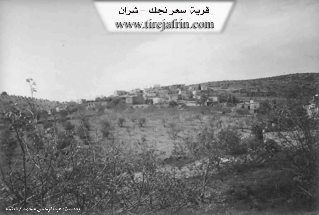
It is stated in the book عفرين .... نهرها وروابيها الخضراء Efrîn... Her River and Her Green Hills: Se'rncek: A village in Çiyayê Kurmênc following the Şeran township, Efrîn region, Heleb governorate, (734 inhabitants). It is a small village located on an elevation and limestone plateau that descends towards the south and a mountainous slope; its soil is clay. It is 27km away from the town of Şeran. It is located on the Şêx Xûrz mountain chain.
It is bordered to the north by a high and rugged mountain chain planted with oak trees and the village of Şêx Xûrz. To the south, it is bordered by a slope and a plain planted with olive trees with two watercourses that start from the north and end in the south at the valley of the Efrîn river and the village of Bellûrsenk. To the west, it is bordered by a valley and a high mountain chain and the village of Qizilbaş and the village of Bîlan Kûy. To the east, it is bordered by a valley and the village of Omer Sîmo.
The number of its houses amounts to about 65 houses and its age is about 300 years. Its old houses are made of stone and mud with wooden ceilings, and the modern ones are of stone and cement. It is among the old villages in the Şeran township. An electricity network is available in it, as well as drinking water from an artesian well. There is a primary school in it and a paved road in the center of the village that connects to Nebî Hûrî, while the road connecting to the village is a dirt mountain road. There are also three modern villas on the western side of the village and a modern technical olive press.
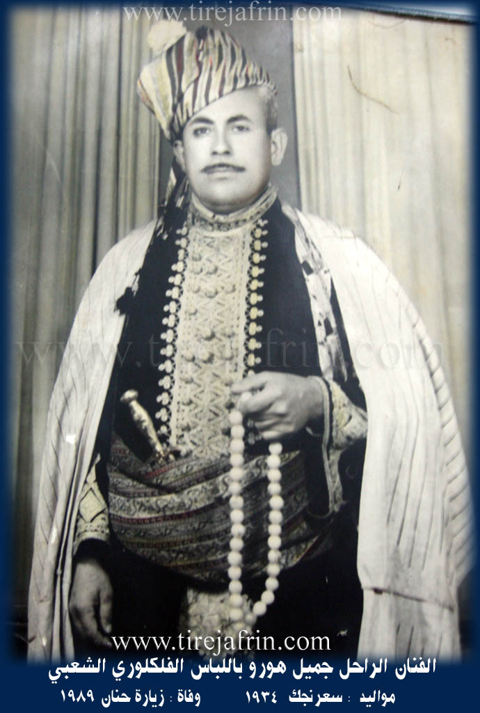
Its inhabitants work in the cultivation of olives and vines alongside raising sheep and goats. It is mentioned that the artist Cemîl Horo is one of the sons of this village.
Village Mukhtar: Horîk Henan
Sources of Information:
- Book: جبل الكرد (عفرين) دراسة جغرافية Çiyayê Kurmênc (Efrîn): A Geographical Study by د. محمد عبدو علي Dr. Mihemed Ebdo Elî.
- Book: عفرين .... نهرها وروابيها الخضراء Efrîn... Her River and Her Green Hills by عبدالرحمن محمد Ebdulrehman Mihemed from the village of Qetme.
- Studies of Navenda Tirej Soft / Ebdulrehman Hacî Osman.
- Some residents of the villages.
Preparation and execution: Manager of the website Tirej Efrîn: Ebdulrehman Hacî Osman 20/12/2013
II. Summary of Serîncekê from Ax û Welat
Source: https://www.youtube.com/watch?v=rnxXMPsgEFw
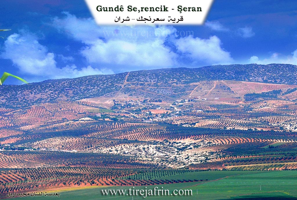
The village of Se'rincekê, located in the Şera district of the Efrîn canton, sits upon the slopes of Çiyayê Kilê Şêr (also referred to as Çiyayê Keleş), roughly 4 kilometers from the Çemê Efrînê and near the Turkish border. The village was founded approximately 400 years ago by nomadic tribes (koçer) who settled in the area. The name Se'rincekê is derived from the word se'rinc (cistern). According to local elders, when the first settlers arrived, there were no natural springs within the immediate village site. To survive, the early families dug individual cisterns to harvest rainwater for their flocks of sheep and cattle. Today, approximately 60 of these historical cisterns remain, some still in use as water storage.
The settlement history involves migration from nearby abandoned sites. Residents describe ancestors moving from Xorabê Sê-malka, a ruin located two kilometers away featuring wells like Bîra Şadiyan and Bîra Tû, and from Gundê Belîsenkê, which is now deserted. The social structure is defined by five founding families: Malê Lîkû, Malê Reşê Ereb, Malê Omer, Malê Qemer-oxlan, and Malê Lîkû (associated with the Lîkûwa tribe). Over time, other families arrived, such as Malê Momedî from Tirkiyê, and several families including Malê Henûse and Malê Şêxmûs from Belîsenkê. The village maintains a reputation for strong communal bonds, described by residents as a "garden with every type of flower," where different lineages live as one household.
Se'rincekê has a distinct history of resistance against the French Mandate. Notable figures like Şêx Henîf and Elî Qurt-ele organized local forces to fight the French occupation. The village was bombed by French aircraft in retaliation, resulting in civilian casualties. Şêx Henîf was eventually captured in Nazanê in 1941 and executed in Efrîn two years later; he is buried in Qîbarê. Other historical figures remembered for their bravery or social influence include Mistefa Çolaq, Ehmedê Rîtû, and Bişra Kurd Elî.
The landscape around Se'rincekê is rich in folklore and landmarks. An elder recounts a tradition related to Keleşîr (or Kilê Şêr), where women would bring milk (şîr) to the site, believing the name originated from the abundance of milk produced by flocks grazing there. A specific rock formation known as Kevirê Gum Gum is said to make a drumming sound when wind or water passes through it. The area also contains Gelî şikeftê (Valley of Caves), specifically Zinêrê birbirê, which served as a hiding place for those persecuted by the Ba'th regime and a secret location for lighting Newroz fires during times of prohibition. The village is also home to sacred sites such as Qurmê malarê şê and Reşkêrê, and lies near the Ziyaretgeha Şêx Xurzê. Culturally, the village preserves old traditions, such as the gawirîn (bride exchange) wedding custom, where two families exchange brides simultaneously to strengthen communal ties.
II. Summary of Serîncekê from Ax û Welat 2
Source: https://www.youtube.com/watch?v=sQLGj8k5gAg
Sarrincêk, is a village situated in the Şera district of the Efrîn region within the Çiyayê Kurmênc mountains. The name Sarrincêk is derived from the word sarrinc, meaning cistern. According to local elders, the village was founded approximately 400 years ago by nomadic ancestors who migrated from a nearby site of ruins known as Xerabê Sêwalka. Upon settling in the new location, the founders discovered a lack of natural springs within the immediate vicinity. To sustain themselves and their livestock, every household excavated a cistern in front of their home. Today, the village contains nearly sixty such cisterns, which define its identity and history.
The social fabric of Sarrincêk consists of several prominent families, with the Lîkûwan tribe identified as a primary lineage. The five foundational families who first established the village center include Mala Lîkû, Mala Reşê Ereb, Mala Omer, Mala Qemer Oglin, and Mala Mehemedê Hecî. Over time, the population expanded with the arrival of other groups. Mala Ûmedê migrated from Tirkiyê, while Mala Henûsê, Mala Betil, and Mala Şêx Mûs moved from the neighboring village of Belîsankê. Other families such as Mala Ewîşê and Mala Hidik came from the ruins of Sêwalka. The villagers describe their community as a cohesive garden containing different flowers, emphasizing unity among the residents.
Historically, the village is noted for its resistance against the French mandate. Local heroes such as Şêx Henîf, Kurd Elî, and Mistefa Çolaq are remembered for organizing the community and fighting against French forces, even facing aerial bombardments that caused casualties among the villagers. The documentary also highlights the cultural heritage of the area, specifically the mountain of Keleşîr (or Çiyayê Kilîş), which served as a communal gathering point for women from surrounding villages like Zeytûnokê and Gundê Marê to milk their flocks.
The landscape surrounding Sarrincêk is dotted with significant landmarks. While the village relies on cisterns, water sources in the surrounding plains include springs like Çinarê, Kaniya Xelîl, and Kaniya Cibê, as well as wells like Bîra Şadiyan and Bîra Tû. Geological features include Kevirê Gumgum, a rock formation where the sound of rushing water can be heard deep underground, and Zinarê berberê. The terrain also features caves such as Gelî şikeftê and Şikeft qîza Cimo, which historically provided refuge for those hiding from government persecution. The area is spiritually grounded by shrines including Urmê Mala Reşê, Reş Kêrê, and Ziyaretgeha Hemikê. A segment of the documentary also touches upon the nearby settlement of Gundê Omer Simo, located near Çiyayê Kilîş, noting its ancient olive presses and a deep ancient spring, further illustrating the rich historical texture of the broader Şera district.
Transcriptions and Subtitles
| Source | Video | Subtitles | Transcript |
|---|---|---|---|
| Ax û Welat 1 | Watch Video | Download SRT | View Transcript |
| Ax û Welat 2 | Watch Video | Download SRT | View Transcript |
Foundation/Origin Information of Serîncekê
No information provided in this source.
Source: TirejAfrin Site
Nomadic families, owners of sheep and cattle, settled in the plains at a site whose ruins are now called Sêmal ka. The founding families—including Malê Lîko, Malê Reşê Ereb, Malê Omer, and Malê Qemer Axa—dug small wells (sêrincek). Over time, the community grew as other families arrived from Turkey and the nearby village of Belîlko.
Source: Ax û Walat Transcript
Possible Village Name Meaning of Serîncekê
Se'rîncek means "underground water tank" with the addition of the Kurdish diminutive suffix ek to the name. The Arabization of the name is arbitrary.
Source: TirejAfrin Site
The village's name itself means "place of small springs," derived from the sêrincek (small wells) that the founding families dug.
Source: Ax û Walat Transcript