General Information
Nahiya (Subdistrict)
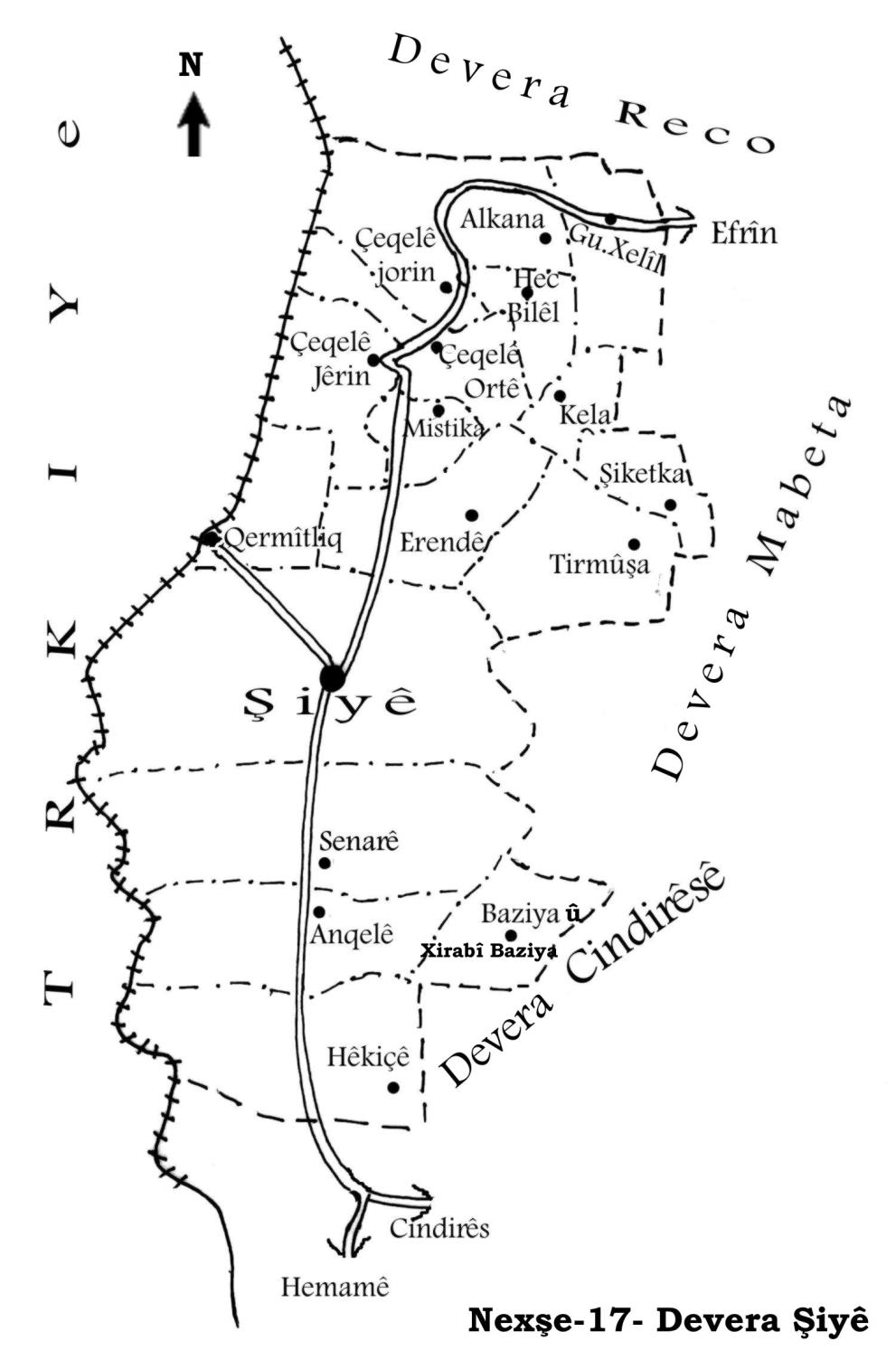
Şiyê
Also Known As
Al-Sati, Alkana, Alkêna, Olkana, Sati Oshaghi, ألكانا, الصاتي, صاتي أوشاغي, صاتي اوشاغي, اولكونه
Tribes
Alkana, Şêxiya
Families, Clans, etc.
Ebasî, Hemo, Mala Bateway, Mala Birokî, Mala Weşma Qostî, Malbata Gind, Omerê Hebeş
Photos
Basic Information about Alkana
Source: Ax û Welat
Etymology: Derived from the words Al (Flag) and Kana (Spring), originally referring to Rûxê Alê (Flag Side/Edge)
Foundation Date/Period: Approximately 800 to 900 years ago
Springs: Kaniya Alkana, Kene, Qestel
Shrines: Ziyareta Şehîdtekî
Wells: Bîra Alkana
Other Landmarks: Geliyê Gencan, Geliyê Kaniyê, Geliyê Bîrkê, Kopriya Heşerge
Source: Afrin 366
Hills: Hofê Kerke
Ruins: Fêrxarabê
Summaries
I. Summary from TirejAfrin Site (English) of Alkana
Source: https://www.tirejafrin.com/site/kura%20afrin%20%20%20shiye%20-%20alkana.htm
Alkana / Satî Uşaxî
According to the book جبل الكرد (عفرين) دراسة جغرافية Çiyayê Kurmênc (Efrîn): A Geographical Study by د. محمد عبدو علي Dr. Mihemed Ebdo Elî:
Alkana, Satî Uşaxî, El-Satî / 1357 inhabitants - 560m altitude /:
Alkana is the name of a Kurdish tribe found in Hekarî (Lerch, p. 46). The Arabized name "Satî" has no meaning.
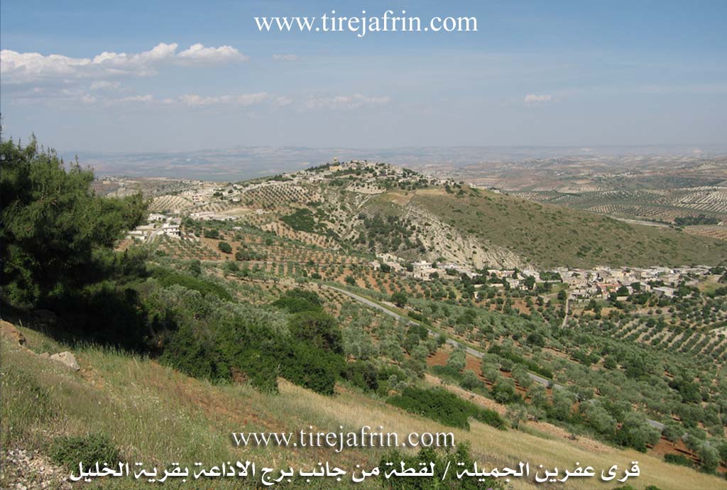
It is a small village located on the western side of a watercourse that slopes steeply southward toward the valley of Alkana. Its site is level and small in area, and its houses are compact.
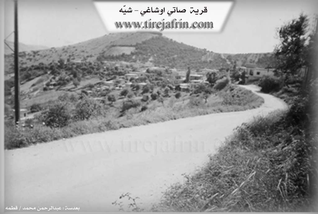
According to the book عفرين .... نهرها وروابيها الخضراء Efrîn... Her River and Her Green Hills by the writer عبدالرحمن محمد Ebdulrehman Mihemed from the village of Qetme / Satî Uşaxî:
It is a village in Çiyayê Kurmênc, administratively following the Şiyê district, Efrîn region, Heleb province. It is a small village situated in the west central part of the mentioned mountain on a rocky flat between two watercourses bordering it to the east and west, which descend toward the south. Its soil is white and thin. It is 14 km away from the town of Şiyê toward the northeast.
It is bordered to the north by a high mountain range, the television broadcast station at the highest peak of the mountain, and the village of Memal Uşaxî. To the south, it is bordered by a deep watercourse, a high mountain range, and the village of Hecî Bîlal. To the west, it is bordered by a mountain range and the villages of Sewlicik and Umer Uşaxî. To the east, a deep valley separates the village of Xelîl Kolko and Satî Uşaxî.
The number of its houses is about 55, and its age is about 350 years. Its old dwellings are made of stone and mud with wooden roofs, while modern concrete dwellings dominate and are spreading to the north and south. An electricity network is available. The village drinks from a water network connected to the irrigation network of the villages of the Şiyê district. In the past, they used to drink from a spring at the bottom of the valley beside the old ruined mill. It has a primary and preparatory school shared with the village of Xelîl Kolko.
The residents work in rain fed agriculture (olives, vines, figs, walnuts, almonds) alongside raising sheep and goats. There is a modern olive press in the village. It is connected to the district center by an asphalt road that passes by the western and northern sides of the village. The farm of Hecî Bîlal follows it administratively. This village is considered one of the old villages in the area and among the neighboring villages.
Village Mukhtar: Mihemed Xêro Cemîl
Sources:
- Book: جبل الكرد (عفرين) دراسة جغرافية Çiyayê Kurmênc (Efrîn): A Geographical Study by د. محمد عبدو علي Dr. Mihemed Ebdo Elî.
- Book: عفرين .... نهرها وروابيها الخضراء Efrîn... Her River and Her Green Hills by عبدالرحمن محمد Ebdulrehman Mihemed from the village of Qetme.
Preparation and execution: Manager of Navenda Tirej Soft site / Ebdulrehman Hacî Osman.
- 20/12/2013
II. Summary of Alkana from Afrin Flo
Source: https://www.youtube.com/watch?v=pMN9LdiFGuk
The village of Olkano, occasionally referred to as Holkono, is situated in the Afrin region of northwestern Syria and falls administratively under the district of Şiyê. The village is located approximately ten to twelve kilometers from Şiyê. According to the village Mukhtar, Feysel, the settlement is ancient ("qedîm") and its name has deep roots, though the precise etymology remains obscure to the current inhabitants. The village is closely linked socially and geographically with the neighboring villages of Gundê Xelîl and Hecî Belî, also known as Hecbiliwa or Sêgundo.
The history of Olkano is marked by a diverse past and significant shifts in its landscape and economy. The Mukhtar notes that the village once hosted Armenian residents, specifically pointing out a site known as Hewşê Ermeniya (the Armenian Courtyards). In this area, residents utilized a communal space for crushing wheat and grain, a practice that dates back over a century. The village was historically defined by its abundant water sources and lush agriculture. In the past, the land supported walnuts, apricots, apples, and hazelnuts (findiq), but due to recent droughts and fires, the primary crop remaining is the olive (zeytûn).
Water management plays a central role in the local oral history. The village contains a historic site called Delîb and a significant water feature known as the Qestel. This stone trough or fountain is located between Olkano and the neighboring Hecî Belî. The Mukhtar attributes the stone structure to the "Time of the Rûm" (Romans or Byzantines) and mentions it was excavated or developed further during the "English time." Another vital historical landmark is the Xerafe, a water wheel system that functioned until the late 1950s to irrigate gardens. A notable figure from regional memory is Eyneto from Hecî Belî, who is remembered for hand digging a deep well to ensure the community had access to clean water when other sources were scarce or contaminated.
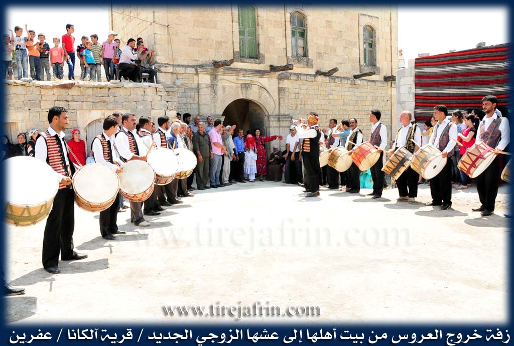
Culturally, Olkano held a distinct reputation throughout the Afrin region for its weddings and dance (reqs). The Mukhtar recalls that the village was famous for its festivities which would attract guests from surrounding areas. Today, the village consists of approximately sixty to seventy households. Residents like Yûsif, who traces his origins to Gundê Xelîl, emphasize the unity between the surrounding settlements. despite the environmental challenges and the drying of ancient wells like Bîra Olkana, the community maintains a strong connection to its heritage and the remaining historical landmarks that dot the landscape.
II. Summary of Alkana from Ax û Welat
Source: https://www.youtube.com/watch?v=Nly07uiriXE
The village of Alkana is situated in the mountainous terrain of the Şiyê district in Efrîn, located between the neighboring villages of Xelîl and Hec Bilêl. According to local oral tradition, the settlement is approximately eight hundred to nine hundred years old. The name Alkana is said to be a contraction of the words Al (flag) and Kana (spring), derived from the phrase "Rûxê Alê," meaning the side or edge of the flag. The village is primarily inhabited by members of the Şêxiya tribe, who have resided in the area for at least six or seven generations.
The history of Alkana is closely tied to regional Kurdish resistance movements. An elder from the village recounts the story of his grandfather, Omerê Hebeş, a literate man also known as "Berê Sipî." During the rebellion of Şêx Seîd in 1925, Omerê Hebeş received a letter from the leader asking the local Kurds to cut the railway lines to impede the movement of the Osmanla (Ottoman/Turkish) forces. Acting on this request, the villagers destroyed the Kopriya Heşerge (Bridge of Heşerge), successfully blocking the route. Before the establishment of modern borders and the installation of wire fences, the villagers traded primarily in Qiriqxan, traveling by camel to stay in khans and sell their goods. After the borders were closed, their economic center shifted to the markets of Efrîn.
Daily life in Alkana has historically revolved around the management of water and the cultivation of olives. The village landscape includes notable valleys such as Geliyê Gencan and Geliyê Kaniyê, and water sources like Bîra Alkana, Qestel, and Kene. A local expert, Reşîd Şêx Mihemed Hemo, continues the traditional practice of water dowsing to locate subterranean wells, a skill passed down from his father. The community maintains a deep connection to their heritage through the preservation of old olive presses (delûv), the preparation of traditional foods like Kutayî and Sorme, and the veneration of a local shrine on the village hill known as Ziyareta Şehîdtekî. The cultural identity of the village is further expressed through folk songs that specifically celebrate Kaniya Alkana and the people of the village.
II. Summary of Alkana from Afrin 366
Source: https://www.youtube.com/watch?v=m6CbXkg5uMM
The village of Olkana is located in the Mabata district of the Efrîn region, approximately ten kilometers from the district center. It is situated in a valley surrounded by a scenic landscape, with the village of Hecîba visible directly opposite. The documentary portrays Olkana as a settlement with a deep history, evidenced by numerous ancient stone courtyards and structures. One ruined structure bears an inscription with the date 1325, which the speakers note is written in Arabic script but may represent an Armenian or Turkish linguistic connection. The villagers estimate the age of various houses to be between 200 and 500 years. A specific ruined site known as Fêrxarabê is also mentioned, indicating areas of the settlement that have fallen into disuse over centuries.
The social structure of Olkana has undergone significant changes due to migration. Speakers recall a time when the population had dwindled to just two households, although there is a current trend of former residents returning to renovate their ancestral homes. The transcript explicitly identifies several key families and lineages that form the core of the village society. These include Mala Weşma Qostî, Mala Bateway, and Mala Birokî. Additionally, the Malbata Gind and the Ebasî are mentioned as part of the community fabric. The elders, including a guide referred to as Xalû, speak with respect about past residents such as Xedîca Bekir, whose memory is preserved by the community.
Culturally, Olkana is defined by its agricultural output and traditional craftsmanship. The village is renowned for the production of Simaq and Hinar. The Simaq grows wild and is harvested for trade, while the Hinar orchards in the lower parts of the village produce fruit described as both sour and sweet. The transcript also highlights the preservation of traditional skills, such as bread baking in a Tenûr and the weaving of carpets using a Têşî to spin wool. These carpets feature designs symbolizing the local mountains and rivers.
The geography of the area is marked by stone architecture and water infrastructure, specifically deep cisterns or sarnic carved into the ground to collect water. The village is positioned near several other settlements, including Gundê Hembo, Gundê Xelîl, Dêmîlya, Qûpê, Berbannê, Gûliya, Kêlî, and Gundê Qeda. A specific high point or location named Hofê Kerke is also noted in the vicinity. The narrative briefly touches upon recent conflict, with a mention of the YPG in relation to events in the village history, but the primary focus remains on the enduring heritage and daily life of the residents.
Transcriptions and Subtitles
| Source | Video | Subtitles | Transcript |
|---|---|---|---|
| Afrin 366 1 | Watch Video | Download SRT | View Transcript |
| Afrin Flo 1 | Watch Video | Download SRT | View Transcript |
| Ax û Welat 1 | Watch Video | Download SRT | View Transcript |
Foundation/Origin Information of Alkana
This village is considered one of the old villages in the region and neighboring villages.
Source: TirejAfrin Site
It was settled by the Sheikhi (Şêxî) tribe approximately seven generations ago. The community faced significant disruption during the Sheikh Said rebellion in the early 20th century, an event that caused the villagers to become refugees and is remembered in their oral history through figures like Emerê Hebeş.
Source: Ax û Walat Transcript
A particularly significant historical house was identified as having been built by Armenians, bearing an Armenian inscription with the date 1325 (likely Hijri, c. 1907 AD), though a resident also stated its age as 325 years.
Source: Afrin 366 Transcript
Possible Village Name Meaning of Alkana
Alkana (آلكانا): Name of a Kurdish tribe found in Hakkari. The Arabized name "Sati" (صاتي) has no meaning.
Source: TirejAfrin Site
Its name is believed to derive from words meaning "bulls" and "spring."
Source: Ax û Walat Transcript
V. Links
- Tirej Afrin:
https://www.tirejafrin.com/site/kura%20afrin%20%20%20shiye%20-%20alkana.htm - Ax û Welat:
https://www.youtube.com/watch?v=XDxXmaPWPvY - Local FB page:
https://www.facebook.com/profile.php?id=100052679717662 - Link:
https://www.youtube.com/watch?v=Nly07uiriXE - Afrin 366:
https://www.youtube.com/watch?v=m6CbXkg5uMM - Afrin Flo:
https://www.youtube.com/watch?v=pMN9LdiFGuk